
Introduction:
What? : In this blog I
will describe places I visit at Northeast California, Driving north from Lake
Tahoe (Truckee), through the amazing Gold Lake Basin, keep driving north to Lassen
Volcanic National Park, pass through Burney & McCloud Falls and visit Lava
Beds National Monument at the northern part of California just on the border
with Oregon.
My recommendation
is to dedicate at least 4-5 days for this road trip.
Another ending or
starting option to this trip is that after Burney Falls visit you will not
drive north to visit Lava Beds National Monument but rather drive to Mount
Shasta area.
You can visit Mount
Shasta area and places along I-5 on the way south to Redding.


Where? :
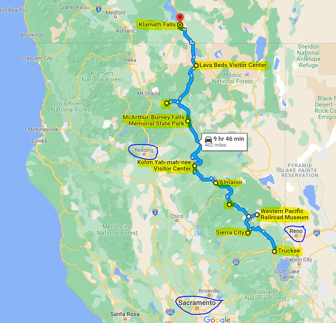
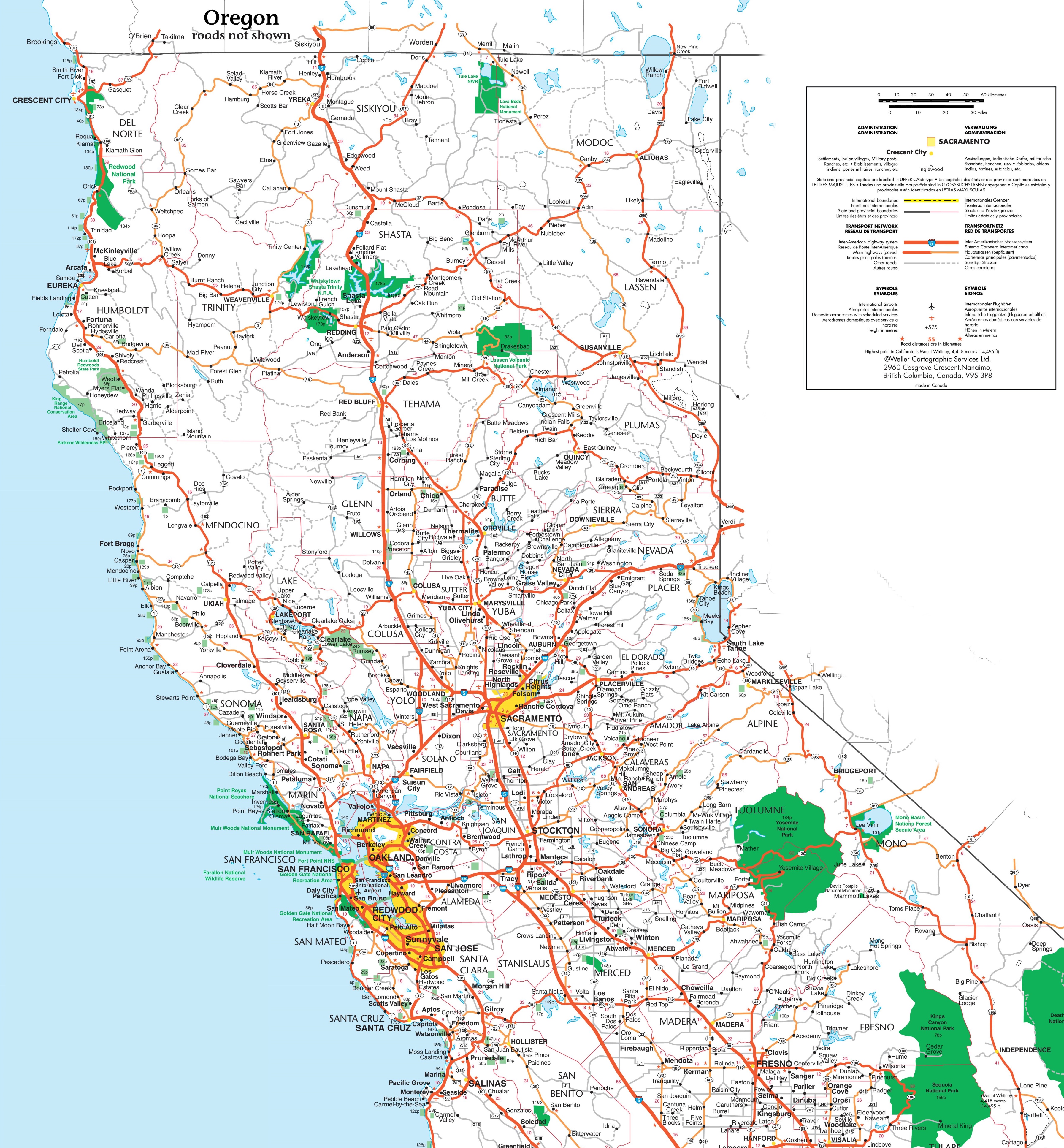
My recommended
road trip starts at Truckee, CA. and end at Klamath Falls, OR.
Overall, this
is 400 miles long drive, and it will probably take you 4 full days to visit the
places along this drive.
Yes, you can spend
here many additional days, there are practically endless nature locations to
explore and things to do in this large aria of California.

You can also end
(or start) the road trip at Redding CA or near Mount Shasta.
I will describe
my trip driving from south to north, but it can be done also from north to south.
Google Map Link


When? :
Winter and
early spring are not the preferred time to visit here, roads and locations are
close because of snow. Spring, Summer, and Fall are the preferred time.
My personal
preferred time is October. The summer crowds and hot days are gone, it still
does not rain/snow, and in some places the tree leaves are just starting to
change their colors to yellow. Most of California forests are pine trees that
does not present fall colors but near lakes or in creek you can find trees that
will show fall color.


How many days ?
At list 4-5 days.
This is always
a tricky question, no matter how many days you are traveling there will always
be something you did not manage to do or see…
I do think that
the bare-minimum number of days for this suggested road trip are 4 days. My recommendation
is to allow 5 days for trip, see below itinerary breakdown.

Maybe you can do
this trip in only 3 full days, but this is not what I recommend. To do this trip
in only 3 days it implies that every day will be with a lot of driving, mainly short
visit in each location, and without long hikes.


You can add one
or more days at Lassen Volcanic NP for longer hiking activities and discover Painted
Dunes remote park section, in addition you can dedicate a full day to Lava Beds
NM.

Standalone trip or part of Longer
Road Trips:
This road trip can
be done as “stand alone” trip to this area starting and ending at San Francisco
or as part of a much longer road-trip in northern California or Oregon.
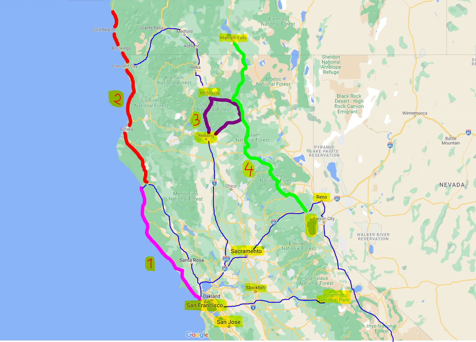
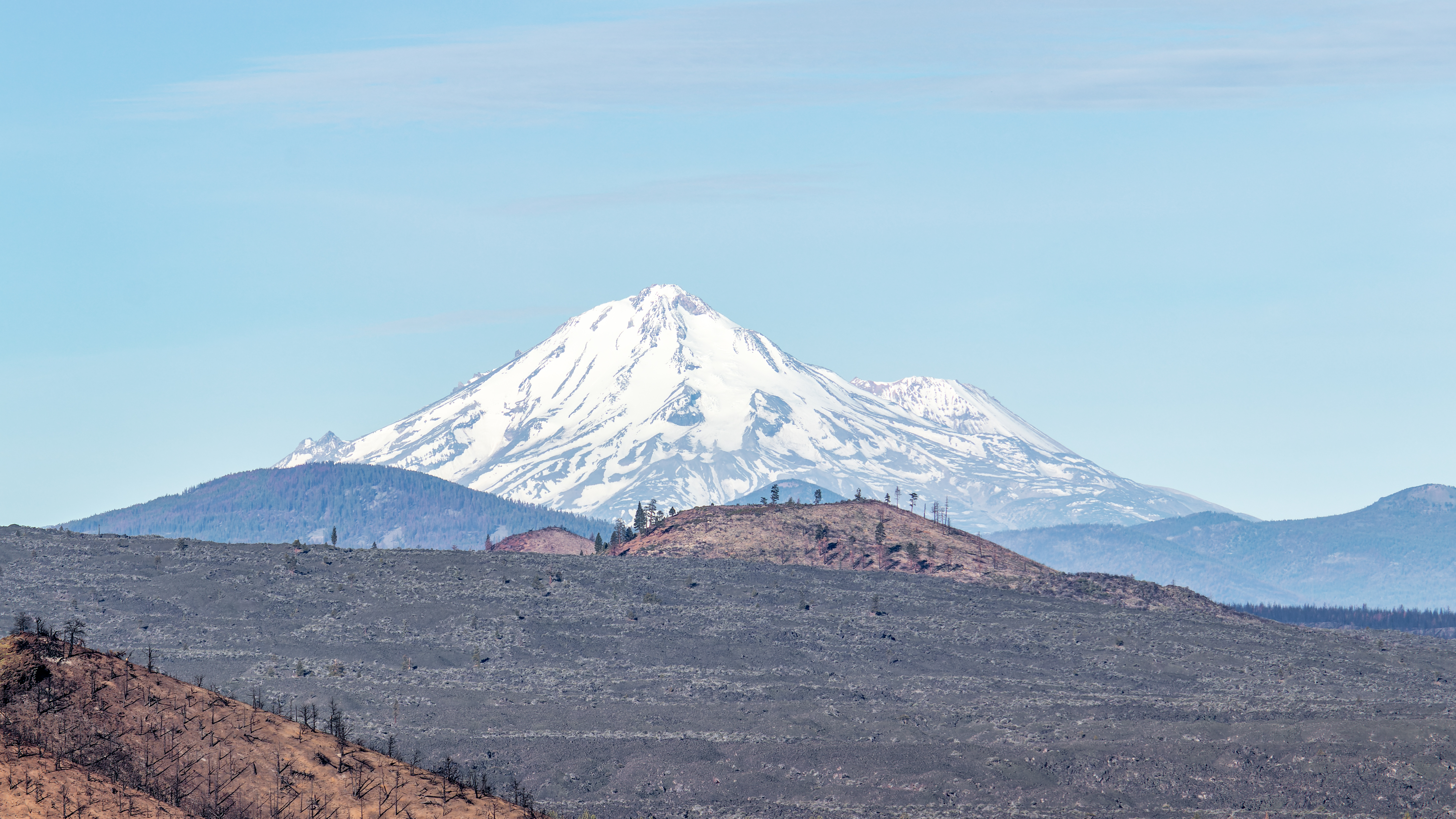
There are many locations that you can visit before/after this trip, Places like: Reno NV, Lake Tahoe, Central Sierra, Gold Country, central north California near Redding and Mount Shasta, North California ocean coast and the state of Oregon.

Map of the proposed North California
road trips:
(1) Highway #1 -
Ocean front from San Francisco to Fort
(2) Northwest
California - Redwoods forests, and
(3) North
Central California - Mount Shasta and the Waterfall loop
(4) Northeast
California - 5 Days Road Trip Planning
If you have 2
weeks you can connect all 4 road trips (or only 2, 3, and 4) into one large north
California loop.
List of Related Blogs:
Lake Tahoe Area:
Emerald Bay State Park – Lake Tahoe
Sierra Butte Hike
Sierra City
The Western Pacific Railroad Museum in Portola
California North Central:
North California - Waterfalls Loop Road-Trip (Redding – Shasta)
McArthur Burney Falls State Park
Potem Creek Falls, Shasta-Trinity National Forest
Hatchet Creek Falls, Shasta County
McCloud River Falls, Shasta-Trinity National Forest

Lake Siskiyou and Faery falls, Shasta County
Heart and Castle Lakes Hike, Shasta County

Hedge Creek Falls, Shasta County
Castle Crags State Park
Lassen Volcanic NP:


Lassen Volcanic NP – Trip Planning
Lassen Volcanic NP – Echo Lake and Cluster Lakes loop hikes
Lassen Volcanic NP – Kings Creek Waterfall Hike
Lassen Volcanic NP – Sulphur Works and Ridge Lakes Hike
Lassen Volcanic NP – Cinder Cone and Painted Dunes
Lava Beds National Monument (North California)

California North Coastline and
Redwoods:
Redwood Parks at Northern California Coastline – Visit Planning


Gas:
This Northern
California road trip pass through many towns and you will find many places to
fill up your gas, after saying this, you probably want to fill up when you are
getting low to about quarter of a tank. You can expect the “California high gas
price standard” but in some remote station’s gas can be more expensive than usual.

Roads:
Most of the
drive is one-lane roads, to my experience most highways in north California are
in good driving conditions, be patient when driving after slow vehicle and
always try to pull over at pullouts if you’re driving is slower than others.

Important note about your driving &
trip planning:
At Lassen Volcanic National Park highway 89 is close
to all traffic during the winter months (usually close at mid-November and open
July).

The typical
opening date of the road that is crossing the park (south - north) is around
July, check with the national park service before you travel.
Link to the
park web page providing information on road conditions:
https://www.nps.gov/lavo/planyourvisit/winter-road-closures-and-spring-clearing-update.htm
If the road crossing
the park is close, you can visit the park from the south entrance and then you
need to go around the snow-covered roads from the west, this will be additional
1.5-hour drive.
You need to
drive back and then west on highway 36 to the small place of Paynes Creek. Turn right onto Lanes Valley Rd. and
find your way to highway 44. On highway 44 turn right and drive east all the
way to the park North entrance on your left.
Night Accommodations:
I always
recommend camping, this is part of the trip experience, you are not limited to
specific location where you can find countless places to spend the night in
official and organized campground with all the services or in dispersed
locations deep in the national forests.
I understand
that camping is not for everyone….

Hotels: I split the road
trip into 4 full days, you need to find night accommodations at the end of each
day. You will probably be driving significant distance in every day, so you
need to find a different hotel for every night.
The Road Trip Planning:
I chose to do my road-trip route
according to the top locations I want to visit:
·
Sierra Butte lookout Hike
·
Lassen Volcanic National Park
·
McArthur-Burney Falls Memorial State Park
·
McCloud River Falls
·
Lava Beds National Monument

Night before the trip:
The first day of
this road trip start at Truckee CA where you can find many hotels and other
accommodation options in all price levels. You can also sleep near lake Tahoe
or even at Reno NV.
Day #1:
Truckee
Sierra City
Sierra Butte lookout Hike
Gold Lakes
Basin
Hike to Frazier
Creek Waterfall
Sleep at Graeagle,
CA


Day #2:
Plumas-Eureka
State Park
Western Pacific Railroad Museum at Portola
Quincy
Keddie Wye
train viewpoint
Sleep at Chester CA or another location near Lake Almanor

{{
You can combine
Day-1 and Day-2 by visiting only the following:
Sierra City
Sierra Butte lookout Hike
If you have
time: Western Pacific Railroad Museum at Portola
Sleep at Chester
CA or near Lake Almanor
}}
Day #3:
This day will
be dedicated to Lassen Volcanic National Park. Even without doing long hikes you
will probably want to spend here one full day.

You can easily spend
here more time, if you will dedicate 2 then you can hike in more places or visit
Cinder Cone and Painted Dunes section of the park.
You can look
for hotels south of the park, near Mineral or look for places to sleep heading north
of the park, on the way or near Burney CA.
There are only
few hotels’ options in Old Station (highway 89), Burney (highway 299) or at Fall
River Mills (highway 299).
Day #4:
The next day
will be dedicated to visiting:
McArthur-Burney Falls State Park

McCloud River Falls

At the end of
the day, you can have 2 options for night stay:
1. Drive the
and camp for the night at Medicine Lake (no hotel options nearby)
2. Drive
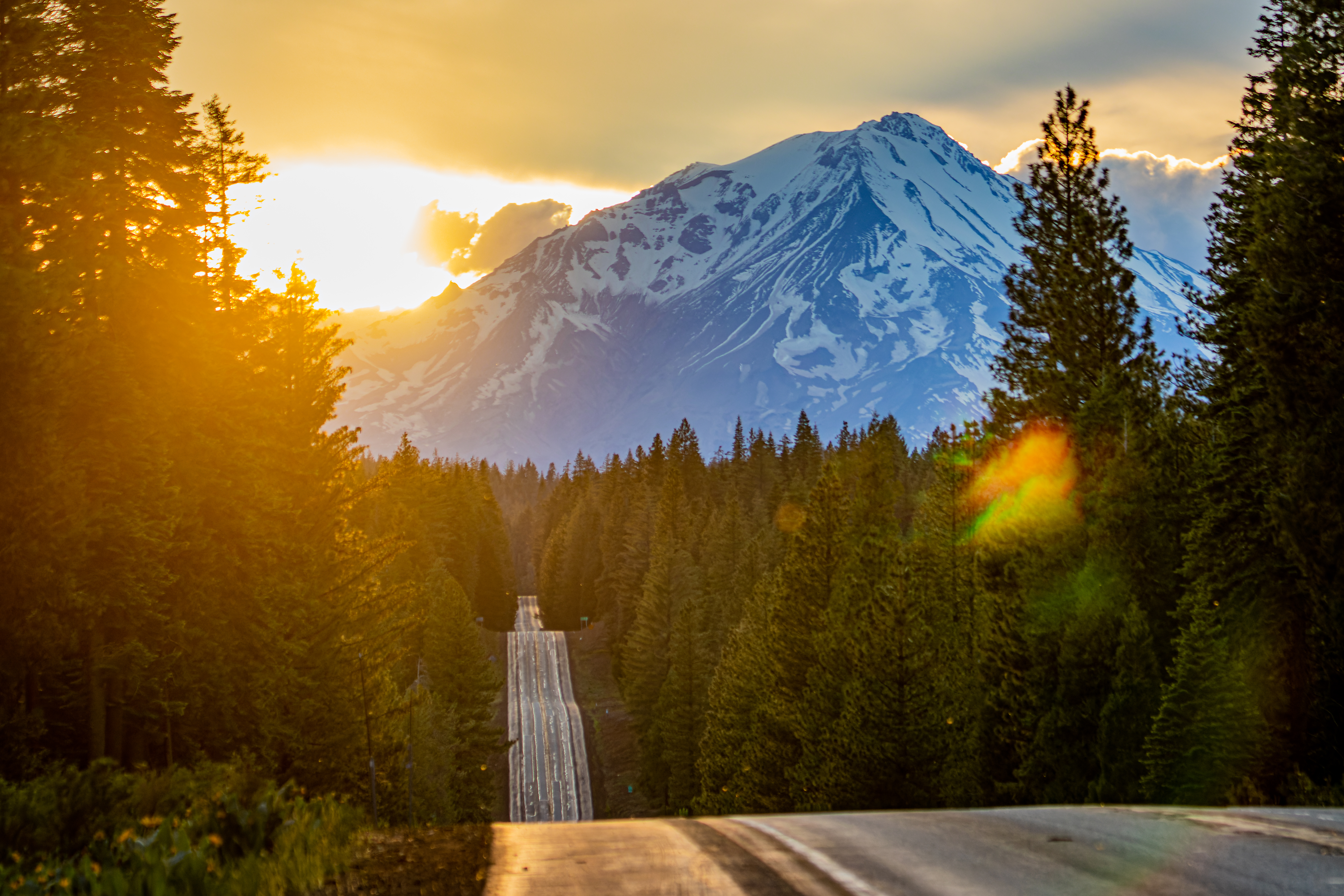
and sleep near Mount Shasta (highway I-5), if you have time at the afternoon I highly
recommend hiking to Heart Lake, one of the most rewarding hikes in North
California with amazing mount Shasta view.


Day #5:
The next day will
be dedicated to Lava Beds National Monument (at least half a day visit).


Last Night:
From here you
can keep driving north and spend the night at Klamath Falls, OR, there are many
hotel options in the city or along highway 97 OR.
Another option
is that you can drive back south to Shasta and find hotel near Shasta and highway
I-5, or drive south and sleep at Redding CA.

Description of Locations (north to
south):
In the
following section I will provide short information on each recommended attraction/location
and a link to my specific blog that has much more information and picture.
Sierra City:
Sierra City is
a census place in Sierra County, California. The elevation of Sierra City is
4,147 feet, and the town is situated in the canyon of the North Yuba River on
California State Route 49. The small-town location right below the Sierra
Buttes and minutes away from the Lakes Basin make it as wonderful, year-around
recreation, fishing, hiking, boating, rafting, mountain biking, skiing,
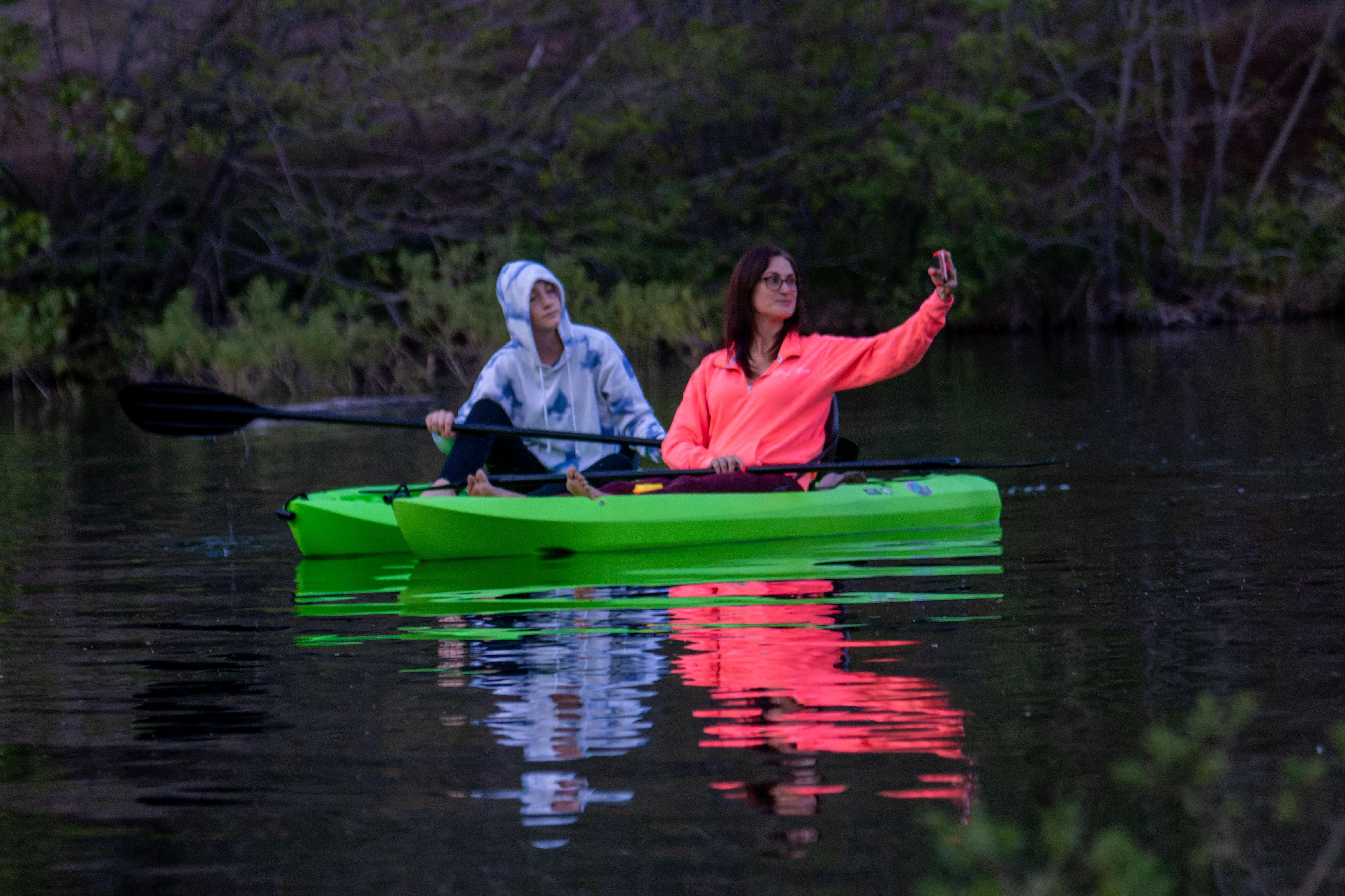
kayaking, bird watching and lots of wildlife!


Gold Lakes Basin and Sierra Butte lookout Hike:
The Sierra
Buttes Fire Lookout (8587ft) in Northern California is an incredible 6 miles
out and back hike with 1600 ft elevation gain. In my view this is one of the
most rewarding hikes with amazing 360 view I did in the north Sierra.


The Gold Lakes
Basin recreation area has special geological features. There is breathtaking
scenery and over 20 small lakes nearby, most of which are accessible by hiking
trails. This area provides a multitude of recreational activities including
camping, fishing, boating, hunting, mountain biking, horseback riding,
picnicking, hiking, backpacking, swimming, windsurfing and nature study. In the
winter visitors can snowmobile, cross-country ski and snowshoe.

Western Pacific Railroad Museum at Portola:
The Western
Pacific Railroad Museum in Portola, California, preserves and operates historic
American railroad equipment and preserves documents, photos and information.

This is a nice
one hour stop along your road trip in northern California. Get into the small
Museum and explore the yard, see all the locomotives and carriage. This is not
a must stop but if you are passing by or near this area than I do recommend this
as something “different” to do.


On your way you
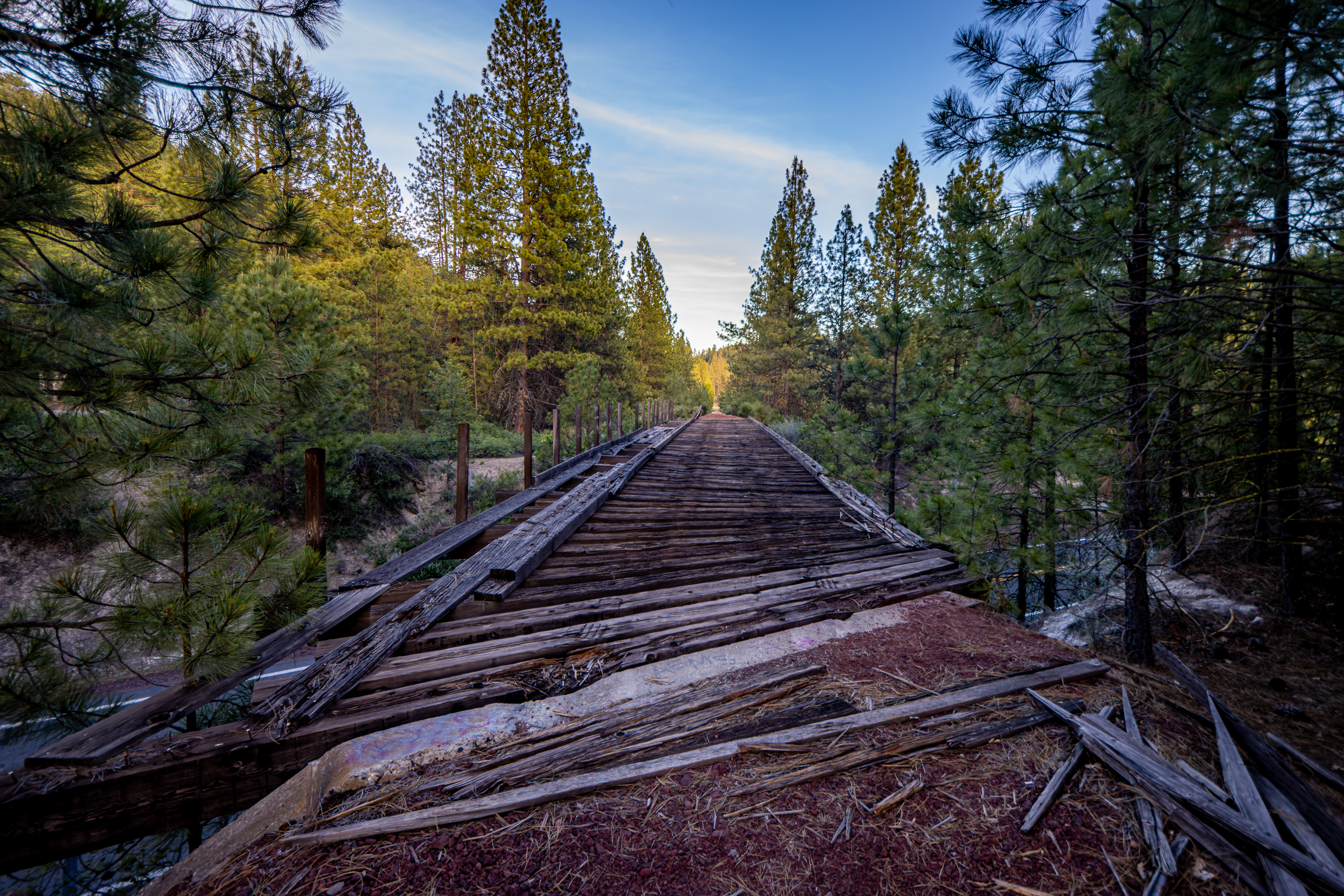
can also take side-road and see Clio Trestle historic railroad bridge in Plumas
County. There’s a gravel road right next to the bridge that will take you to
the top you can watch the train go over the bridge.
Graeagle:
Small summer
tourism town, located in the High Sierras of Plumas County. There is not so
much to do in the town itself but there is plenty to do in the nearby outdoors.
Plumas-Eureka State Park:
Located near
the town of Graeagle, the park, as a mining museum, shows and protects the
history of the active mid-19th century California Gold Rush mining period.
Link to the state
park website: https://www.parks.ca.gov/?page_id=507
Quincy:
Quincy is relatively
a large town with a walkable, historic downtown, restaurants and a relaxed outdoor
vibe.
I just drove
through the town; it has a nice small downtown so I stop and took few pictures,
and it looks like that Quincy can be you’re a hub for outdoor adventures.


Keddie Wye train viewpoint:
The Keddie Wye
is a railroad junction in the form of Y over a river and into a tunnel under
the road. It is the world's only wye with two legs on bridges that meet in a
tunnel.


Nice place to
stop and view the interesting engineering large Y shape bridge structure.
When driving on
highway 70 north of Quincy you will get into Feather River canyon, exactly 7.7
miles from Quincy downtown you will see an opening and a place to park on the
left (other) side of the road, cross and park here.
Cross carefully
the road to the river (cliff) side and walk to the viewing point above the
track and the train tunnel.
If you are
coming from the north this is exactly 2.8 miles from the road junction of
highway 70 and 89.
When I visit here,
I saw a train coming out of the tunnel and crossing over the bridge to the
other side.


Lake Almanor and Chester CA:
Lake Almanor, large
reservoir in northwestern Plumas County, is located at the boundary of the
Cascade and Sierra Nevada geologic provinces, south of Lassen Volcanic National
Park. Known for water sports, Lake Almanor is one of the largest lakes in
Northern California.

At the summer of 2021 Dixie Fire that was the largest ever recorded fire in California reached its final size of 73,240 acres within the Lassen park boundaries, covering most of the east south of the park area.
The west side of the main park road there’s very little fire impact and everything looks green but on the east side you can see the large burn forest devastation with dotted patches of surviving trees.
The west side of the main park road there’s very little fire impact and everything looks green but on the east side you can see the large burn forest devastation with dotted patches of surviving trees.

Over 60% of Lassen park forest has had fire in it. There are places with dramatic high intensity burned impact where all you can see are black burned naked ded standing trunks where there are other areas where the fire had only a light touch.
The Dixie Fire hit all the northeast section of California and reached its final size of 963,309 acres making it the largest single fire in California history.
You can see the huge, burned forests areas when traveling to this region, once it was covered with endless dense forest and today covered with standing black, burned, tree stamps.

Susanville: I will not
cover this town, because I did not visit here.

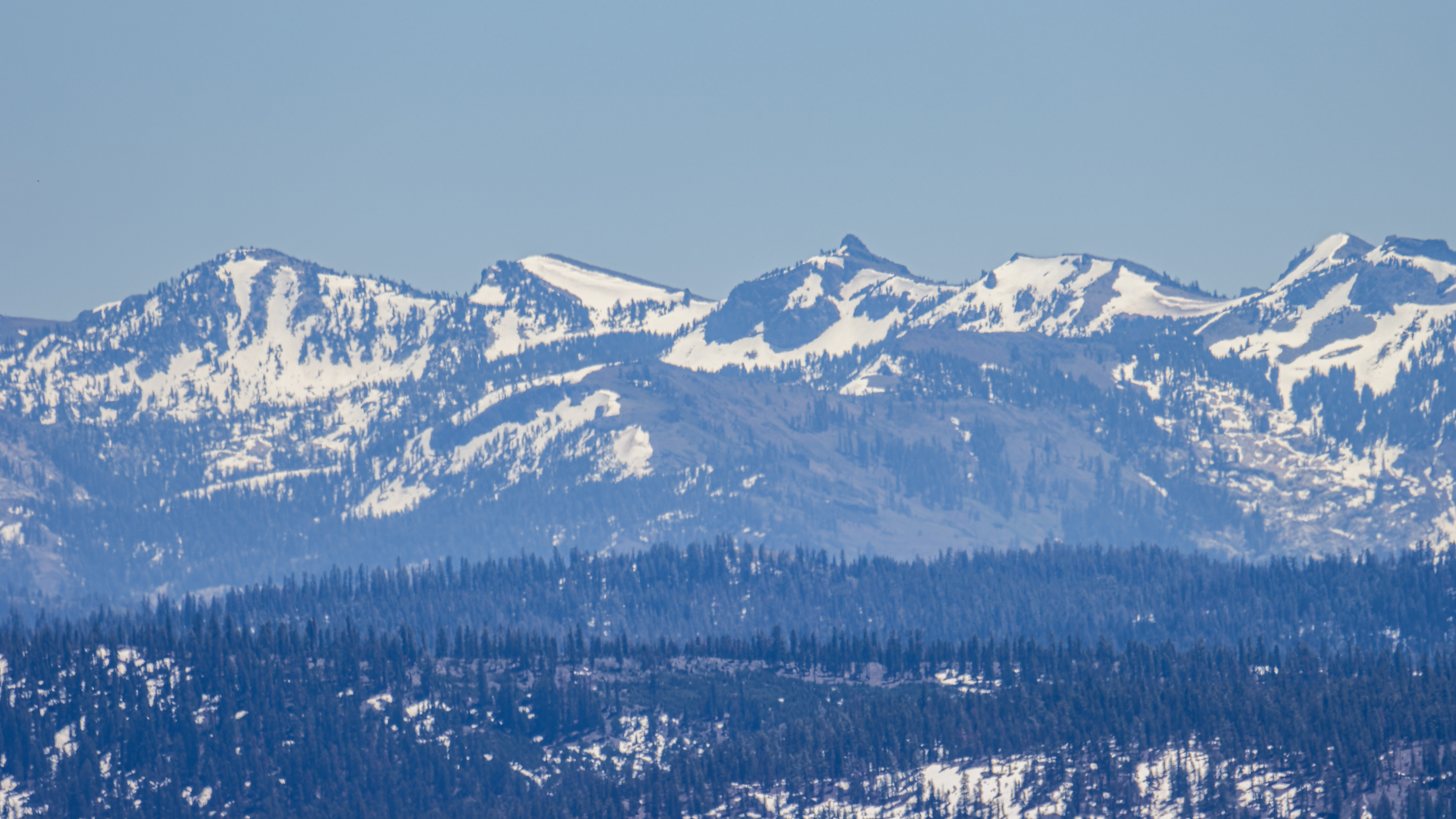
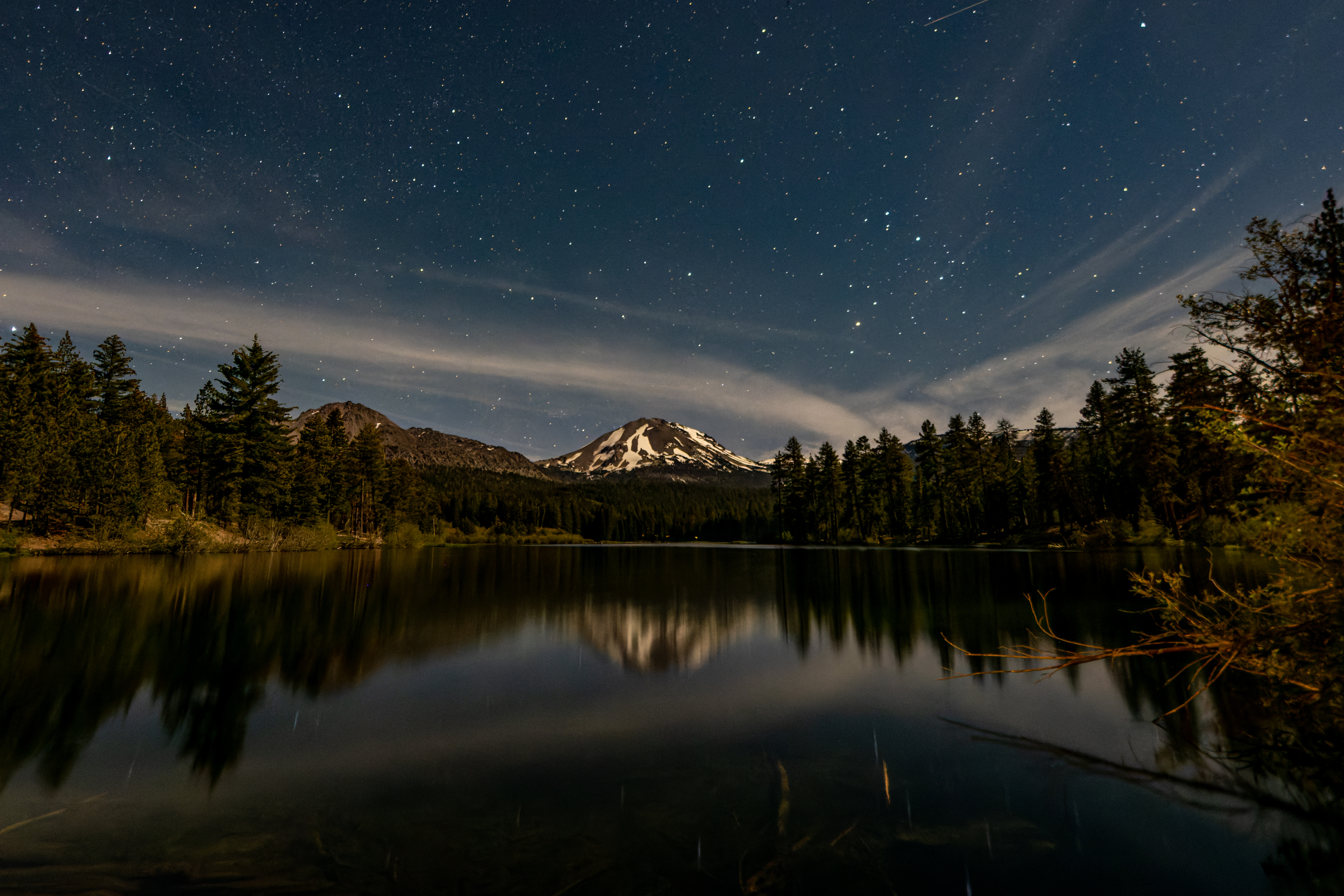
Lassen Volcanic National Park:
I think that Lassen
National Park is underrated, and it is my favorite park in Northern California
central mountains.
I wrote series
of 5 detailed blogs on Lassen National Park.


From serene
alpine lakes to active hydrothermal boiling mud pots, and from to jagged
mountain peaks to volcano cones and Painted Dunes, there are many hikes, in all
difficulty levels and length, that you can do in this large park.
Important note about your driving &
trip planning:
At Lassen Volcanic National Park highway 89 is close
to all traffic during the winter months (usually close at mid-November and open
July).

The typical
opening date of the road that is crossing the park (south - north) is around
July, check with the national park service before you travel.
Link to the
park web page providing information on road conditions:
https://www.nps.gov/lavo/planyourvisit/winter-road-closures-and-spring-clearing-update.htm
If the road crossing
the park is close, you can visit the park from the south entrance and then you
need to go around the snow-covered roads from the west, this will be additional
1.5-hour drive.
You need to
drive back and then west on highway 36 to the small place of Paynes Creek. Turn right onto Lanes Valley Rd. and
find your way to highway 44. On highway 44 turn right and drive east all the
way to the park North entrance on your left.

Old Station and Subway Cave Lava
Tubes:
I did not visit
here because I visit Lava Beds National Monument that has many, longer and probably
more beautiful lava caves.
Link to the Subway
Cave website: https://www.fs.usda.gov/recarea/lassen/recarea/?recid=11435
Lassen Park Cinder Cone and Painted Dunes section:
This is 4 miles
challenging trail up Cinder Cone Volcano that rewards you with breathtaking
views in all directions and the view of Painted Dunes area below.
This hike, although located in Lassen Volcanic National Park, is at a remote park section and you need to drive there from highway 44 entrance. 
This hike, although located in Lassen Volcanic National Park, is at a remote park section and you need to drive there from highway 44 entrance.

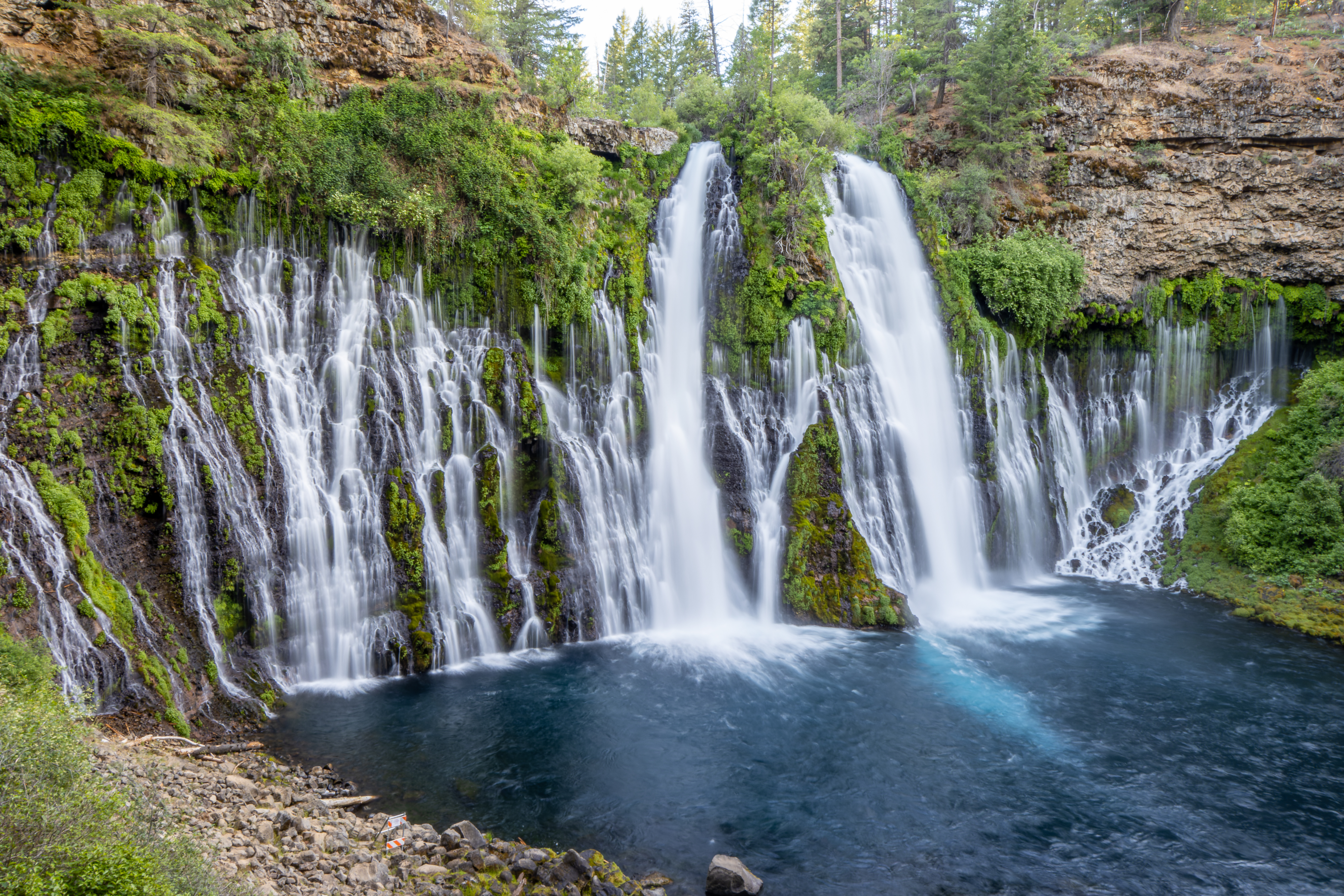
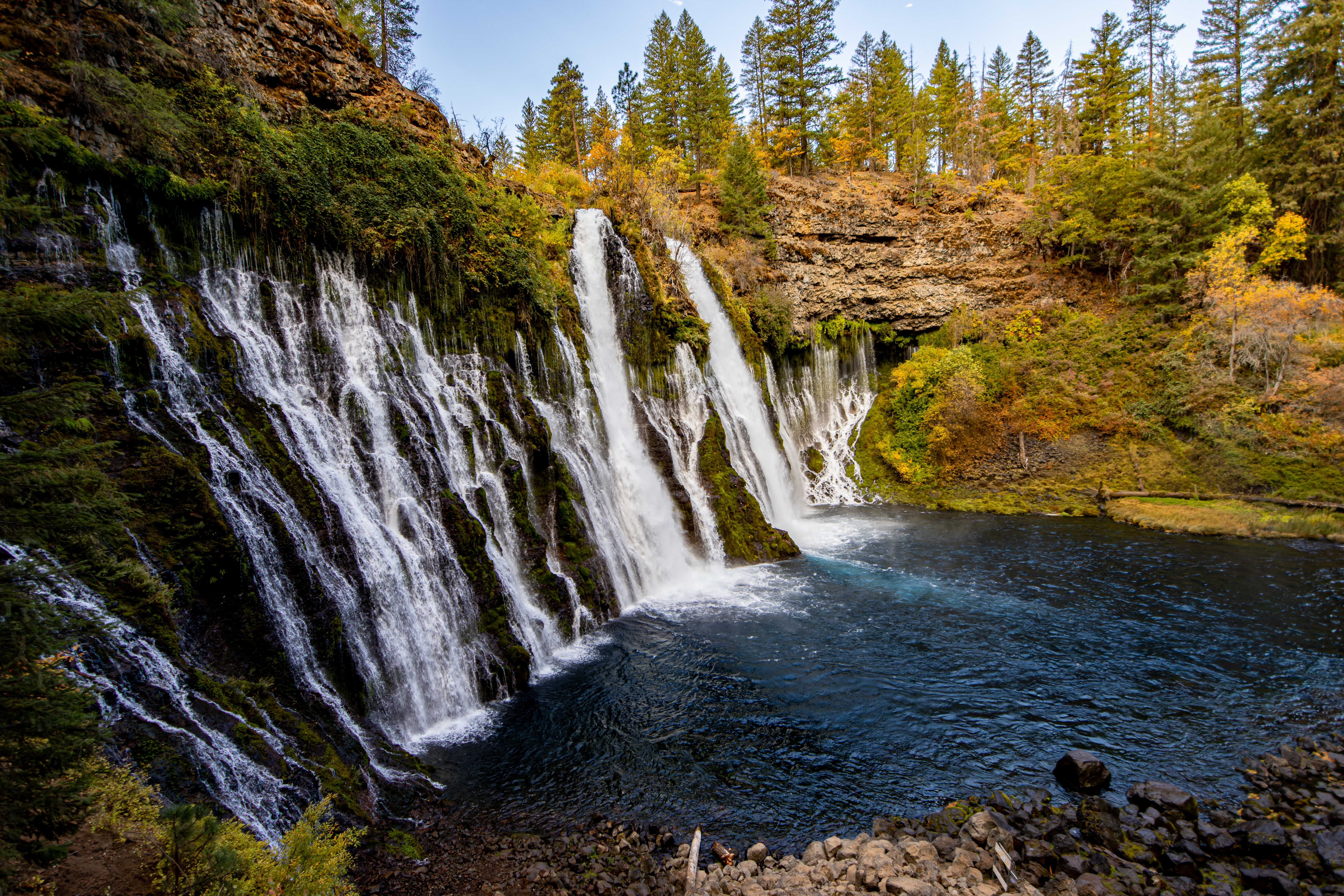
McArthur-Burney Falls Memorial State Park:
McArthur–Burney
Falls Memorial State Park is the second oldest state park in the California,
located approximately 6 miles north of Burney. The park offers many outdoor
activities including camping, fishing, watersports, hiking and horseback riding
facilities but the main park attraction is the amazing waterfall, one of the
most beautiful waterfalls I ever saw, definitely in all of California.


You can have
here a short stop, just to see the waterfall near the parking lot or a longer
visit, hike, visit the large lake and enjoy your time in the park.


McCloud River Falls:
Open forest
land where the river winds through a canyon of basalt lava rock and creates a series
of 3 impressive waterfalls.
You can view
the waterfalls from above, near the parking lots, hike down to their base or
hike the trail along the river and visit all 3 waterfalls.


Although it is
not a state park this is well maintained forest land that offers summer
swimming, fall foliage, making it fun and accessible year-round.
Medicine Lake:
The Lake and Recreation
Area is in the Modoc National Forest at an elevation of 6,770 feet. It is located
far from any town and main road, practically “in the middle of nowhere”, I visit
here several times and stay for the night on my way to Lava Beds National
Monument the following morning. Medicine Lake Recreation Area offers camping,
boating, fishing, and swimming.


Lava Beds National Monument:
Lava Beds
National Monument is in northeastern California, in Siskiyou and Modoc
counties. The monument has the largest total area covered by a volcano in the
Cascade Range.
The main park
attractions are the Lava Tube Caves. There are over 20 developed caves that you
can explore by yourself, and you need to plan for at least half day visit in
this park.
Check my park
detail blog for a lot more information and pictures.


Klamath Falls, OR:
Klamath Falls
OR is the end (or starting point) of my recommended northeast California Round-trip.
There is not so
much to do in this large city except find something to eat and spending here the
night (many hotels).
Summary:
In this blog I
tried to provide as much information as I can that will help you plan your northeast
California visit based on thing I did and places I visited.
There are many
more things to do and explore in this large aria and I plan to visit here again
and “discover” more locations.
I hope that you
will find this blog useful.
www:
https://www.fs.usda.gov/Internet/FSE_DOCUMENTS/stelprdb5361167.pdf
https://ontheworldmap.com/usa/state/california/map-of-northern-california.jpg
More Pictures from this road-trip:


Comments
Post a Comment