
Introduction:
What? :
The dramatic Cinder Cone volcano display a perfect cone shape volcano. At the end of your out and back 4 miles hike, you will climb the steep 700-foot ascent to the summit. From the top rim trail, you will enjoy views of the dramatic cinder cone rim and the colorful Painted Dunes below you.


For a Beautiful Nature Prints - Visit my Etsy Store
Where? :
Located in
the north Butte Lake Area of the park.
To get to this park
section, you need to drive about a 45-minute from the northwest entrance of the
park.
Drive north on highway
44, at Old Station turn right (this is still highway 44 E) and keep driving for
additional 11 miles. Here you can see a clear turn into Forest Road 32N21 (Look
for signs indicating Butte Lake Campground.). Turn right (south) into the
forest road, drive additional 6.6 miles and you will arrive to Butte Lake Campground
and the trailhead.
Google Map Link

Additional Lassen Volcanic Park Blogs and Related Posts:
Lassen Volcanic NP – Trip Planning
Lassen Volcanic NP – Echo Lake and Cluster Lakes loop hikes
Lassen Volcanic NP – Kings Creek Waterfall Hike
Lassen Volcanic NP – Sulphur Works and Ridge Lakes Hike
North California - Waterfalls Loop Road-Trip (Redding – Shasta)
McArthur Burney Falls State Park
Potem Creek Falls, Shasta-Trinity National Forest
Hatchet Creek Falls, Shasta County
McCloud River Falls, Shasta-Trinity National Forest
Lake Siskiyou and Faery falls, Shasta County
Heart and Castle Lakes Hike, Shasta County
Hedge Creek Falls, Shasta County
Castle Crags State Park

When? :
Access is
closed during winter, reopen when snow conditions allow it.

Due note 1: Although it
looks like this is a National Forest location, a mile before the end of the
road you are getting back into the area of Lassen National Park.
Due note 2: Drinking water
is available when the Butte Lake Campground is open. There are no other
services in this area.
Due note 3: I do recommend
hiking here with close shows and not with sandals, the small volcanic sand-like
gravels can get into your sandals and hurt you.
Due note 4: Although this
is only 4 miles long hike bring plenty of water to your hike, it can be hot out
here and the climb to the cone can be challenging and over there you are fully
expose to sun.

Due note 5: Lassen is home
to an estimated 50 black bears. As in the rest of California there are only
Black Bears even if their color is brown.
When hiking Cluster
Lakes loop hike, I saw a Bear, he was relatively far and running away from me,
but I still manage to take some pictures.
When Hiking be Bear
aware and stay safe, for more information:
https://www.nps.gov/lavo/planyourvisit/bear_safety.htm#storage
My thoughts:
I visit here several times and I have good memories from this place.
The hike to the perfect
cone is not long or difficult, the climb up is steep but short, and the
surrounding view and the painted dunes below are rewordings.
Although this hikes is located far
from the main park road (about 1 hour drive from the northwest park entrance) I do recommend coming here and even staying for the
night at the campground.


The visit:
When arriving
at this area keep driving all the way to the end of the road near the lake, the
trailhead starts at the end of the road.

The clear trail heading Southwest in an area of large Jeffrey pines forest.
As far as I manage
to check in Dixie fire maps this section of the park was not burned by Dixie
fire but you can see fire marks when walking to the cone.

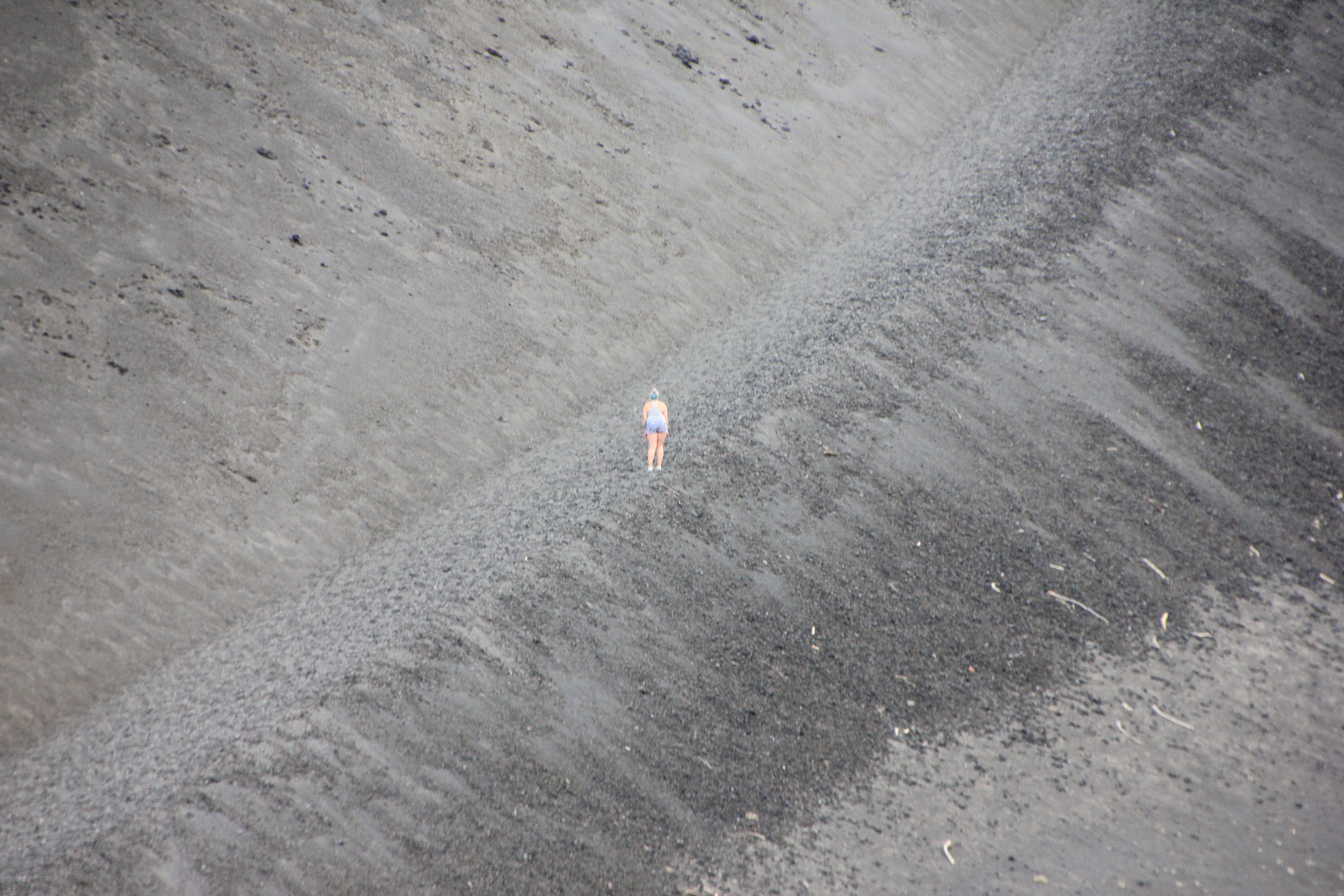
The small
volcanic sand-like gravels can make the hike more challenging.
If you will
look south of the trail, where no trees are growing you can see the large Fantastic
Lava Beds flow section, the origin of the large lava flows are from the base of
the cone.

At 1.2 miles,
the trail reaches a fork left , just before the base of Cinder Cone.
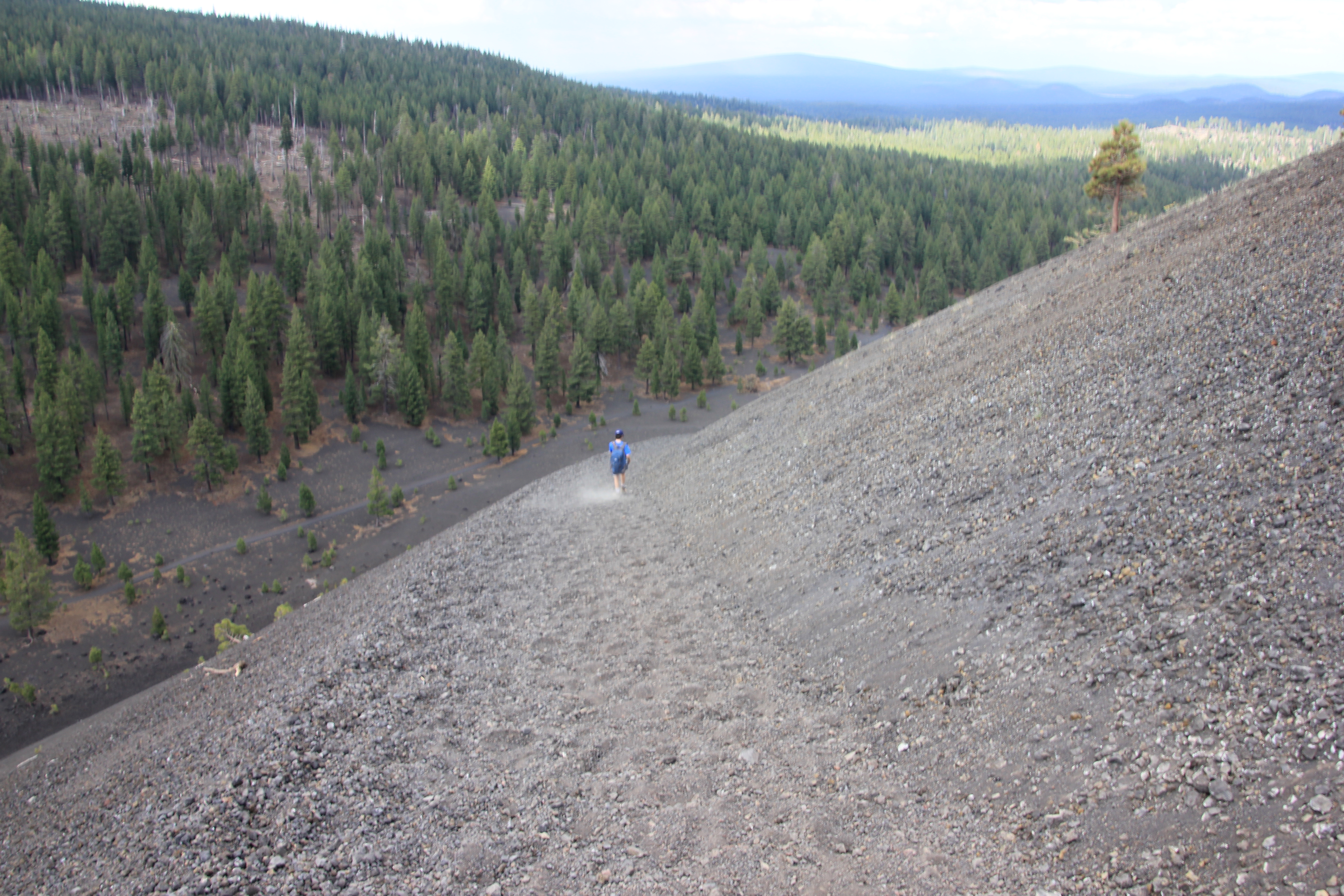
When climbing
the 500 ft cone please stay on the trail to avoid scarring the landscape for
many years with footprints.
Climbing up the
cone trail is a challenge because of the steep slope and all the loose rocks that keep sliding you
down, like you are walking up a sand dune.

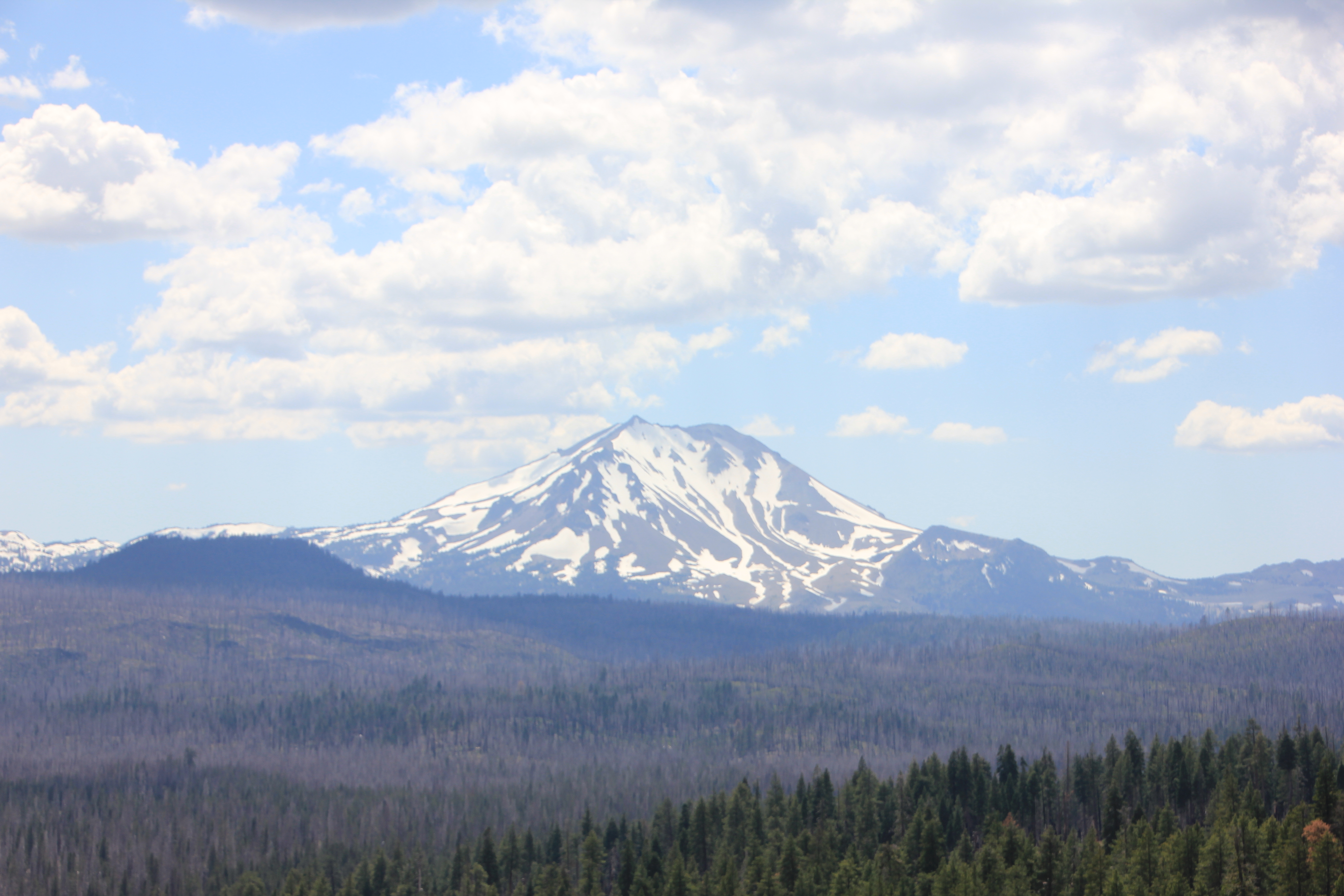
As you climb up
on the steep trail and start to circle the narrowing cone Lassen Peak comes
into your view.


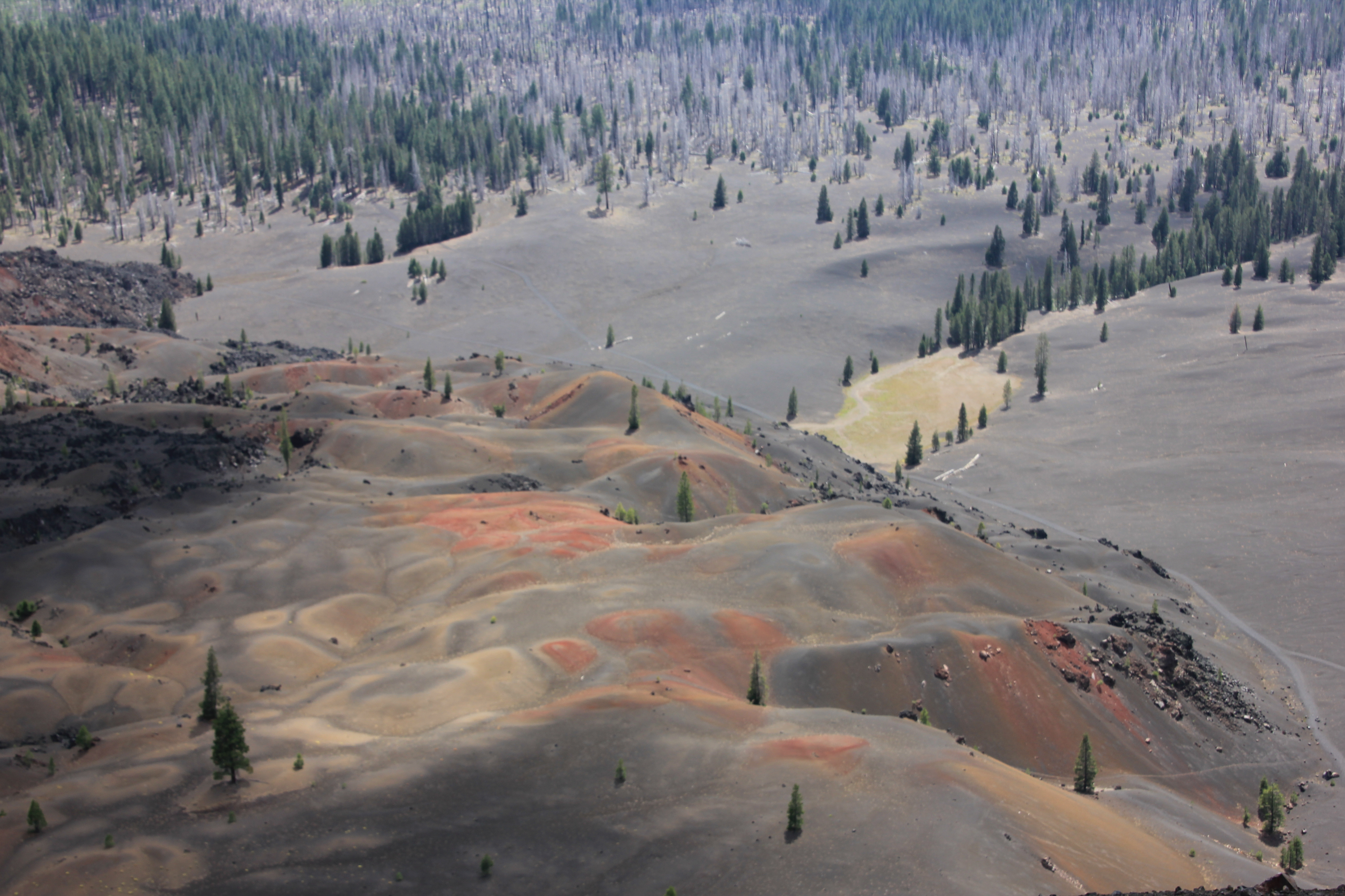
Once you reach
the summit you will enjoy the panoramic views in all directions.
North of you
there is the large Prospect Peak (8338 ft), the large Fantastic Lava Beds
spread all the way back to the lake and the Painted Dunes are clearly visible
below the cone on the southeast side, Lassen Peak is visible far to the west.


The trail at
the top circles the cone rim, but you can also hike down into the crater of Cinder
Cone.
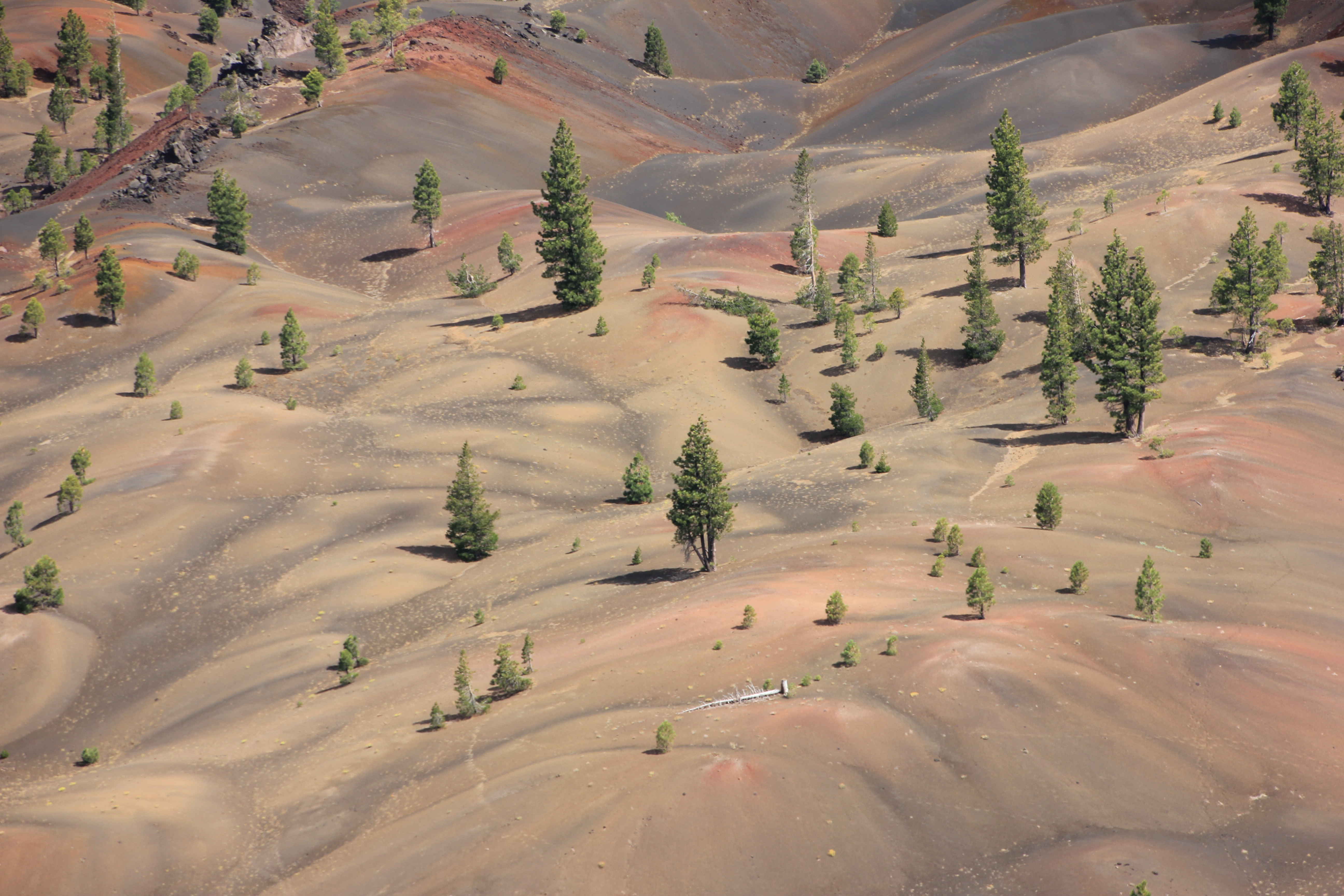
Approach the southeast
rim and you will see below you the beautiful Painted Dunes.
This relatively
small area of rolling terrain covered with colorful send where few pine trees
manage to grow.


According to
the U.S. Geological Survey the colors were caused by volcano ash spewed from
the Cinder Cone becoming oxidized because it fell on the lava flows when they
were still hot. This process, hot, oxidation with minerals introduce the different
colors into the send.
This is very
interesting to see this color mix from above and “discover” the different color
palettes.
Once you decided
you spend enough time here, enjoying the view and that you want to go back you
can take the same trail you climb up, but I do recommend taking the east side
trail that will take you down near the painted dunes, keep heading right
(north) and you will reconnect back to the main trail.
www:
https://www.nps.gov/places/cinder_cone.htm
Map:
https://www.nps.gov/carto/hfc/carto/media/LAVOmap1.pdf
Additional Pictures:


Comments
Post a Comment