
Introduction:
What? : Majestic
Castle Crags 6000-feet tall granite spires are located above Castle Crags State
Park. The Park offers a variety of camping, picnicking, hiking, and fishing
opportunities.
This location is part of my "North California Waterfall Loop" road-trip suggestion.


Where? : The park is located
just off highway 5, 14 miles south of the City of Mount Shasta and 21 miles
north of Shasta Lake.
Google Map Link

When? : The park open
year round but winter is less recommended season to visit (snow and cold
weather).
Due note 1: Dogs are not
allowed on hiking trails.
Due note 2: Castle Crags
State Park is open year-round for camping (76 developed campsites), day use
subject to closure during severe winter weather conditions.
Due note 3: Castle Crags
Wilderness and the tall granite mountain spires border the northwestern edge of
Castle Crags State Park.
Due note 4: If you are
planning to park and hike from the Vista Point parking lot make sure to come
early morning. The small parking at the end of the road may be full and you do
not have any other close option to park at.
Due note 5: For Crags
Trail plan for a half day hike, bring enough water with you and warm cloth for
cold days.
Due note 6: You can
combine this park visit with several other excellent nearby destinations, see
my Redding and Shasta Waterfalls Loop Road Trip blog
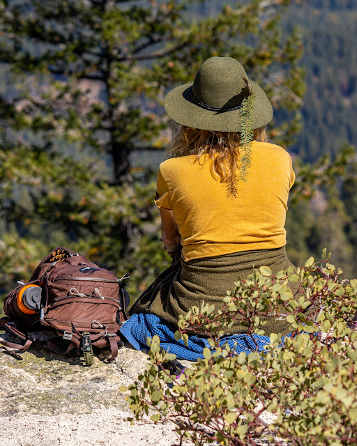
My thoughts: I visit this
park with one goal in mind, hike up the Crags Trail. The trail starts at the
upper parking lot to the base of Castle Dome. It was fun hike, I’m in a good
shape but this climb was tough constant uphill hike. The view from the top is
amazing, Castle Crags, Mount Shasta, and the river gorge below.

Addition North California blog posts:- North California - Waterfalls Loop Road-Trip (Redding – Shasta)
- McArthur Burney Falls State Park
- Potem Creek Falls, Shasta-Trinity National Forest
- Hatchet Creek Falls, Shasta County
- McCloud River Falls, Shasta-Trinity National Forest
- Lake Siskiyou and Faery falls, Shasta County
- Heart and Castle Lakes Hike, Shasta County
- Hedge Creek Falls, Shasta County
- Redwood Parks at Northern California Coastline – Visit Planning
- Highway 101 Attractions between Leggett to Avenue of the Giants
The visit:
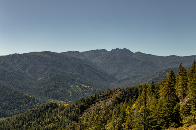
The large state
park has 28 miles of hiking trails, some are moderate and some that climb up
the mountains can be long uphill strenuous hikes.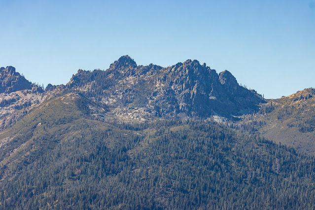
Parking at the Vista Point parking
area:
The small
parking lot at the end of the road can get ill up midday. If it full there are
no other nearby parking options, you need to wait or to drive down half a mail
and find roadsides parking spots.
Highly advise
to come early morning or later in the afternoon (not too late, make sure to
have enough time for the long hike).
Easy hike options:
From the Vista
Point parking area, a quarter mile accessible trail leads visitors to Vista
Point where there are dramatic views of Castle Crags, Mount Shasta, and nearby
Grays Rocks.
Another easy
hike is the mile long Root Creek Trail that will take you to a year-round
flowing creek.

Crags Trail Hike:
My visit here
was centered around hiking the Crags Trail which leads adventures to the base
of Castle Dome.
This is the
most popular and challenging trail in the park which leads to the base of
Castle Dome where the views are simply breathtaking.

This hike one
way is 2.6 miles long (5.2 miles out and back) with a constant climbing,
overall elevation gains of 2,200 ft.
When arriving
mid-day to the park I did not find any parking spot available at the Viewpoint
parking lot. I did not want to wait until it get one available. I drove down
and find off the road parking, 0.6 mile down the road, this add 0.6 mile of
climbing just to reach to the parking lot.
Overall, it
took me 3.5 hours including a long rest at the top but I’m in a good shape and
hiked fast all the way up (and down).
For moderate
hiking past plan for 4-5 hours hike.

The trail starts
at the parking lot north section, follow the signs to Crags Trail, soon after
start hiking you will reach trail junction, keep left. From this point this is
constant hike up the mountain.
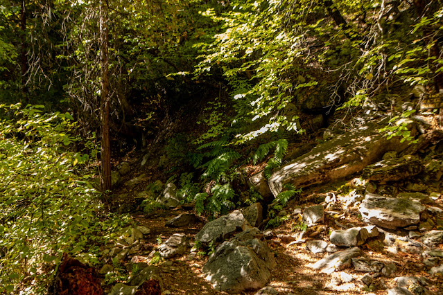
Cross few other
trails and keep hiking, this section is covered with pine forest so it has
shaded (old fire traces can be seen in this trail section).
After hiking 1.6
miles from your starting point, you will see the side-trail to Indian Springs
Trail, a short 0.2-mile hike to the springs. I will recommend taking this trail
on your way back unless you want to have a stop in a nice place on your way up.
Soon after
Indian Springs Trail the Crags Trail starts to find its way up the steep
mountains rocky section, the forest change and landscape become open.
After and many
switchbacks climbs you will reach the open section just below Castle Dome,
overall distance from the parking lot is 2.6 miles, but it looks and feel
longer 😊.
Here there are
few viewing points, just above the cliffs, be careful not to fall from the
cliff edges.
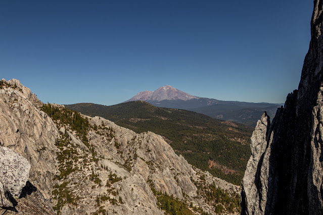
The dramatic
views of Castle Crags pinnacles towering above you on one side, Castle Dome rock
on the other, Mount Shasta to the north and the Shasta River gorge below.
After resting
and enjoying the amazing view you start your hike back down to the parking lot.
www:
https://www.parks.ca.gov/?page_id=454
https://www.parks.ca.gov/pages/454/files/CastleCragsCampgroundMap2014.pdf
Map:
https://www.parks.ca.gov/pages/454/files/CastleCragsSP_WebBrochure2014.pdf
Pictures:


Comments
Post a Comment