
Introduction:
What? : This hike, although
relatively easily accessible from the main road, gets into the wilderness area
of the park where you will cross a mountain ridge and get into less visited mountain
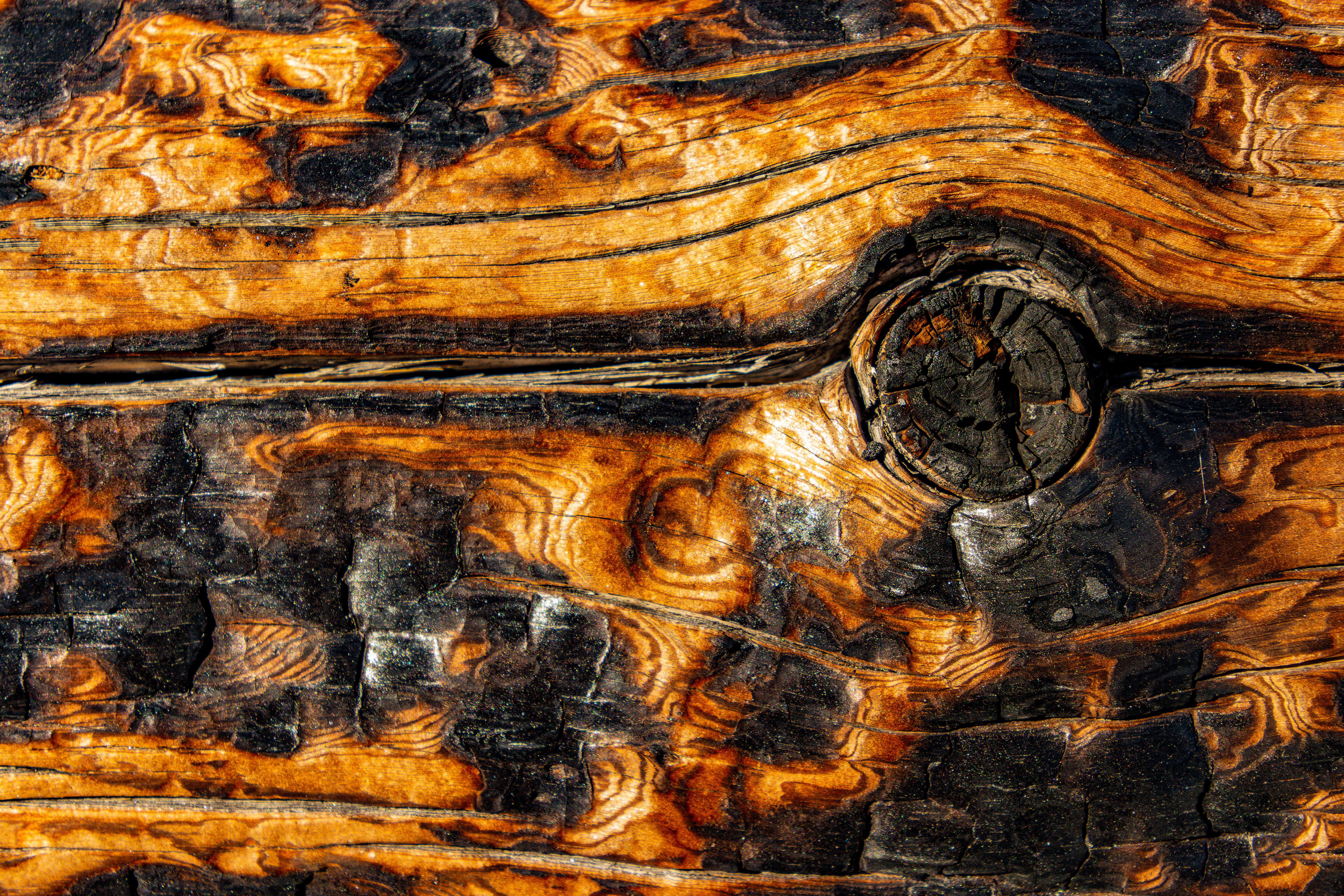
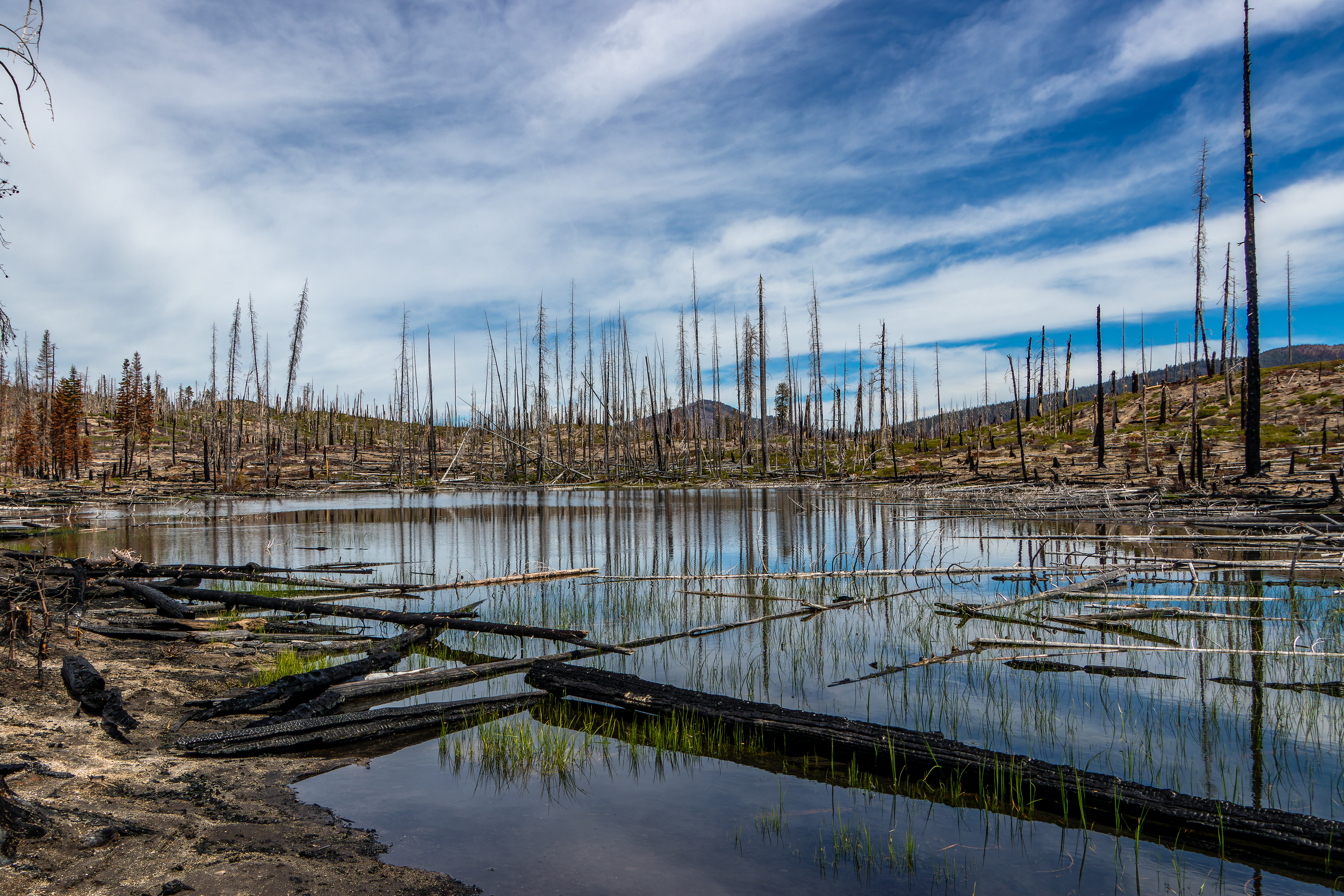
area that has many lakes. This area was hit by several wildfires, including the
2022 Dixie fire and for most of the time you will hike in a partly or fully burned
forest area.
The hike I did here
was the longer 12-miles Cluster Lakes loop (it took me 5.5 hours to complete with almost no stops, plan for 6-7 hours hike), this is a rewording hike, and you
will probably be the only one out there. Another, and more popular, hiking option
is to hike out and back to Echo Lake, this is 4.5-miles hike.


Where? : Summit Lake
Ranger Station Trailhead located 17 miles north of the southwest entrance or 12
miles southeast of the northwest entrance. This is a small exit from the main
park road leading to a parking lot in the woods. If you are coming from the
north and you reach the Summit Lake North Campground entrance you just missed
it, if you are coming from the south this is the first right turn after you are
passing the north Campground.
If you are
staying at one of the Summit Lake Campgrounds, you may also pick up the Summit
Lake trail from there.
Google Map Link

When? : You can
reach the trailhead parking lot once the main park road is open from the north
and you can drive up to Summit Lake. When the park road is open south to north
you can reach here also from the south park entrance.
Additional Lassen Volcanic Park Blogs and Related Posts:
Lassen Volcanic NP – Trip Planning
Lassen Volcanic NP – Echo Lake and Cluster Lakes loop hikes
Lassen Volcanic NP – Kings Creek Waterfall Hike
Lassen Volcanic NP – Sulphur Works and Ridge Lakes Hike
Lassen Volcanic NP – Cinder Cone and Painted Dunes
North California - Waterfalls Loop Road-Trip (Redding – Shasta)
McArthur Burney Falls State Park
Potem Creek Falls, Shasta-Trinity National Forest
Hatchet Creek Falls, Shasta County
McCloud River Falls, Shasta-Trinity National Forest
Lake Siskiyou and Faery falls, Shasta County
Heart and Castle Lakes Hike, Shasta County
Hedge Creek Falls, Shasta County
Castle Crags State Park
Due note 1: Echo Lake hike
is relatively popular hike, but the longer 12-miles loop is less visited.
Due note 2: The trails
here, and at the rest of the park large wilderness area are less (not)
maintained so much and in some cases are in bad conditions. The fires that burned
through the park in the last 20 years left the deed tree trunk standing and after
several years they fall and block the trails. The focus of the park trail maintenance
crews is on the most popular trails, campgrounds, and facilities so all other
trails are not maintained. This 12 mile hike passes through some sections where
it difficult to find the trail.
Due note 3: In this hike
you will pass by many lakes (I counted 10 larges lakes), I hiked here in June but
I’m sure they all have water year-round so you do not need to carry a lot of
water with you, bring a filtration bottle and you can fill water.
Due note 4: I highly recommend
for this hike to use a navigation phone application. I’m usually using GaiaGPS
but also Alltrail is good. There aren’t any major navigation challenges here
but in some sections the trail is not clear and covered with falling logs and
you may miss trail junctions. It is always good to have a navigation app on top
of a paper map that you always need to carry with you…
I also recommend
to carry with you a charging battery-bank for the phone…

Due note 5: Pets are not
allowed on any hiking trails in Lassen Volcanic National Park.
Due note 6: As Always bring
plenty of water to your hike, it can be hot out here and when crossing burned
forest areas there is no shade, and you are fully expose to sun.
Due note 7: Lassen is home
to an estimated 50 black bears. As in the rest of California there are only
Black Bears even if their color is brown.
When hiking Cluster
Lakes loop hike, I saw a Bear, he was relatively far and running away from me,
but I still manage to take some pictures.
When Hiking be Bear
aware and stay safe, for more information:
https://www.nps.gov/lavo/planyourvisit/bear_safety.htm#storage

My thoughts: I really enjoyed
this hike. Although you will hike in many sections where the fire completely burned
and destroyed the forest and all you can see are standing burned tree trunks,
because it was different this is a hike I will remember. The north section of
the trail cross an old fire area where all the ded trees are with gray/white
color, many of them fall and completely cover the trail.
Interesting side-effect of the fire is that the landscape is now “open”. Usually when hiking in such forest covered area you do not see a lot of the landscape and all you can see is the woods near the trail. Here where the fire “clears” the forest you can see the surrounding mountains, valleys, and lakes in the area. This is why I manage to spot the bear from several hundred feet away.

The visit:
There are few
hiking options starting from Summit Lake Ranger Station Trailhead: hike out and
back to Echo Lake (4.5 miles hike), or as I did a much longer and less visited
loop hike that cover a lot more of the park remote wilderness (12 miles hike, it took me 5.5 hours to complete with almost no stops, plan for 6-7 hours hike).
I will describe
both hiking options in detail:
Echo Lake Hike:
This is 4.5
miles hike starting at Summit Lake Ranger Station, plan for 3 hours hike
depending on your hiking past and how much time you want to spend at Echo Lake.
From the Ranger Station trailhead, the trail starts by crossing the usually flooded meadow on a boardwalk and from there the trail turn right into the direction of the Summit Lake campsite.


After short hike you will see on your right side the campground, keep
hiking to the direction of the lake. After reaching the lake shore look and
enjoy the reflections of the mountains in the lake. Keep hiking left and after several
hundred feet you will reach a trail junction, this trail junction is around 0.45
mile from your hike starting point.
You can also reach
this trail junction location from both campgrounds, there is a trail that circle
the lake.


From here you
will take the Echo Lake Trail (also leading to Twin Lakes), the trail starts to
climb moderately the mountain range east of the lake, this is not a difficult
climb although you are climbing 400 ft. This section of the trail cross area
that was severely damaged by the fire, but the trail is in good condition. Because
of the fire, as you are climbing up, you can look back and see the mountain
peaks towering above the rest of the landscape.


After 0.9 miles from the lake you will reach a relatively flat area and here you will see a trail junction post. Turning left here will take you to the longer Cluster Lakes Loop (see details below), for Echo Lake we will keep heading right.

After additional
0.2-mile hiking in a flat area the trail starts to descend 300 ft all the way
to Echo Lake, from the trail junction to the lake it is 0.82 miles. The last
section of the hike pass trough a forest that was not hit by the fire, it is interesting
to see how a short distance and different conditions effect the fire outcome.
Once you reach
the Echo Lake you can stay at the west shore or take the 0.7-mile-long trail
that circle the lake.

The shaded
shores and green cold blue water of Echo Lake offer hikers a quiet destination
for picnicking, swimming or relaxing.
Overall, from
the Parking lot Trailhead to the lake shore it is 2.2-mile hike.
After enjoying
the lake, you need to hike back the same way you arrived.
I was hiking
this trail as part of my larger loop hike and only at this trail section I saw few
other people where hiking to Echo Lake.
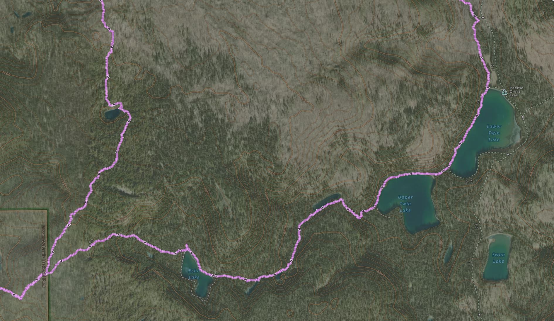
Cluster Lakes Loop:

This hike is 12
miles long with overall elevation assent of 1530 ft, it took me 5.5 hours to complete
with almost no stops (plan for 6-7 hours hike).
I highly
recommend doing this hike, you will cross many different areas and can enjoy
the more remote landscape of this park, some areas are completely burned and
others are less effaced from the fires, you will pass many lakes and there is
always something different to see.
The starting description
of this hike is the same as the above hike to Echo Lake.

After 1.4 miles
from the starting point, you will reach the trail junction that is leading into
Cluster Lakes Loop. Here the Bear Lakes Trail turns left (north) and start to cross
the flat area with easy climb up.
After 0.5 mile of
easy climb from the trail junction, you will cross a ridge line and start to descend
to the first lake you will see in this loop, hiking down 0.5 mile and you will
see the small, un-named, lake. The 1-mile trail from the trail junction to this
lake was relatively clear.


From this small
lake the trail keeps heading north and after 0.5 miles it start descending into
the direction of Little Bear Lake. Just before the trail descends into the valley
on your left you can see a nice view of the landscape to the east.

After hiking
1.15 miles from the unnamed lake, you will reach Little Bear Lake and after
additional 0.3-mile descend you will reach Big Bear Lake.


This area was completely
burned during 2004 fire and all the gay/white dead trees trunks are still there,
some are standing but many fall to the ground.

Once you reach Big
Bear Lake the trail became difficult to find, it is there but all the falling
trees and the renew low vegetation hide it. It does not look like that this
section of the trail was ever cleared from all the falling tree logs. When I
hiked here (10 days from last rainfall) it did not have any indications of fresh
foot tracks.


It doesn’t look
like many people are hiking here and you really need to look good to find the
trail in all this mess. Try to find the trail and not just to walk in the right
direction, it is easier and has less growing vegetation.
You will hike
along the Big Bear Lake shore and from the lake there is another 0.5 mile of
hiking down into the direction of Cluster Lake. I manage to follow the trail but
almost completely missed the trail junction signed that was buried under a huge
tree that fall on the trail junction post.

From the trail
junction that we left Echo Lake trail to this point it is 3.12 miles.
Once you almost
reach to Cluster Lake and hit the junction with Cluster Lake Trail you turn right
(keep hiking on Bear Lake Trail) into the direction of the nearby Silver Lake.
Soon after
passing Silver Lake, you will reach Feather Lake.


All this area
was severely damaged by old and latest fires, and it is almost completely clear
of trees.
In this hike
section I saw the Bear.


he Bear saw or
heard me first when I was still far and looks like he was afraid, he just run
away.
All happened fast,
the bear was fur and running away and I did not manage to get good pictures. This
Bear encounter shows me how fast bears can run. I know they can run fast but
this was surprisingly very fast and for long time, running constantly up the mountain
slop all the way to the top and to the other side.

I kept hiking heading
to the direction of Lower Twin Lake, on the right-side Fairfield Peak is the
dominate mountain and the somehow unclear sections trail is crossing the lower
valley floor.
After 2 miles from
Cluster Lake, you will reach the trail junction with the PCT, additional
0.35-mile hike will bring you to the relatively large Lower Twin Lake.
I stayed on the west
side of the lake, the trail here passes right on the lake shore.
After hiking
almost 0.5 mile along Lower Twin Lake and crossing the short distance between
the lakes you will reach Upper Twin Lake.


Keep walking
all the way to the west side of the lake, looks like that the forest near the
Twin Lakes was not hit by Dixie fire and everything is still green.
The trail section
from Cluster Lake to the west side of Upper Twin Lake is relatively easy hike
without a significant elevation gain.
Right after Upper
Twin Lake there is a short but steep climb out of the valley, after the first climbing
section you will pass a long narrow pond, additional climb will bring you to
Echo Lake East shore.
From Upper Twin
Lake to Echo Lake, it is 1.2 miles hike.


Comments
Post a Comment