
Introduction:
What? : The Sierra
Buttes Fire Lookout (8587-ft) in Northern California is an incredible 6* miles
out and back hike with amazing views at the top (1600 ft elevation gain). One of
the most rewording hikes with amazing 360 view.
*you may do a slight
shorter 5-miles-long hike depending where you park your car.


Where? :
From Sierra City
(highway 49): head northeast on Highway 49 for about 5 miles. Turn left on Gold Lake Highway. After 1.3
miles, turn left again on Packer Lake Road.
From Sierraville
(highway 49): head west on Highway 49 for 18 miles. Turn right on Gold Lake
Highway. After 1.3 miles, turn left again on Packer Lake Road.
From Graeagle
(highway 89): drive south on highway 89, after 1.4 miles turn right into Gold
Lake Highway. Drive south on this road for 14.1 miles and turn right on Packer
Lake Road.


Follow signs
for Packer Lake, turning right at the split (0.3 mile from the road junction). Shortly before reaching Packer Lake, turn
left on Co Rte 621 (marked with a sign reading: Sierra Buttes). Follow this road up a steep grade until you
reach a wide junction with many parking spots (Packer Saddle). I parked at the junction
(also junction with PCT) and start my hike here.
Google Map Link
Bear at South Lake Tahoe
Emerald Bay State Park – Lake Tahoe
Eagle Lake Hike – Lake Tahoe
Susie Lake Hike – Lake Tahoe
Emerald Bay State Park – Lake Tahoe
Eagle Lake Hike – Lake Tahoe
Susie Lake Hike – Lake Tahoe

You can turn
left and drive for 0.5 mile and find another parking spot and trailhead.
Google Map Link


When? : Late spring
(snow melting), summer and fall. When I visit here ate mid-June 2022 (low snow
year) there were still large snow patches melting at the high elevations’ sections
of the trail.
Gold Lake Road
is closed in winter.


Due note 1: Although not
long this is considered a challenging route, it takes an average of 3-4 hours
to complete, with enough rests along the climb also average hikes can do this.
Due note 2: This is a very
popular hike, my recommendation to avoid the crowds, go early in the morning or
late in the afternoon.
Due note 3: Dogs are allowed
(this is Tahoe National Forest), even MTB are allowed in the trails. Sierra
Buttes is not in a wilderness area, so a permit is not required for camping in
the backcountry. There are many fee campgrounds near the lakes off Gold Lake
Road.
Due note 4: There is no
water, restrooms, or any other services along the trail.
Due note 5: Nearby towns of Sierra City (closest), Graeagle, probably have commercial lodging available. This is about 1 hour drive north of Truckee CA on highway I-80.


My thoughts: For a few
years, since the first time I saw the amazing pictures of the lakes below the
mountain this hike has been on my “to do” list, I finally find the time to
hiked it and it did not let me down. This was my first time in this area (Gold
Lake Basin Highway) and looks like there is a lot to see, do and visit here, I
will come to explore this area again.

The Hike:
At 8,857 feet
in elevation, Sierra Buttes is the tallest peak in the Lakes Basin region, and
offers one of the best hikes and viewing points in the northern Sierra.
The lookout was
built 1915, the actual completion of the stairs was done only in 1964 by five
Tahoe employees during that summer, this made it possible for people to visit
the top safely today.
I started my
hike at the road junction at the top of the climb at 7,000 ft elevation, this
is the large road junction and the location where the PCT cross the road, but
you can drive a ¼ of a mile south on the ridge and park your car there.

From the junction,
you will begin your hike by walking south on the PCT parallel to the road. After
very short climb the trail level and after 0.35 mile you will pass another “more
official” parking lot, keep hiking on the ridge. After 0.5 mile from the
starting point, you will reach another trailhead parking option. From here the
real climb begin.
The dirt road trail
going uphill right away for 0.5 mile and here, 1 mile from my starting point, you
will see that the dirt road turn left (down) and a hiking trail to the right is
going up, keep hiking the trail on the ridge.


At this point
the trail levels out for almost 0.5 mile as you are walking along the ridge line,
you can see the lookout from here, far on your left.
Now, the trail
starts another steep section up through a shaded grove of trees. After hiking
almost 3 quarters of a mile you will reach a forest opening and connect to a
forest dirt road (close to cars), this is 2.3 miles from your starting point.


Here you can rest
and walk east to the direction of the cliff and see Yong America Lake way below
you nested between the mountain cliffs.
From here you
can take the dirt road up or better use the hiking trail.


Continue upward
in a series of large moderate switchbacks through the forest where the trees
are getting larger and more spread up. Soon the trail connects to a
four-wheel-drive dirt access road that will lead you up.
Hiking the last
quarter mile on the road with a series of long switchbacks.
After the last
turn and you will see the lookout, cross another corner, and you will reach the
base of the butte.
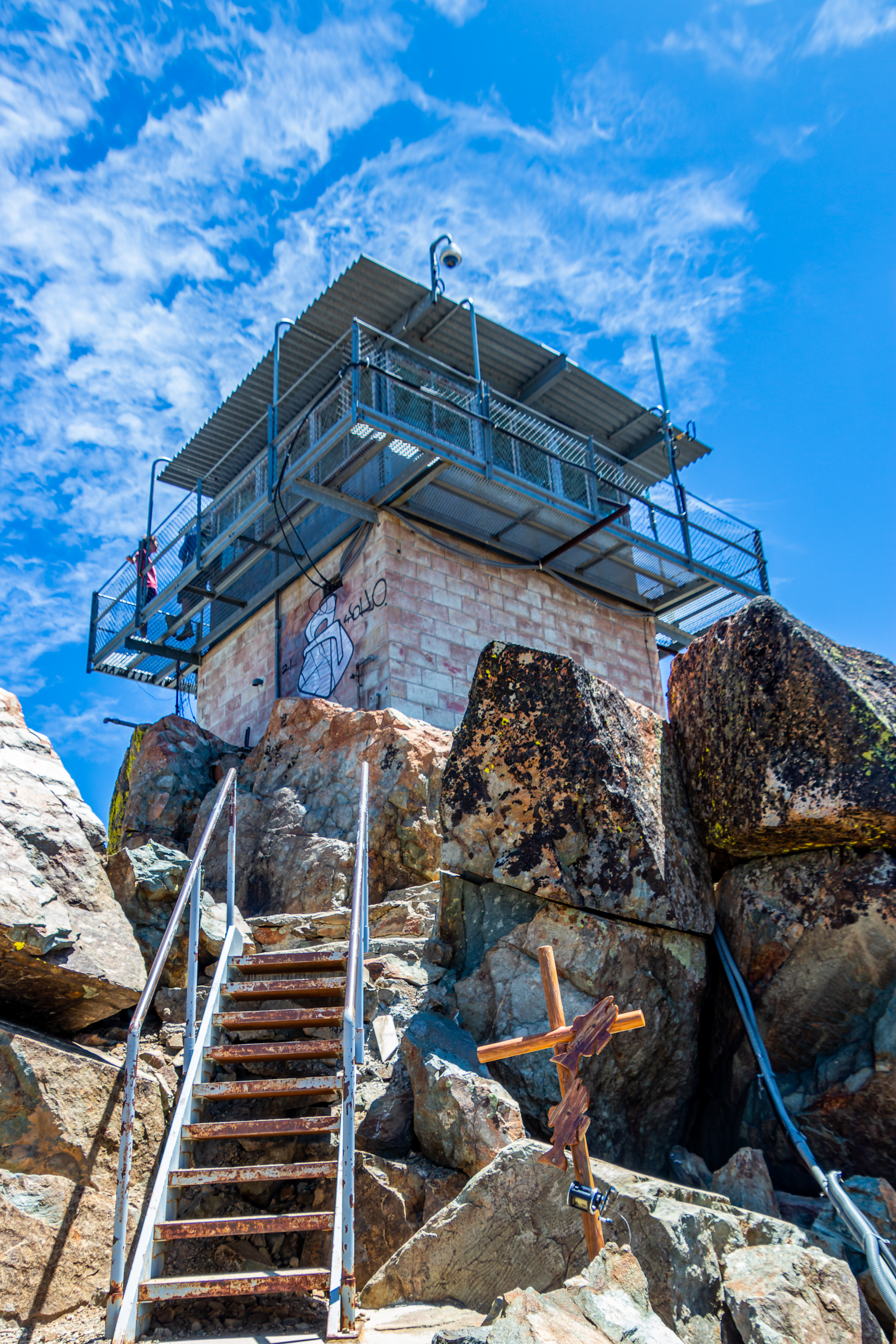
From here there
are about 200 stairs that will take you to the lookout structure.

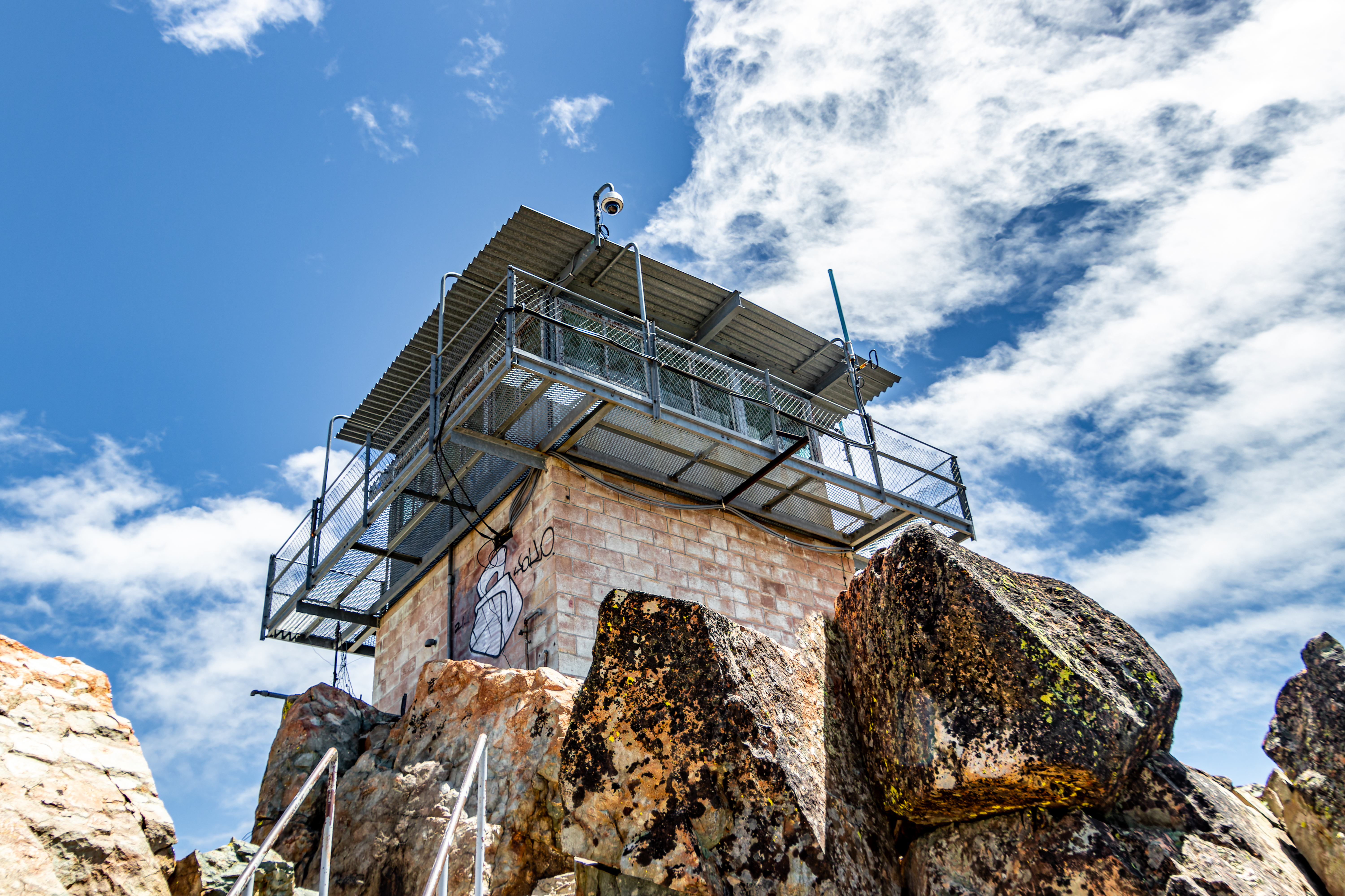
The lookout house
is close, but you can walk up to the balcony surrounding the structure.
From here you
will see one of the best and most impressive views in the entire area.


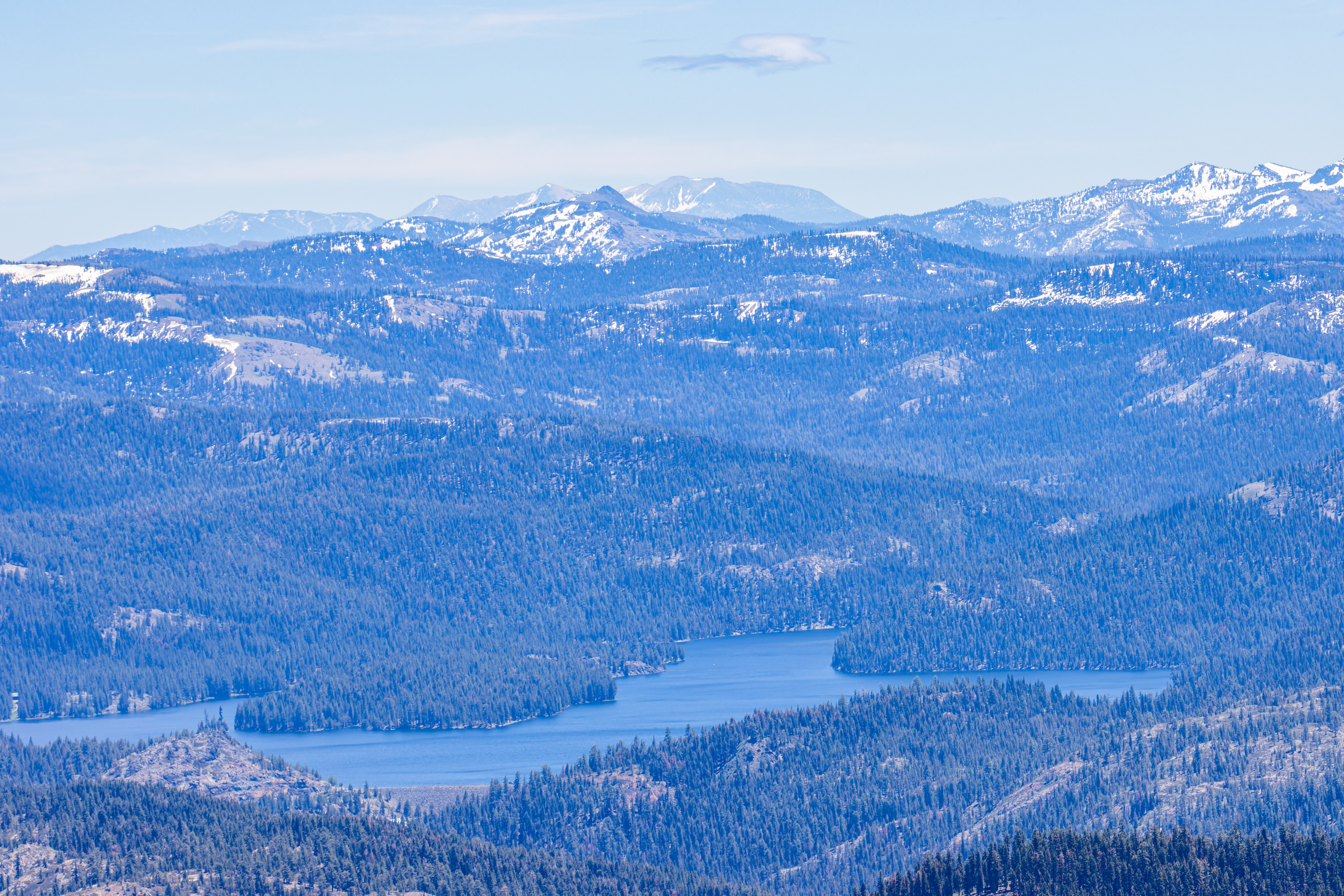
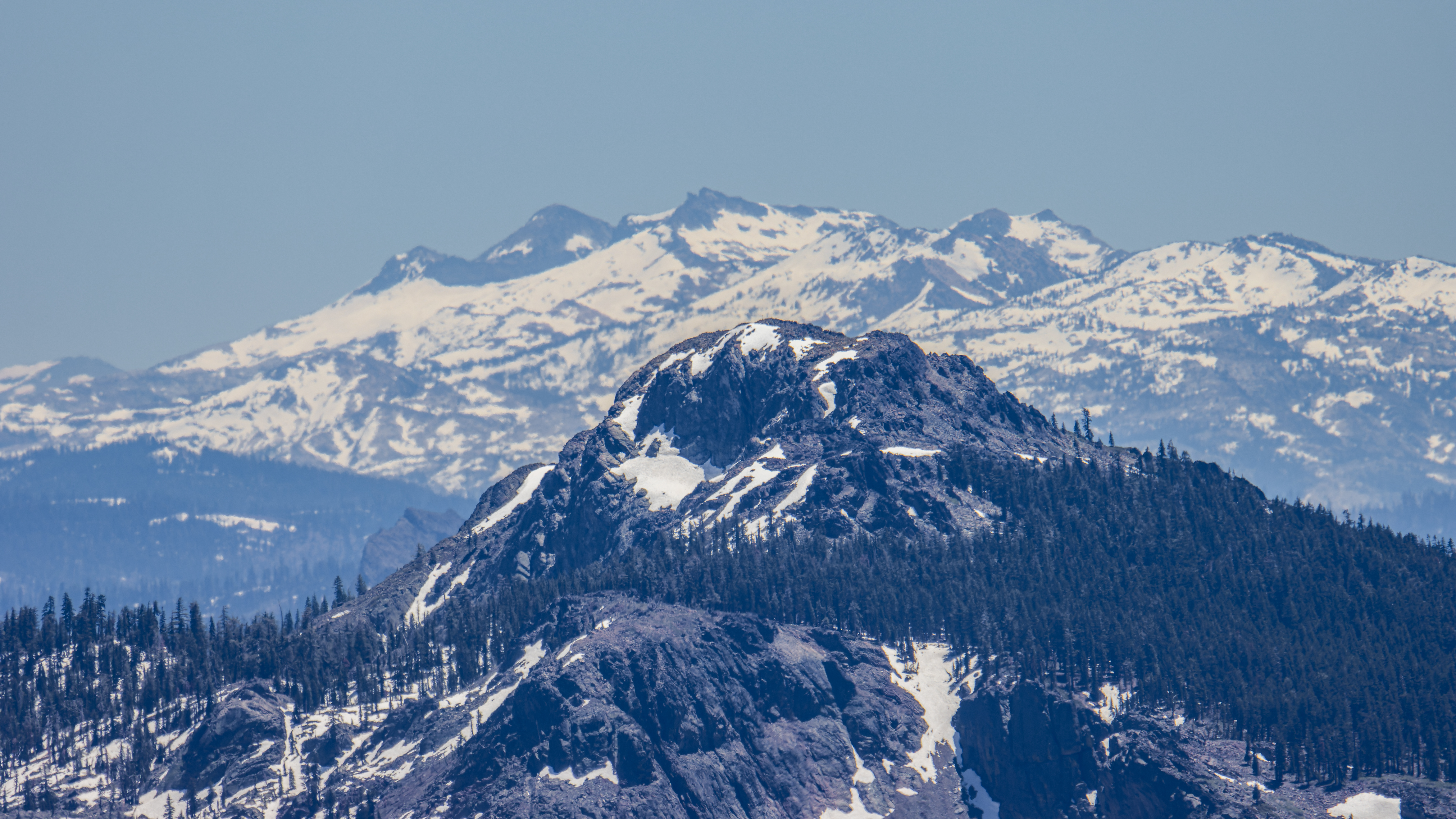
Sardines Lakes
(upper and lower) are way below you; the entire Gold Lake Basin area, lakes and
mountains is to your northeast, the 360 view from this lookout is just amazing.
Depending on
the weather and air quality you may see Mt Lassen 75 miles to the northwest and
Tahoe area 50 miles to the southeast.

I got to my hiking
starting point at 12pm and there where many cars in both parking lots, when
hiking up the trail I saw many groups of people taking their way down. It took
me 1 hour and 40 minute to hike the 3 miles up to the summit with 1630 ft
elevation gain.
When I was at
the lookout there was another one couple there, when I climbed up, they went
down so I had the place to myself. My recommendation to avoid the crowds, go
early in the morning or late in the afternoon.

After spending 15
minutes up at the lookout in the cold wind, eating, drinking, resting, and
enjoying the view, I headed down the trail.
I started my
way back down, this time the 3-mile-long trail back to my car took me 1 hour
and 15 minutes.
Summary:
All in all,
this is one of my favorite hikes I did in north central California. Excellent hiking
exercise and rewording view from the butte lookout.
Pictures:


Comments
Post a Comment