
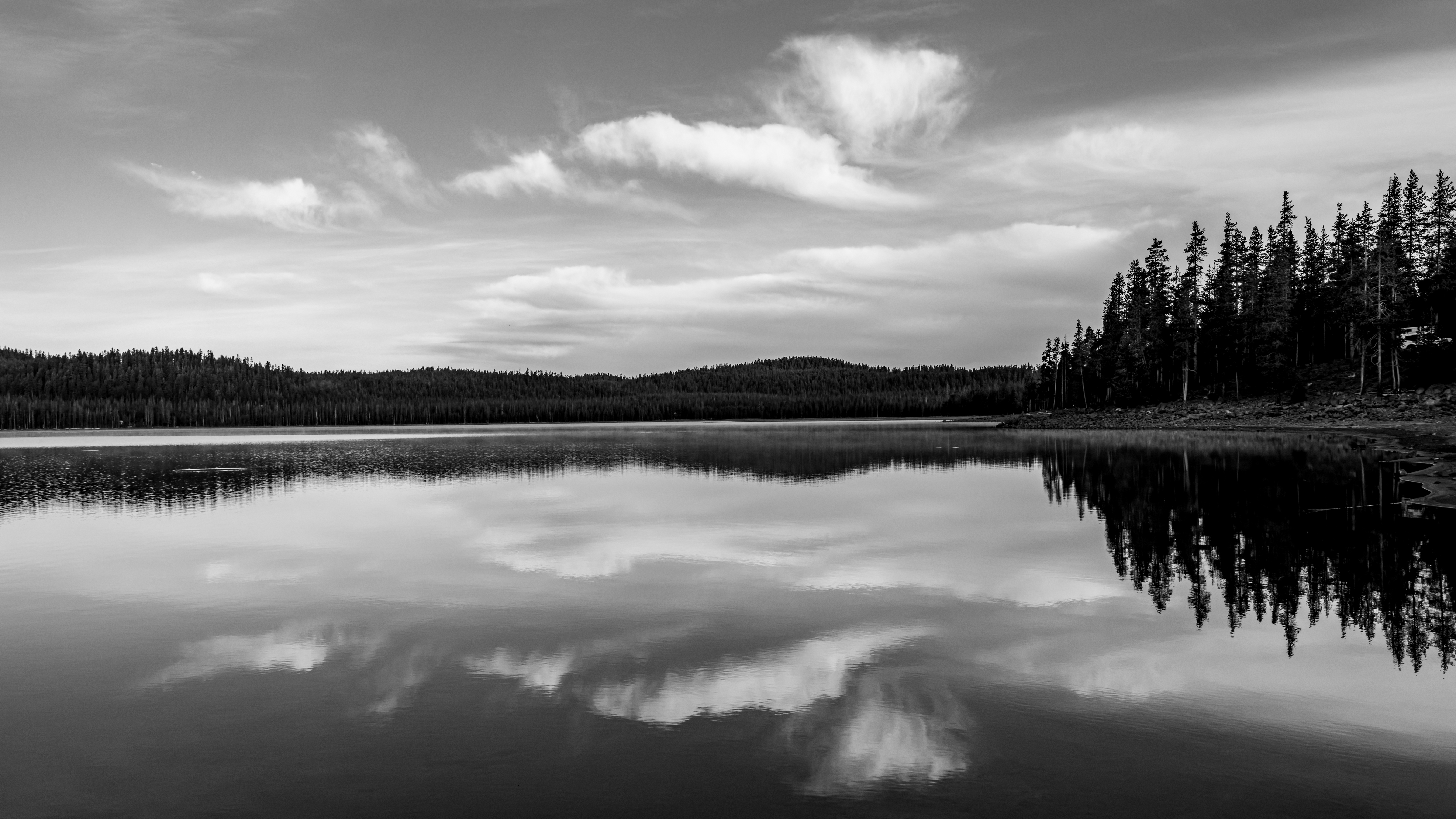
Introduction:
What? : Lava
Beds National Monument is unique park located at a far location in East Northern
California just on the border of Oregon. You have many things to see and
explore in this remote park so it worth the visit. It’s rugged high lava flow
desert landscape, dotted with volcanic mountains and cones, countless lava tube
caves that you can walk into and explore, Native American rock art, historic battlefields,
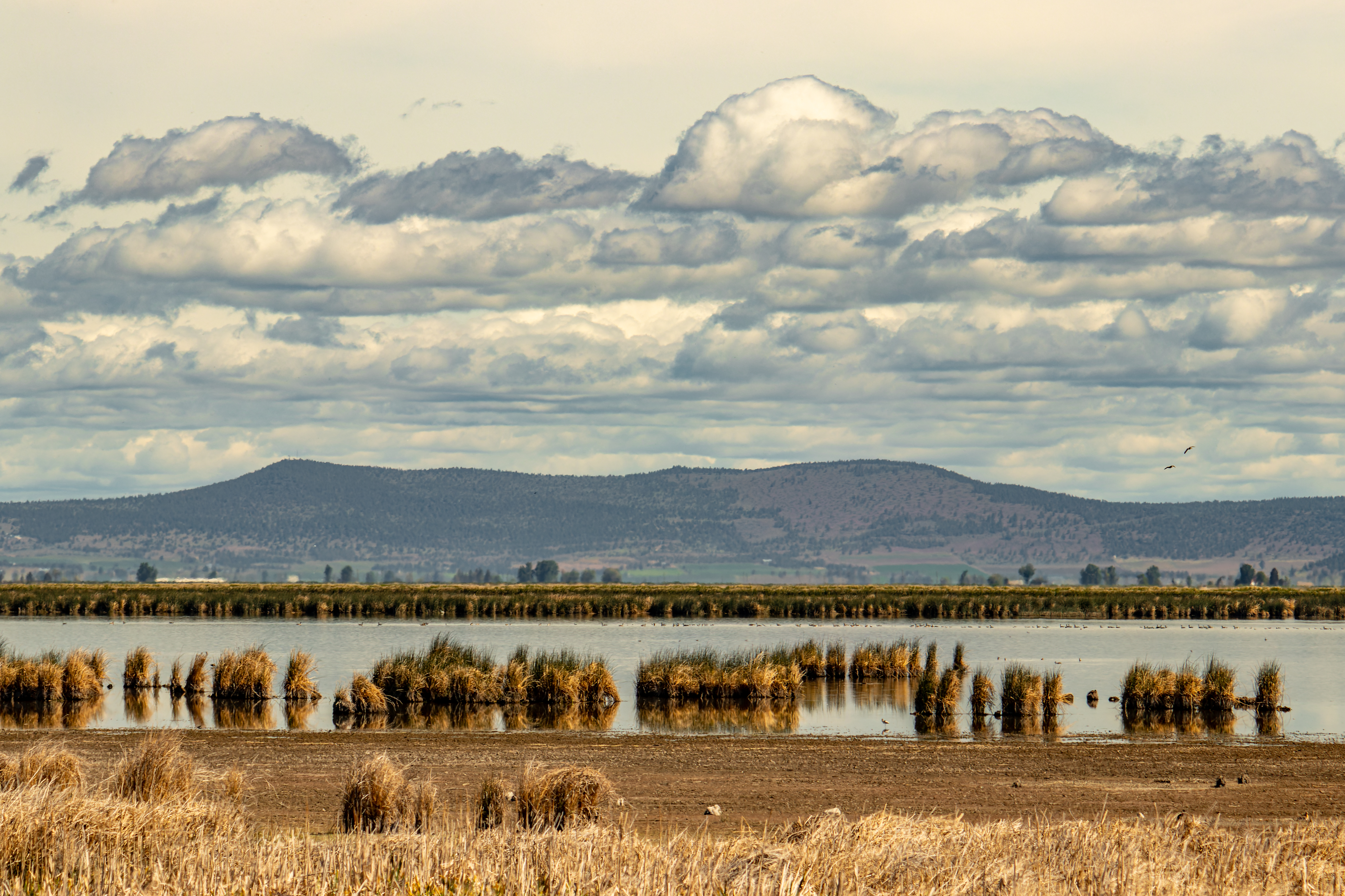
and the nearby Tule Lake National Wildlife Refuge.


Additional Lassen Volcanic Park Blogs and Related Posts:
Lassen Volcanic NP – Trip Planning
Lassen Volcanic NP – Echo Lake and Cluster Lakes loop hikes
Lassen Volcanic NP – Kings Creek Waterfall Hike
Lassen Volcanic NP – Sulphur Works and Ridge Lakes Hike
Lassen Volcanic NP – Cinder Cone and Painted Dunes
North California - Waterfalls Loop Road-Trip (Redding – Shasta)
McArthur Burney Falls State Park
Potem Creek Falls, Shasta-Trinity National Forest
Hatchet Creek Falls, Shasta County
McCloud River Falls, Shasta-Trinity National Forest
Lake Siskiyou and Faery falls, Shasta County
Heart and Castle Lakes Hike, Shasta County
Hedge Creek Falls, Shasta County
Castle Crags State Park

For a Beautiful Nature Prints - Visit my Etsy Store
Where? : Lava
Beds National Monument is located in a remote part of California, the
Northeastern corner; near the small town of Tulelake, California, and Klamath
Falls, Oregon.
There are 2 main
ways to reach the road that is crossing the park, one is from the north (highway
161) and the other is from the east (highway 139).
Google Map Link


When? : While the park
is open all year, not all roads outside the park are open during the winter and
early spring months. Occasionally in winter, snow can temporarily close park
roads until they are plowed.
During early
springs you can enjoy the wildflowers bloom and a hot summer day it is fun to
get into the cold air caves and enjoy the low temperatures.
Due note 1: Lava Beds has
one campground, Indian Well Campground, located 1/2 mile from the visitor
center and cave loop.
Due note 2: The Park Rangers at the visitor center can
help you plan your visit in the park based on your time constraints and skill
levels.
Due note 3: Some caves can
close due to nesting bats, check in advance about close cave in the park
website or at the visitor center and respect clear clos signs at cave
entrances.
Due note 4: You need a
Caving Permit before entering any cave. These permits are free, and available
at the Visitor Center during operating hours, I received it at the park
entrance station.

Due note 5: I recommend visiting
the cave by yourself as a self-guided tour, according to available time and
difficulty level chose the caves you want to visit, take your time, and explore
the different corners of the caves. There is no problem of getting lost inside the
caves because most caves are practically one tube, in and out walk. Make sure
you are keeping you and your group safe. The monument does offers ranger-led
cave tours, morning walks/talks, and evening campfire talks in the summer.

Due note 6: When getting into the cave it is recommended, but not a must, to have: long pants, closed-toed shoes, knee pads, and helmets. Gloves, knee pads, helmets, and few flashlights can be purchased at the visitor center. Flashlights can be checked out for free at the visitor center and must be returned each afternoon. Although recommended, it is not a must to have all the items above and you can enjoy the caves without any special elements like gloves, knee pads, helmets. A good reliable flashlight and one spare is a must !

Due note 7: Phones are not considered
as a flashlight, when getting into the cave carry with you 2 good flashlights.
Due Note 8: The caves have
cooler constant temperatures, ranging around ~50 degrees or cooler, dress
accordingly.
Due Note 9: In some caves
you can see the hydrophobic green/gold sparkling bacteria that cover portions
of the caves ceiling. The bacteria are sensitive, do not touch the “golden”
areas where it exists.


Due Note 10: No fires,
smoking, food, or pets are allowed in caves. You can bring water with you.
Due Note 11: First time spelunkers
(caving activity) and small children can handle these caves, provided being in
an absolutely dark close space under the surface doesn't scare you them too much.

My thoughts: Although its
remote location I visit this park several times and it was always fun to
“rediscover” the beauty of the many lava caves or to visit new caves that I
skip the last visit. The walk in the cave is unique experience, you can
actually see how the melted lava flow inside the tube like gluey-liquid or honey.
The interesting ceilings shapes where melted lava dripped and “frozen” into
spikes. Do not miss the longest and most challenging cave, the Catacombs, you
do not need to do it all, progress until you want and then hike out.


Plan Your Park Visit:
Lava Beds Park remote
location at the northern border of California is far from major tourist
attractions but it worth the effort coming here.
Due to park
relatively remote location I usually combing the visit here in a longer road
trip I’m doing in northern California (Redding/Lassen) or a visit at Oregon
state (Bend OR, Crater Lake NP,…).

How much time to plan for the park
visit:
I do recommend planning
your park visit as one full day and give yourself enough time to explore many
caves and do some hiking.
If you are
short in time and need few hours to drive to/from your next destination so also
a shorted half a day (3-5 hours) visit will be also good. If this is only few
hours visit plan ahead which cave to visit, start at the visitor center and ask the
ranger for recommendations.
Where to sleep:
The nearest
city to the park is Klamath Falls, OR. where you can find many night accommodation
and restaurants options.
Stay at the
park campground or if you are coming from the south, you can spend the night at
Medicine Lake campgrounds.
You can combine
this park visit as part of you South-North road-trip where you visit the park
for half a day, and from here you continue to your night destination.

Road trip Options:
(Direction is north to south but you
can do them also from south to north):
·
Klamath Falls OR à Park visit for half day à Drive to Redding CA through
highway I-5
·
Klamath Falls OR à Park visit for half day à Drive for 2 hours and visit at McArthur-Burney
Falls Memorial State Park à Drive
to Redding CA or stay for the night near Burney and the following day drive to
Lassen National Park.
Example of trips I did:
·
Visit Lassen NP and at the
afternoon drive north to McArthur-Burney Falls, after a short visit at the
waterfalls keep driving to Medicine Lake campgrounds and spend the night there.
Drive into Lava Bed Park and visit there for half a day, visit 5 caves and even
hiking up to Schonchin Butte Lookout, from here we drove north to crater Lake
NP OR.
·
Stay for the night at Klamath Falls
OR, drive to the park, visit Petroglyph Point and Schonchin Butte Lookout,
visit Skull Cave, drive the Cave Loop Drive and did Golden-Dome, Hopkins-Chocolate,
Catacombs, Sunshine, Juniper and Upper & Lower Sentinel Caves. At 1 pm I
finished with my park visit and headed south to Lassen NP (3 hours’ drive).


Driving directions:
Driving Klamath Falls, OR:
From Klamath
Falls OR this is 1 hour drive south on highway 39, in California it changed
into highway 139. After passing the small town of Tulelake CA turn right into road
111, here you can have a short stop at the Petroglyph Point. After a short
drive turn right into road 120 that will lead you into the park.

Coming to this area from California:
If you are
planning to drive here from Redding CA this is almost 3 hours drive, you can take
Highway 299 through Barney or through I-5. On Highway 299 you can visit for
short time the amazing McArthur-Burney Falls Memorial State Park (see my blog),
at the small town of Adin CA merge north into highway 139. After driving 48
miles on 139 N, you need to take RD44N01 and from there take Lava Beds National
Monument Rd.
Another option
from Redding CA is to drive north to Shasta on highway I-5 and then using
highway 97 to the directions of Klamath Falls OR, from highway 97 follow
Highway 161.

Arriving from Medicine Lake
option:
Another option
to arrive Lava Bed NM is through the south backcountry national forest. There
is a clear and in good condition forest road that connect Medicine Lake to Lava
Bed NM. I did this drive several times and this is my preferred way to drive
here, maybe longer but it is part of the trip fun.
I came from
Lassen National Park, short visit on my way north at McArthur-Burney Falls
Memorial State Park. Keep driving north and stayed for the night near Medicine Lake.
The following morning, I drove the forest road and arrive early at Lava Bed NM
Park.


Driving instructions to this
option:
From highway 89
take the small forest road Volcanic Legacy Scenic Byway north, this road is 17.1
miles east from McCloud CA, or 24 miles west of McArthur-Burney Falls Memorial
State Park. Drive north for 31.3 miles on Volcanic Legacy Scenic Byway taking
the directions to Medicine Lake. Turn into Medicine Lake but before getting
into the lake campground road keep driving north on the paved road past the
lake. Keep driving on the road (you will see large Lava Beds rocks on your
left), at some point, the road turn into an unpaved well maintained forest
road. Keep driving north in a burned forest section, in the winter this area is
Doorknob Warming Hut Snowpark. When I drove here, June 2022, there was a major cleaning
and recontraction work here to clear some the fire damage.


After ~6.5
miles drive on the forest dirt road you will get into the Lava Bed NM area, here
you will see on your left the small parking lot for Mammoth Crater (very short
viewing stop).
From here
another 3 miles driving on the dirt road and you will arrive on the main park
road, turn right and after a short drive you will see the visitor center
entrance on your right.


The Park Visit - Half Day
Itinerary:
·
Dedicate around 2-4 hours for cave
visits. Focus on the caves that are located on the loop road near the visitor
center. The largest, most beautiful, and most time-consuming cave is probably
the Catacomb Cave (located in the cave drive loop near the visitor center), do
not miss this cave visit. Plan for at list 1 hour only to this cave. As your
time permit you can visit several others cave that are much shorter in length
and difficulty. I manage to visit Golden-Dome, Hopkins-Chocolate, Catacombs, Sunshine,
and Upper&Lower Sentinel Caves and it took me 3 hours. I was alone so I was
fast, plan 4 hours for this loop.
·
If you have more time and you want
to do 1 hour hike than the best option is to climb the Schonchin Butte Lookout,
it has amazing view from the top.
·
On your way from/to Klamath Falls
OR stop at Petroglyph Point section of the park (this can be short as 15
minutes stop). You can also enjoy the Tule Lake National Wildlife Refuge on
your drive.
·
If you have additional 30 minutes to
spare (including the drive to the cave) I recommend visiting the unique and
large Skull Cave.
·
Unless you are interested to learn
about the place history I will skip the visit in Modoc War sites, there is
nothing much to see here.


Explanations on Lava Tubes
Creation:
Over the last
half-million years, volcanic eruptions on the Medicine Lake shield volcano have
created a rugged landscape dotted with diverse volcanic features. This area is
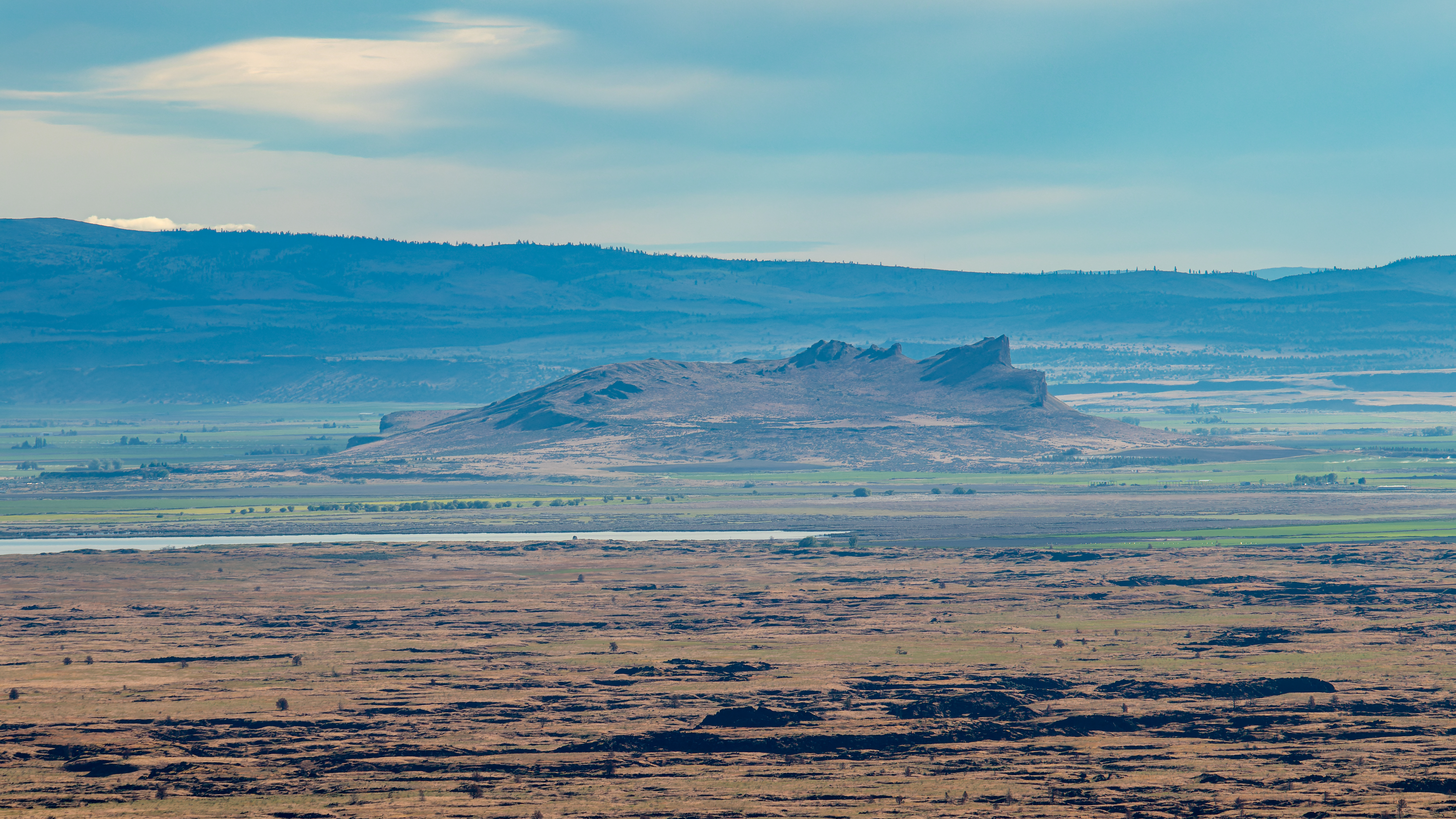
the largest total area covered by a volcano in the Cascade Range.
Most people
think of volcanoes as mountains, but there are no real large mountains in Lava
Beds NM. Unlike the classic volcanic cone mountains, here, a large Medicine
Lake Shield Volcano that has shallow and slow-moving lava “rivers” that flowed
out of vents of a deep magma chamber. The lava flowed and covered the valley.

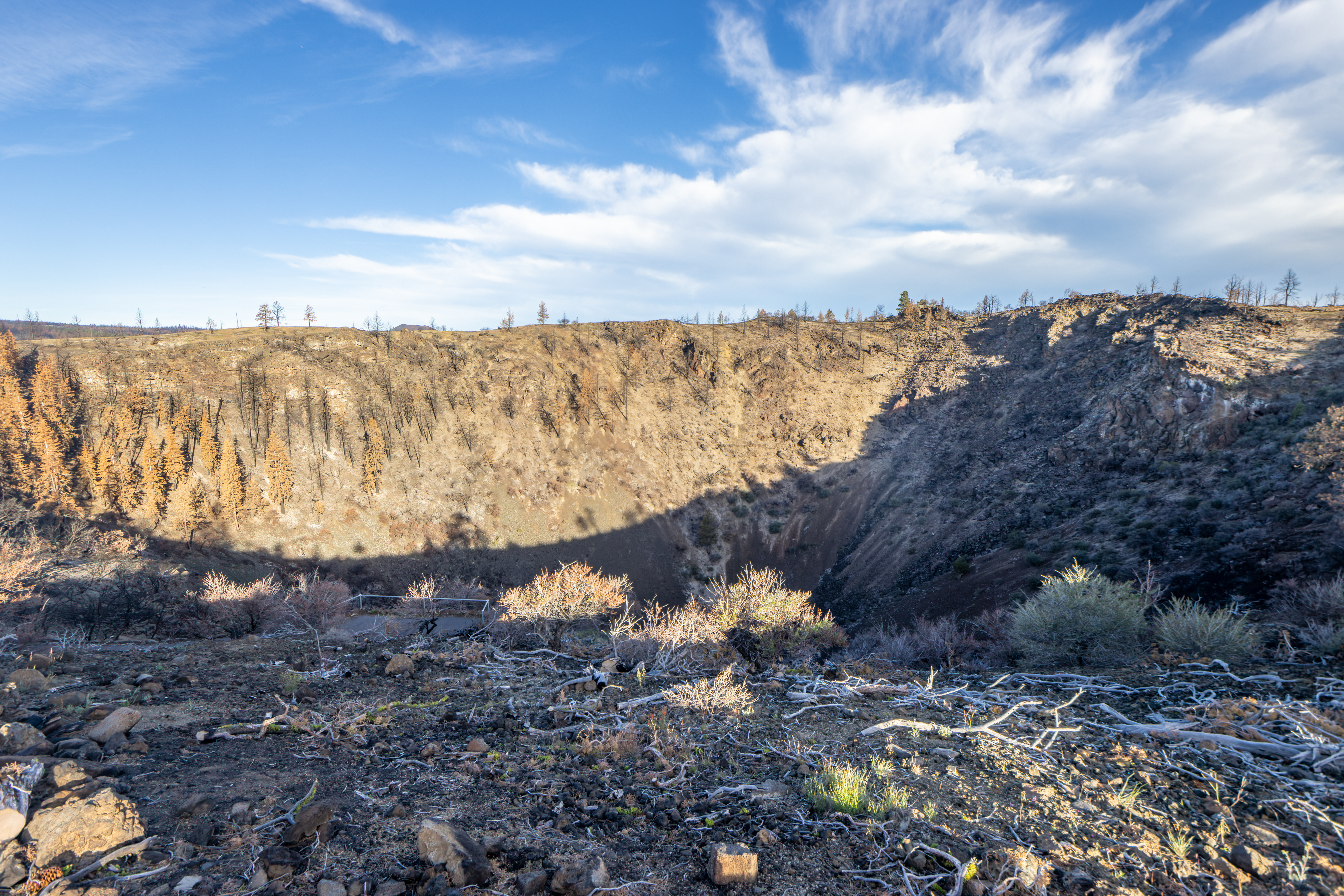
Around 10,000
to 60,000 years ago as lava flows on the surface, the outer edges cool and
harden, below that upper layer the melting lava keep flowing. Once the lava
flow ended and drained away, they left behind them and empty worm-shaped rock
tubes. These tubes diverge and converge, forming a network of caves underlying
the surface of the rocks.
Today, there
are over 700 lava tube caves in the National Monument, of which around 20 caves
can be explore by the park visitors.
Lava Tubes, unlike
water-formed crust caves, are dry with no current activity of stalactites and
stalagmites creations, they are “frozen in time” of the hard lava rock.
The lava tube
floors are mostly flat because the last liquid lava got flat before it hardened
in place.

Before Visiting the Caves:
Before you are
getting into any lava tube you must pass at the visitor center for explanations
and get (free of charge) approval permit and car tag that indicate you can
visit caves. The permit is open from 10am to 4pm. I received this car tag when
I entered the park north entrance.
The need for a pass
is as a precaution against the spread of White-nose syndrome that has infected
bats, anyone wanting to enter the lava caves must be screened and receive a
permit and this is also for you getting safety explanations from the rangers.
In any case it
is good to visit the visitor center, get information on open/close cave and recommendations
how to plan your park visit.
From the
Visitors Center, where you can rent flashlights and buy helmets, a walking
trail takes you to few caves within a few hundred feet, I understand that those
caves are lit with electric lights. I must admit I did not visit at the cave
near the visitor center but rather went straight to the cave driving loop.
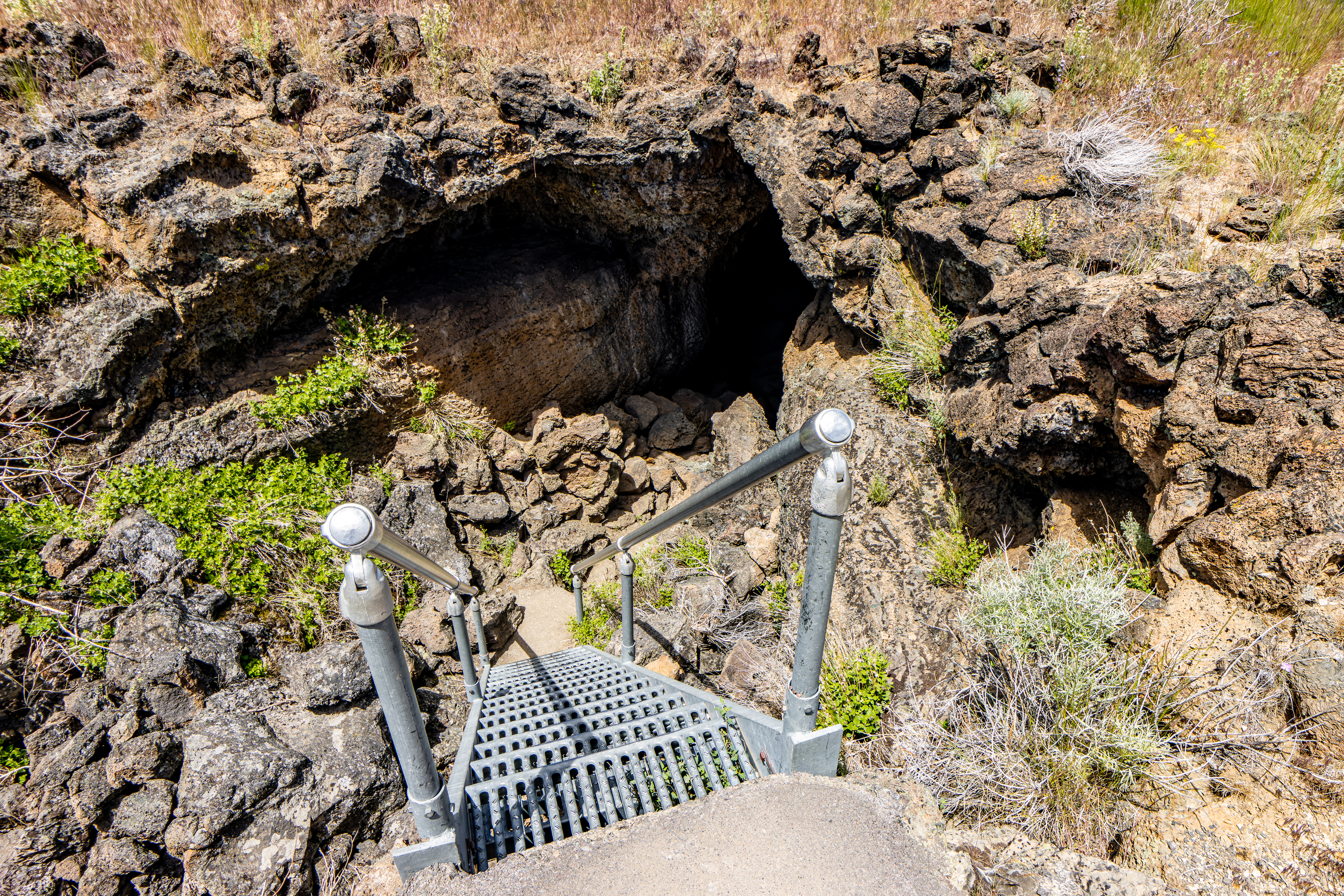
Cave Driving Loop Visit:

Along the loop,
various accessible lava tunnel and cave entrances are well-marked. Drive and
stop at each starting point. A very short and easy hike will lead you to the
cave entrance.
The loop road
doesn't have a dedicated foot path, forcing hikers to walk along the edge of
the road.
"Go before
you go" There isn’t any restroom near the loop drive. Make sure you are
prepared for lots of time spent exploring the caves by making a pitstop at the
Visitor Center where bathrooms are accessible from outside the building even
after-hours.
A two-mile-long
one-way drive loop from the Visitors Center will lets you visit 9 caves (if
they are all open). There are other cave locations in the park, most are only
within a short driving distance from the park visitor center.

List of caves and difficulty levels
according park website:
Least Challenging Caves: Mushpot, Sentinel, Valentine, Skull, Merrill, Heppe, Big
Painted, Symbol Bridge, Ovis, Paradise Alley.
Moderately Challenging Caves: These caves may involve stooping through low sections
and/or rough floors. Golden Dome, Sunshine, Indian Well, Balcony &
Boulevard, Blue Grotto.
Most Challenging Caves: These caves
have some portions which require crawling and maybe some cave-navigation. Labyrinth,
Lava Brook, Hopkins Chocolate, Hercules Leg, Juniper, Catacombs, Thunderbolt.
Detailed Cave Information:
Golden Dome:
This cave is
the first cave on Cave Loop drive. The cave is a short walk from the road and
the descent into the cave is through a very narrow opening in the rock on a
ladder. Be careful not to bang your head on the entrance rock (mainly on your
way up).


Once you walk
down into the cave you should explore both up and down directions of the tube.
In Golden Dome you will find the areas of hydrophobic bacteria that cover
portions of the cave’s ceiling, causing a “golden, sparkling green”, and the figure
eight loop at the rear of the cave. Overall, this is 2,230 ft long cave.
Hopkins Chocolate Cave:
This is not a
cave but rather a cave that collapse leaving behind some roof sections. The
beauty here is the melting like hot Chocolate rock formations and colors, this
is very short visit, and it is interesting to see the “melting and dripping”
rock. At the same location you can have a short visit at Garden Bridges.


Blue Grotto Cave: It was close
when I visit here.
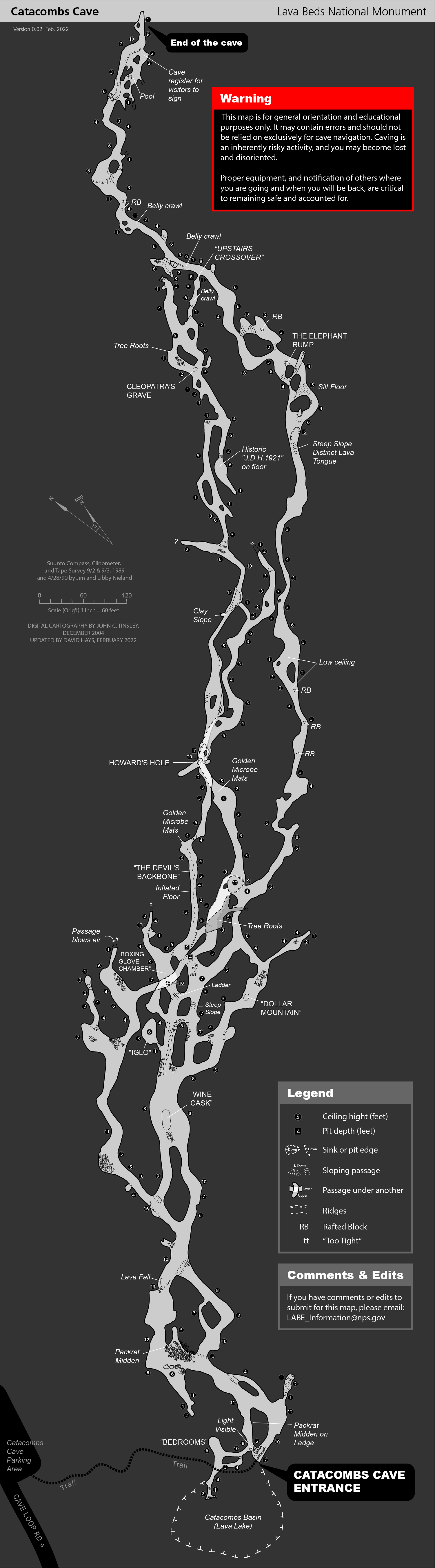
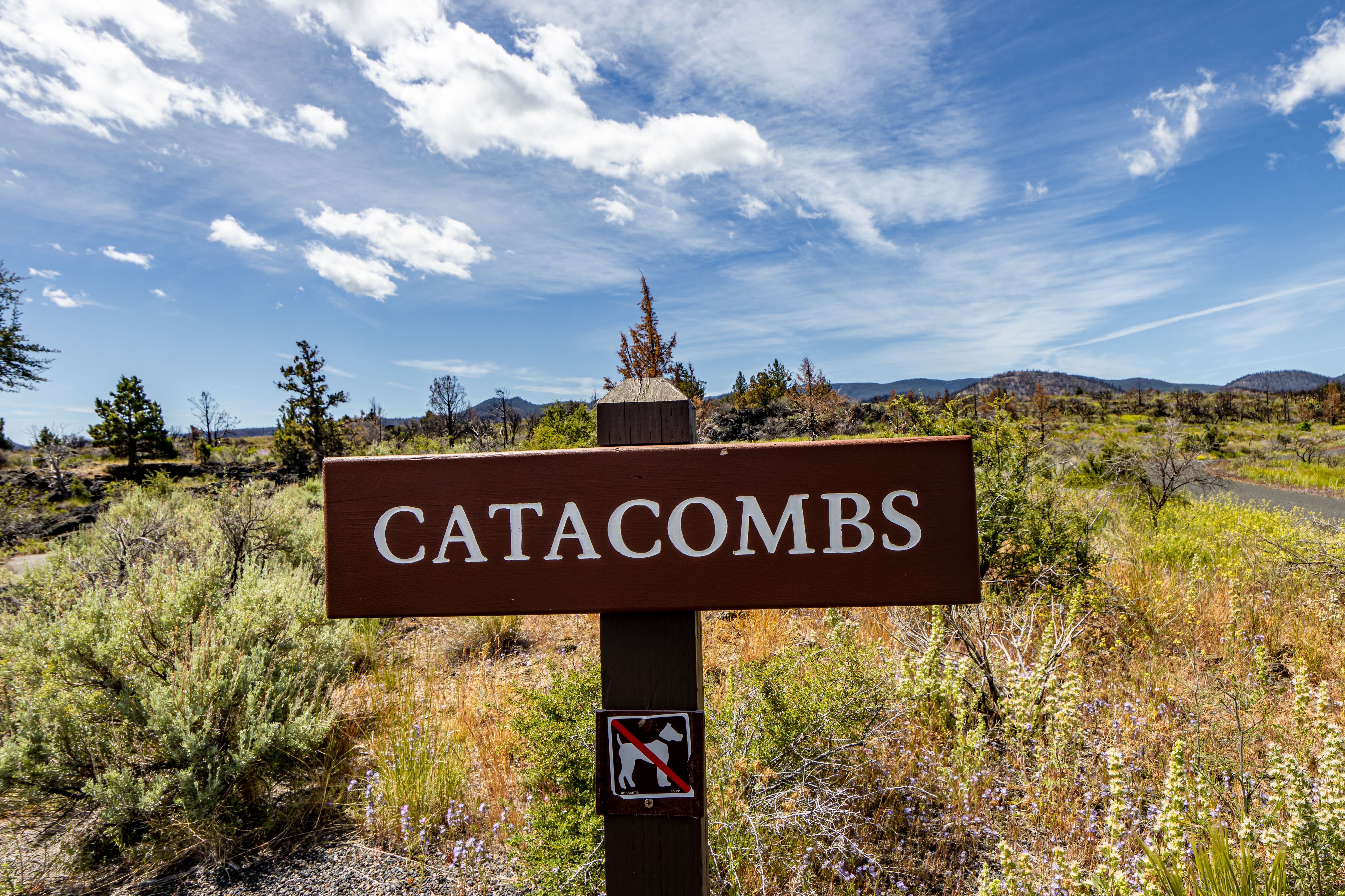
Catacombs:
This is the
park’s longest and most challenging caves. You can have only a short visit here
(beginners), but you can also spend here several hours of cave exploring
(experts). A full cave exploration can take 6-8 hours, but you do not need to
do it all and even in 30-60 minutes visit is very rewording.
I visit here
for a more than 1 hour and it was fun !
No matter your spelunker
level is do not skip this cave visit. Go and explore it as your time allow or
as you reach a place with a difficult level that is not comfortable for you to
proceed.

According to
the park website the length of the Catacombs Cave is 6,900 ft long.
This very long
cave is easily entered, but gradually increases in difficulty, both in path complexity
and ceiling level as you progress it is getting into low (3ft) to very low
(1ft) ceiling height sections.
A cave map is
highly recommended for any group planning to explore the entire cave, as
multiple levels and numerous side passages can be confusing.
There is a
detailed map of this specific cave. You can see how long it is and how complex
it can look when exploring it.
https://npgallery.nps.gov/GetAsset/bb069f42-57b9-4582-9403-e94fa8a81828/original.png?

The trail to
the cave gradually descends and enters the cave. At the first section the ceiling
is high, and you can walk up straight. You immediately find fork in the cave
where you can go into two different directions. The cave split and rejoin
several times, and this create a confusion of a much larger and complex cave. Usually,
no matter where you go you will rejoin on the other side.
At some point
there are more levels so you can walk down to a lower/upper cave level. At some
places you need to climb down on the rocks and in other there is a metal leader.
As you progress
more into the cave the ceiling is getting lower, and you must bend or even
“walk” on your knees with the help of your hands.
After some
progress like that I “gave up” and turn around.
Going back is
simple, almost no matter which way you chose to go it is in the right direction
of the cave entrance.


If you plan to explore
longer and deeper sections of this cave, I recommend the following:
·
You must have knee pads
·
Bring head flashlights (and
additional good light source for backup and safety)
·
Use helmet, it will prevent head
injuries
·
Do not carry any backpack
·
Long sleeves shirt
·
Have some water with you (and “pee
bottle” to collect your urine).
·
Bring a paper cave map copy


I visit this
cave twice, the previous visit (summer 2017) was with my kid, and we enjoy
exploring the cave for 2 hours, The last time I was here (June 2022) I visit alone
and when I was exploring the cave I was the only one in the cave, thing that
enhanced my caving experience.
As I said I did
not explore the entirety Catacombs cave, as it takes very long time and efforts,
and I did not have knee pads, so it was hurting my knees.


I can only say
that the cave section that I visit were amazing, this is the most fun cave to
explore and unique experience.
I recommend it
to all, go and explore until you feel you had enough and then head back out.
Ovis Cave: It was close
when I visit here.
Sunshine:
This cave is
the next cave up Cave Loop Road from the Catacombs and was the most well-lit
cave out of the caves I visited here. As you progress into the 500ft long cave there
are two collapses in the roof of the cave that let the sunlight in.


Hercules Lag Cave:
As in Sunshine
also here there is a collapse roof section that insert light into the cave. You
can go through the collapse area and come back from the other side.
The Hercules
Leg has generally high ceilings and smooth floors.


Juniper Cave:
I only spend a short
time in this cave, and I did not manage to fully explore it. Starting with high
ceiling but after short distance it get low and challenging to progress.


Upper Sentinel/Lower Sentinel:
This is the
last cave on the Cave Loop Road, it is actually one long cave with two
entrances. The best way to experience this cave is to park a vehicle at the
trailhead for Upper Sentinel entrance and walk through the cave down to it exit
and from there walk back to the road ad Lower Sentinel stop. At this point you
need to walk up the short loop road back to your parking car.


This is
relatively long cave, around 3,500 ft long but unlike Catacomb cave that has
low ceiling in many places this is a large, tall cave where it easy and simple
to explore the cave.
In the middle
of the cave there is a metal structure that help you to cross some sections, overall
because it is easy to walk through you can finish this cave in relatively short
time.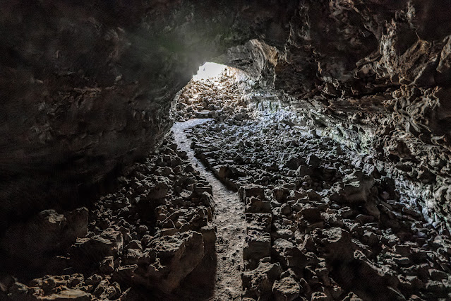

After exiting Lower
Sentinel, the car one-way loop road end and you can drive back to the parking
lot.
Cave outside Cave Loop Road:
Although there
are few caves outside the visitor center, I only visit Skull Cave.
Skull Cave:

This cave is
not located on the Cave Loop Road; but is located 10 minutes’ drive from the
Visitor Center on the main park road.
Once you
finished exploring the caves on Cave Loop Road and you are on your way out (or on
your way to hike to Schonchin Butte Lookout) take the main park road to Skull
Cave. The cave is named for the many animals skulls found within it.
This is not
just one lava tube, but two lava tubes that are stacked atop one another.
This cave is uniquely
large, the towering open mouth of the cave make a dramatic entrance into it.
This cave
extends hundreds of feet long into the ground and at the end you are getting
down in few stairs stretches into the lower lava tub. The trail ends at fenced ice
floor that collects in the winter and remains frozen year-round.


Other Park attractions and Point of
Interest:
Schonchin Butte Lookout:
Probably the
most landscape dominate element in the Lava Bed NP is Schonchin Butte cinder
cone volcano.


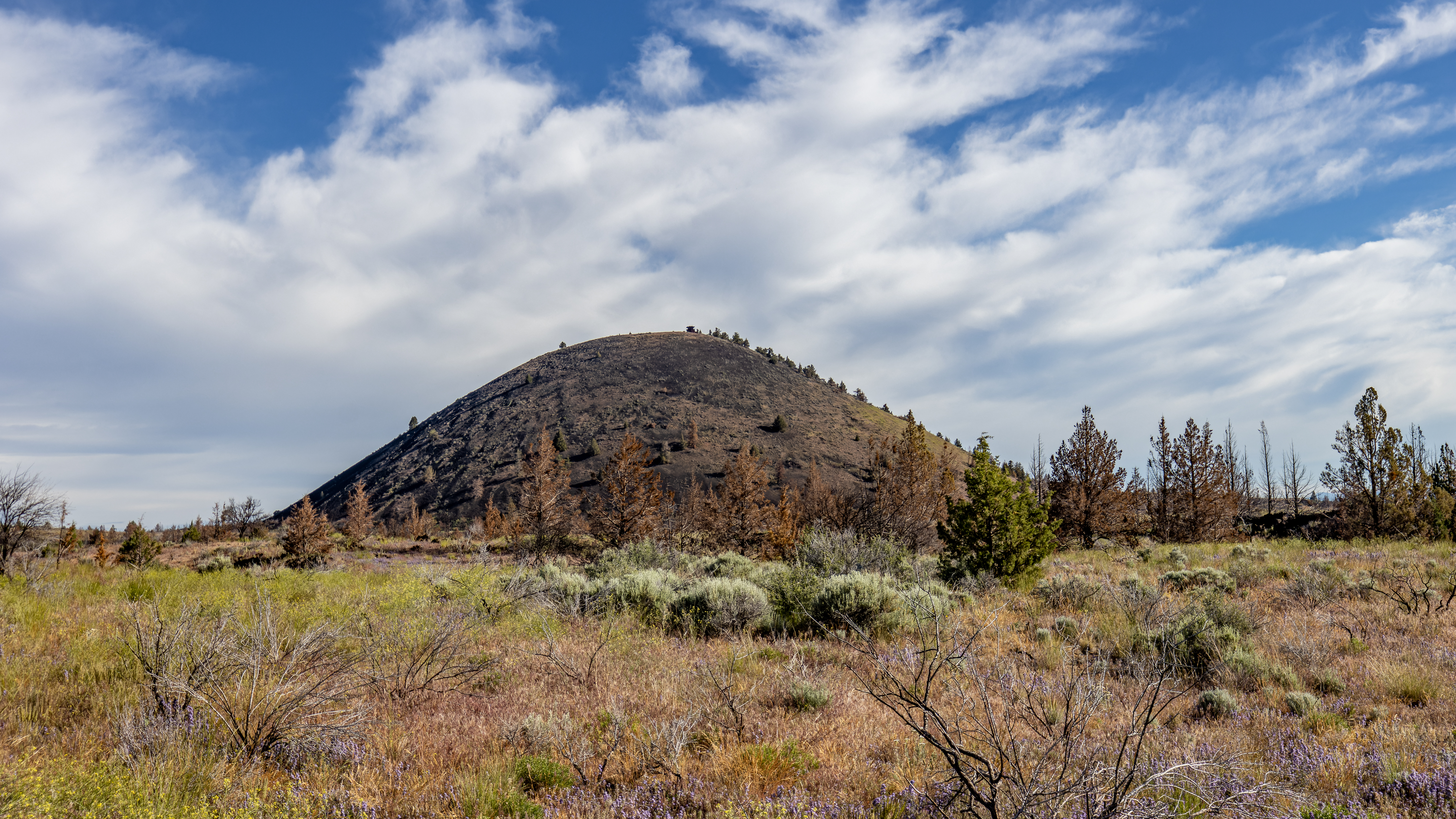
You first need
to drive to the small parking lot at the end of the unpaved road leading to
the base of the cone. From the parking lot a short but steep 0.7 miles hike
will take you to the fire lookout at top of Schonchin Butte. At the summit's
lookout, you'll find a rewording 360-degree view of the park and all the surrounding
for many 10’s of miles away.

From here you
can clearly see the flat Klamath National Wildlife Refuge are to your north, Mount
Shasta to the southwest and Mount McLoughlin in Oregon to the northwest.
Overall, this
is 1.5 miles hike up and back, and it took me and hours to complete and get
back in my car.


Mammoth Crater:
Located on the
pard dirt road that led south from the park into the National Forest land and Medicine
Lake.
Between 30-40
thousand years ago a torrent of red-hot lava flowed out of this crater. Mammoth
Crater had the greatest impact on the monument’s landscape, over 70% of the
surface area of Lava Beds is covered by basalt that originated here. From this
crater, lava ran downhill, forming braided streams of lava up to ten miles
long. These lava streams formed most of the caves along Cave Loop Road.
From the
parking lot a very short trail leading to the rim viewing point of Mammoth
Crater. This is a surprisingly deep created but except a short visit there is
not a lot more to see here. This is a very short visit and I’m not sure it
worth it driving here …. unless you are driving to Medicine Lake or the nearby
forest.

The Modoc War:
The winter of
1872-1873 was a troubled one in the Lava Beds, where a small band of Modoc
Indians was surrounded by a US Army force outnumbering them as much as ten to
one. Most of the battlefields of this conflict, known as the Modoc War, are
located today within the monument, and are still preserved today.
Modoc War sites
are found primarily at the northern end of the park. I must admit there is not so
much to see here and unless you are interested in the local history I will
recommend skipping this place.


Petroglyph Point Unit:
This unit is located
off the main park area to the north.
You can visit
here if you are coming from/to Klamath Falls because this is right on your way.
If you are
coming from the park visitor center: From the park north entering station you
need to drive east, pass Captain Jack's Stronghold, and drive all the way out
of the park until you reach a T junction. Here you turn left on road 111, cross
the train track and immediately after turn right into a dirt road that will
lead you to the large rock hill on the east side of the field, park your car
near the restroom.
Google map link


Most
petroglyphs found at Lava Beds are located at Petroglyph Point, a former island
within ancient much larger than today, Tule Lake. It's thought that Native
Americans from the Modoc people canoed out to the rock to carve figures into
the vertical soft rock surfaces that were once just above water level.
With over 5,000
individual carvings, this site is one of the most extensive representations of
American Indian rock art in California. Dozens or even hundreds of generations
of artists paddled out in canoes, sharp sticks, or stones in hand, to leave
their mark here in the soft volcanic tuff.


Japanese WWII camps:
Not so far from
location, right on highway 139 you can find California Historical Landmark
850-2: Tule Lake Relocation Center.
Tule Lake was
one of ten American concentration camps established during World War II to
incarcerate 110,000 persons of Japanese ancestry American citizens.
Not a lot to
see here except the explanation boards.
Probably the best-preserved
camp is located in Manzanar CA, just on highway 395 between Big-Pine and
Lone-Pine.
www:
https://www.nps.gov/labe/index.htm
https://caves.org/grotto/sag/content/newsletter/LavaBeds.pdf
Map:
https://www.nps.gov/labe/planyourvisit/upload/park-map.pdf
Pictures:


Comments
Post a Comment