
Introduction:
What? :
Russian Gulch
State Park offer ocean cliffs with large sinkhole, sandy beach below the picturesque
road bridge and lush forest canyon and waterfall.
In this blog I
will provide information on my hike to Furan Waterfall. This waterfall is one
of the most beautiful waterfalls I saw along the northern California coast, and
it is highly recommended hike.
This is a 6.5-mile
loop trail considered a moderately and it takes an average of 2.5 hours to complete.
I did a longer
version of the hike with total of 8.7 miles with total of 1,030 ft of elevation
gain.


Where? :
Located only
two miles north of Mendocino town and 7 miles south of Fort Bragg., just off
highway 1.
Google Map Link

When? :
The park is
open year-round, if you are planning on staying at the campground check winter
closing.
This is a very
popular park and not large in its size, or with number of trails, at summer
month and weekends it maybe overcrowded.

Additional Blogs of nearby Parks:
- Highway 1, San Francisco to Fort Bragg – A Trip Planner
- Fort Bragg and Mendocino, CA - 3 Days Visit Planning
- Navarro Beach and Redwood Park
- Van Damme State Park
- Mendocino town and Headlands State Park
- Russian Gulch State Park
- Russian Gulch State Park – Devil’s Punchbowl Hike
- Point Cabrillo Light Station
- Fort Bragg - Pudding Creek Trestle and Beach
- Glass Beach, Fort Bragg
- MacKerricher State Park
- Usal Beach - Sinkyone Wilderness State Park, CA (4x4 drive)
Due note 1: This is one
of the most popular parks in Mendocino area, when we tried to enter the park
during summer weekend at around noon the park was close for cars entries, after
few hours, late at the afternoon we came back and manage to get inside.
Due note 2: The fee is $8
per car and the pass allows you to get into any other state parks you visit
that day.
Due note 3: you need to
find parking spot in one of the park small parking lots, preferred when you drive
down below the bridge, just before the campground entrance.

Due note 4: The Furan Waterfall
Hike is very popular hike, but it stand to it reputation.
Due note 5: There is an alternate
shorter hike to the waterfall, see details below.
Due note 6: The first 2
miles of the creek trail are open for bicycles, but you need to hike the last
section leading to the waterfall.
Due note 7: The creek trail
had a major improvement and reconstruction work over the last year, and as of
early 2023 the work is still on going.

My thoughts:
I visit this
park several times and only now I manage to hike the trail to the waterfall.
This is
probably the most rewording hikes I did when visiting Mendocino County.
The hike
combine deep creek where all the surrounding hills are covered with forest, secondary
growth redwoods trees and picturesque waterfall at the end.
When I was here
(late January 2023) the park was not overcrowded and at the afternoon most of
the other hikers where on their way out from the trail, so I only saw few
people during my hike. During the summer month this can be completely different
experience, this is a very popular hike.

The visit:
No matter where
you park your car you will need to cross the campground area to it far east
side.


The new
renovated trail progressing east parallel to the creek on it left bank.
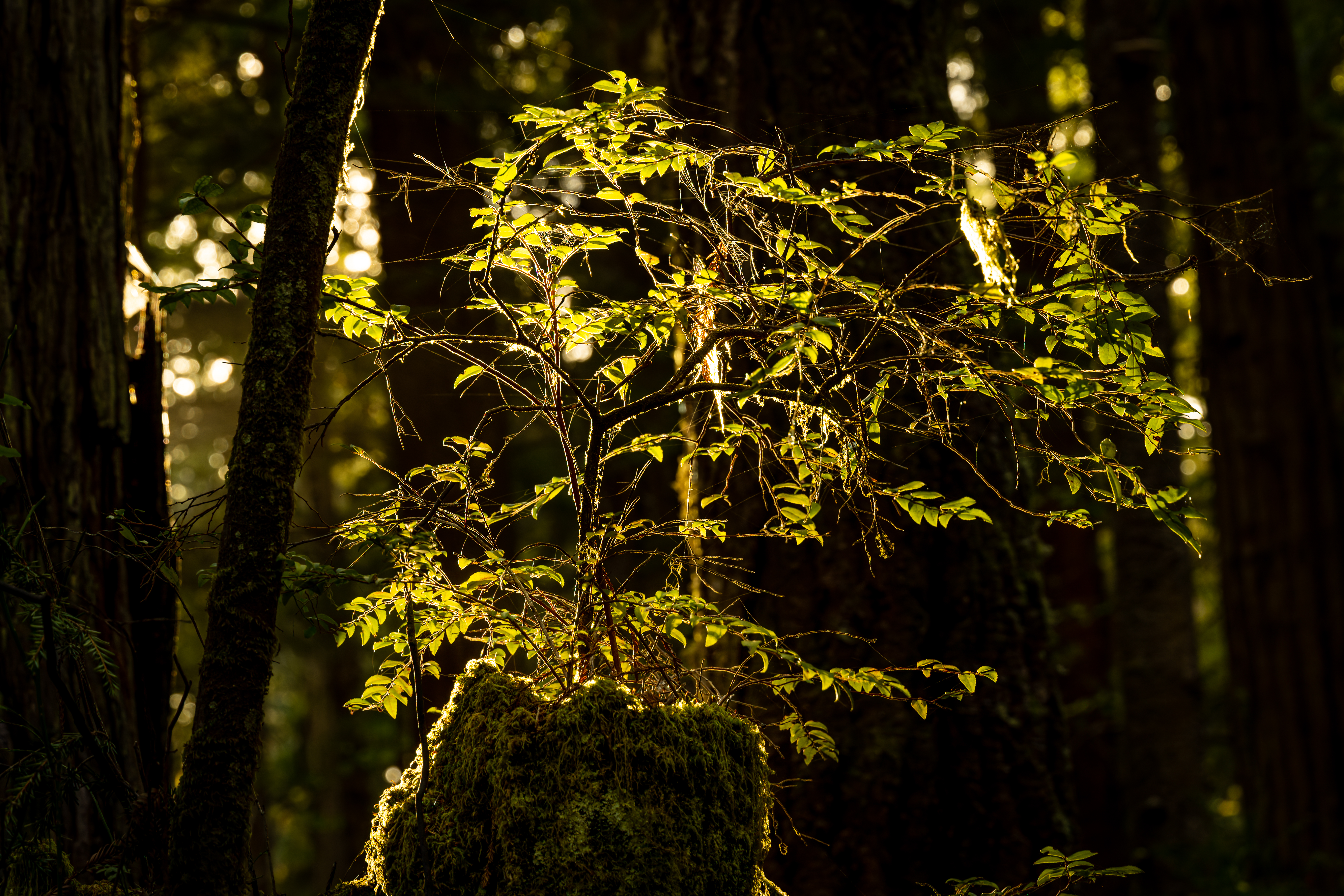
Everything is
green and the hills on both sides are covered with forest.


It is a fun flat
easy hike down this trail and after hiking for 2 miles you will reach a trail
junction.
Do not confuse
and keep hiking on the Fern Canyon Trail, slight left.

Do not cross
the bright on the right trail (you will come from here if you will do the loop trail)
and do not climb left on North trail.
This is the last
point people can ride their bikes.
After additional 0.7 miles hiking and some slight climbing you will reach the Fern Waterfall.


Overall,
the waterfall is around 2.7 miles away from the trail starting point (or 3
miles if you parked before the campground).
What a
rewording view of the waterfall.


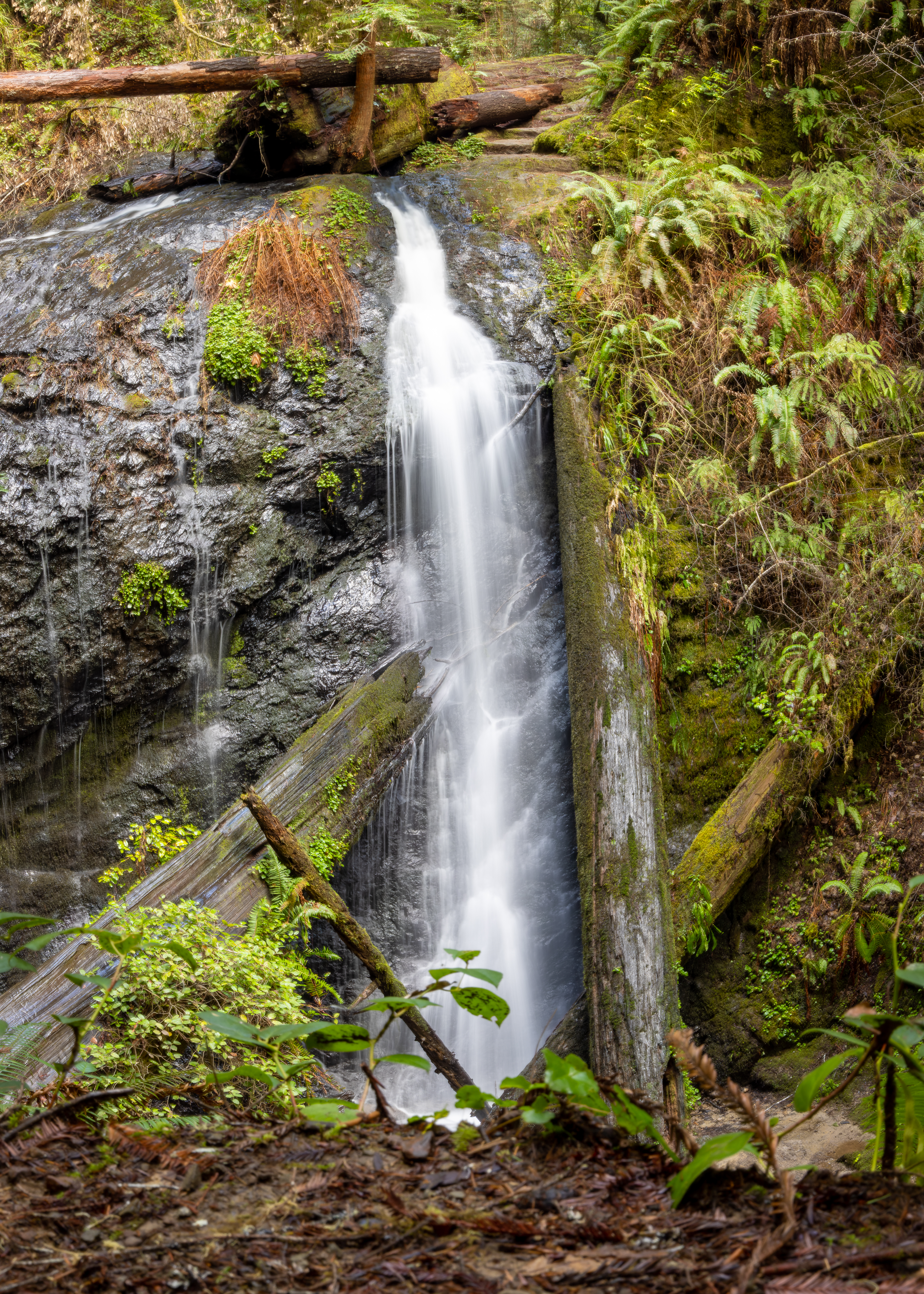
The waterfall is
36-foot tall that plunges down over few large fallen redwood’s trunks, mosses,
and ferns.
When I visit
here after few weeks of heavy rain the water flow was high and it covered the
waterfall widening.
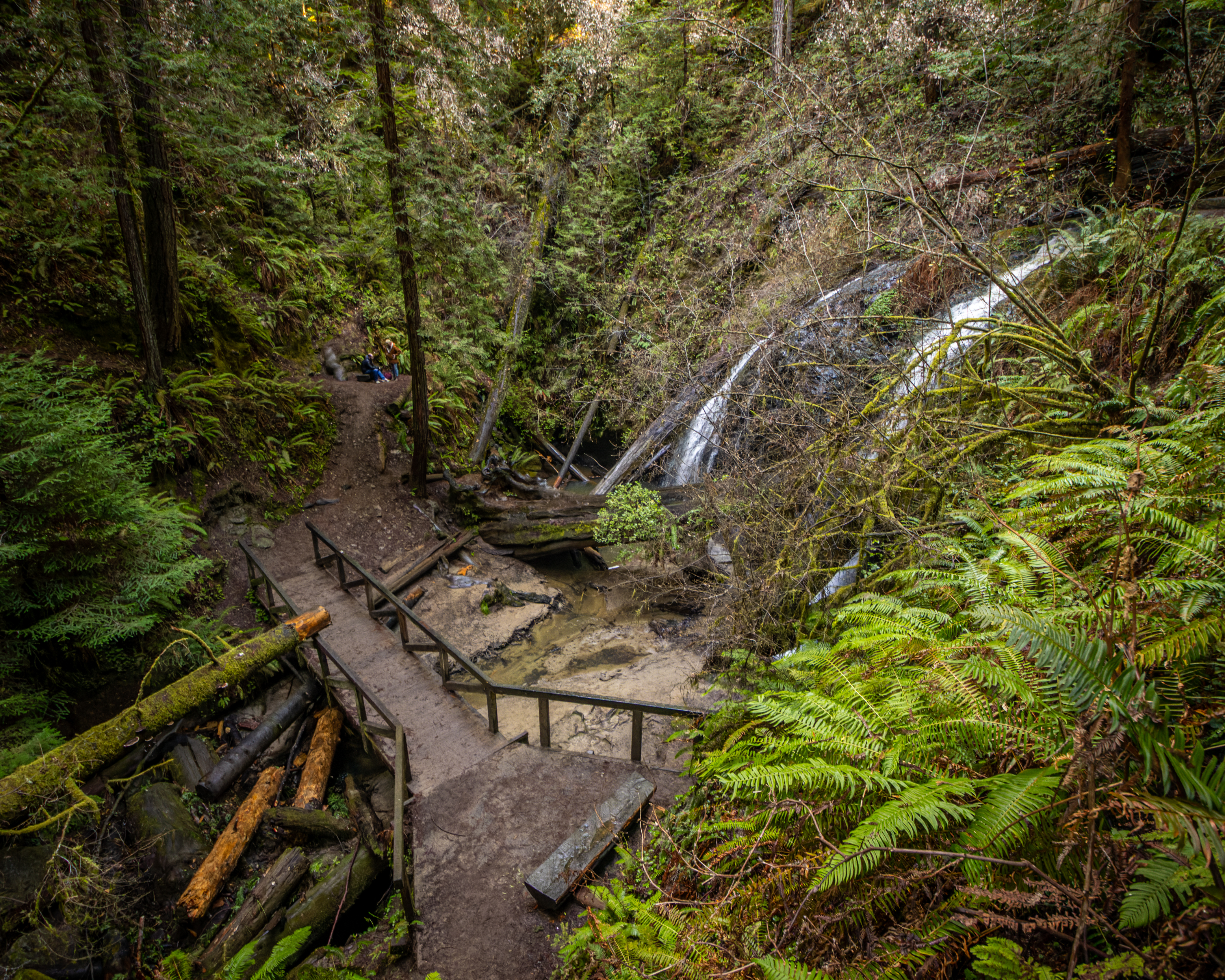
There is a small
bench in front of the waterfall and just below it the small bridge cross the
creek.

Now you can
turn around and hike back the same way you came here or you can extend the hike
with the longer loop trail.

If you decided
to extend your hike, from the bridge waterfall the trail climb to the top of
the waterfall and after short walk you will reach a trail junction.
Here you need
to turn right and up the waterfall loop trail, the other trail (east trail) climb
up to the north park boundary (see the short hike option below).

The fall loop trail is 1.6 mile long, it start by climbing the ridge, this is around 250ft climb and after 0.4 mile you will reach the top of your climb and from here the trail cross the forest landscape until it start to descend and loop back into the main Russian Gulch Creek trail.

After 1.6 mile you will cross the bridge
and reconnect back to the main trail.

Now you have tow
options, the first and most popular and shorter option is to hike back on the
same trail you arrive, take the creek all the way to the campground and your
car.
There is
another option to hike back, somehow longer and involved with additional climb,
and this is what I did.
From Fern
Canyon Trail take the north Trail that climb up the mountains north of the
creek. After 0.5-mike of hiking up the hill the trail flatten and following the
ridgeline parallel above the creek.
On you way you will pass 2 other trails connecting from the north, keep hiking on north trail, always sticking to the left.


In this 1.5-mile section the trail gradually descending
so this section this is easy hike.

After 2.4 miles
hiking the north trail, you will descend back down to the Russian Gulch Creek and
reconnect to the main trail, just at the end of the campground. From here walk
to your car.

Another 2.2-mile-long hiking option
to the waterfall:
I describe above
the hike that start at the main park entrance and follow the Russian Gulch Creek;
this is the recommended hike.
There is another,
shorter, option to hike to the waterfall from the Russian Gulch State Park
North Boundary parking on Caspar Little Lake Rd.
I did not hike this
trail but this short 2.2 miles out and back hike start at the north park boundary
parking lot. The trail will lead you down the creek almost directly to the
waterfall (1.1-mile one way). You can combine this hike to the waterfall loop trail
to overall 3.9-mile hike.
From the
waterfall you need to climb back to the trailhead, this will be 300 ft elevation
gain.

www:
https://www.parks.ca.gov/?page_id=432
Map:
https://www.parks.ca.gov/pages/432/files/RussianGulchMendoHdldVanDammeFinalWebLayout2017.pdf
Additional Pictures:


Comments
Post a Comment