
Introduction:
What? : Saline Valley is a large arid valley in the northern Mojave Desert, as of 1994, declaration and expansion of Death Valley, most of it became a part of Death Valley National Park. At the heart of Saline Valley there is an old drying lake with large salt deposit. An abandon salt mining operation can be found in this location.


Where? : Located in
remote and isolated location deep in the Death Valley northwest wilderness.
For a Beautiful Nature Prints - Visit my Etsy Store
The main desert
dirt road that passes through Saline Valley from north to south is Saline
Valley Road. From SR 168 in the north to SR 190 in the south, it is 95 miles long,
and ranges in elevation from 1094 to 7593 feet.
The Salt Lake
is located 38 miles north of highway 190 entrance to the road and 41 miles
south of Death Valley Road (total of 54.5 miles from highway 168 entrance to Death
Valley).
Plan for at
list 2-3 hours’ drive to get to the valley center.
Google Map Link


Additional Blogs on many others Death Valley places to visit:
- Death Valley
- Death Valley Road Trip
- Mojave Desert – Highway 127 from Death Valley to Baker
- Beatty Nevada and Rhyolite Ghost Town
- Death Valley – Titus Canyon Drive
- Death Valley – Ibex Dunes and Saratoga Springs
- Death Valley – Striped Butte Valley 4x4 Drive
- Death Valley – Sidewinder Canyon
- Death Valley – Badwater
- Death Valley – Artist's Palette Drive
- Death Valley – Hiking Golden Canyon and Gower Gulch
- Death Valley – Zabriskie Point
- Death Valley – Salt springs sunset visit
- Death Valley – Mesquite Flat Sand Dunes
- Death Valley – Ubehebe Crater
- Death Valley – Racetrack Playa
- Death Valley – Saline Valley, Salt Lake
- Death Valley – Saline Valley, Warm Springs
When? : The
recommended time to visit here is late fall, winter and early spring, summer is
just too hot.

Due note 1: This drive is
recommended for high clearance 4x4 vehicle, the road is usually kept in a good condition,
but some sections can get eroded after rain, close by snow or ice at the high
elevation passes. When I visit here, early March 2022, the road was in a good
condition and passable by any 4WD. The main problem is flat tire, this is very
long drive on gravel dirt road !
Towing from
this remote location can be VERY expensive.
There are long
stretches of road that are rough and surfaced by sharp-edged primitive rock
gravel, full-size spare tires are strongly recommended.
Although it is
not difficult to find the road, I always recommend to have both a paper map of
the area and map application (one that you can download maps and use them where
there is no cell reception).


Due note 2: Do not take
lightly any off-road driving in this environment, there is very minimal cellular
reception.
Due note 3: Always have
enough fuel before heading into the drive !
Although this is easy to navigate with a clear road you always need to plan for
more fuel than needed. From off-road driving perspective this is at list 120
miles drive but you must take into account its remote location in the park, far
from any gas station.
Due note 4: Off-road
driving is prohibited as the desert is very fragile and vehicle tracks can remain
for years.
Due note 5: As in any other
desert area activities, always bring enough water with you. I do not recommend
doing such drive at 120-130f in the summertime…
Due note 6: This drive is
in remote park section but usually you can see other cars on the road and there
are almost always people at the warm springs.
Due note 7: There is very
little shade anywhere in Death Valley so use Sunscreen even in winter months.
Due note 8: When visiting
or hiking at the Death Valley use several layers as clothing. You can start
your day with cold temperatures during early morning sunrise to a very hot midday
(even at fall, winter, and spring). At the afternoon it can warm but at sunset
temperature plumage and it can be near freezing.
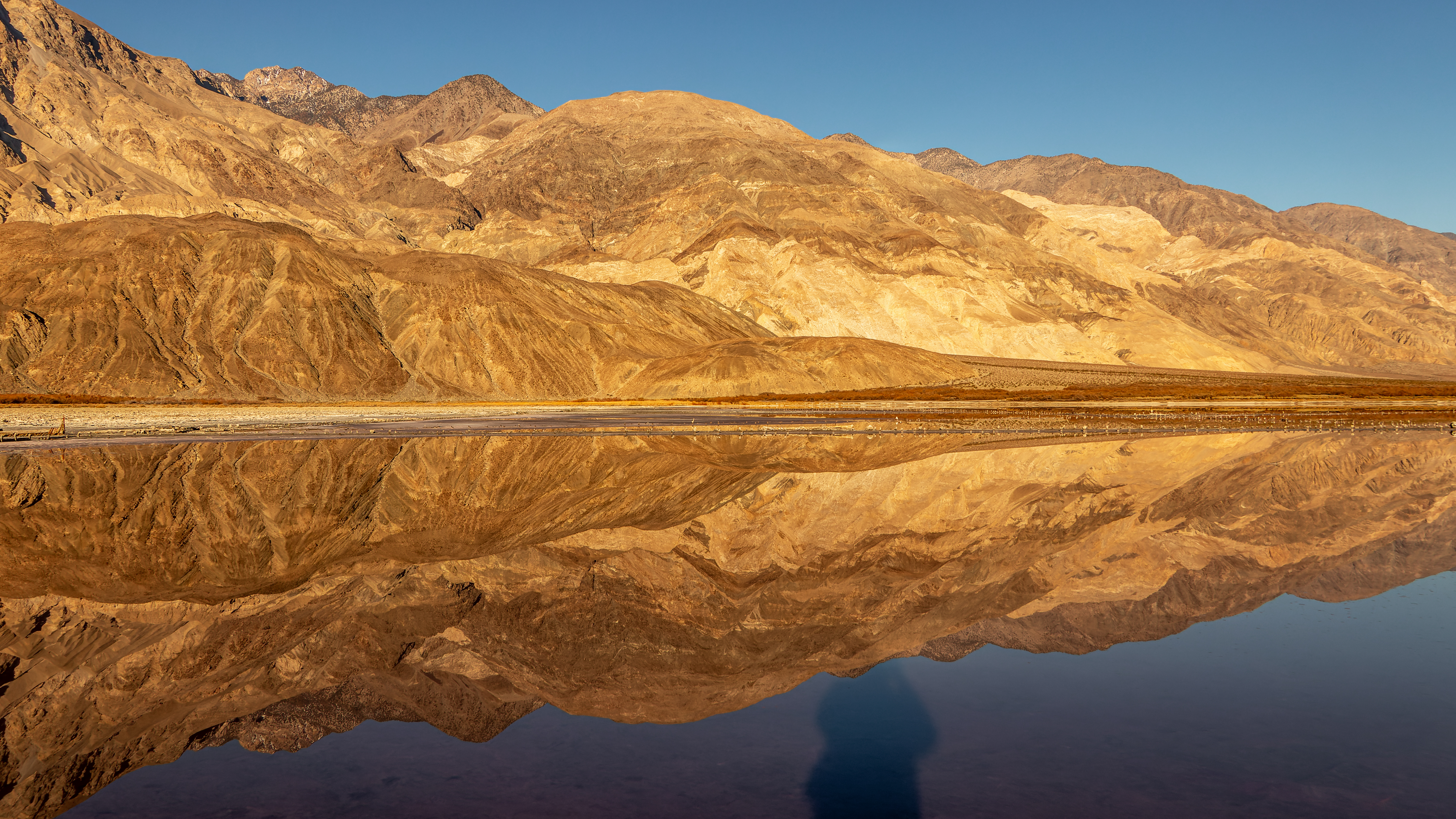
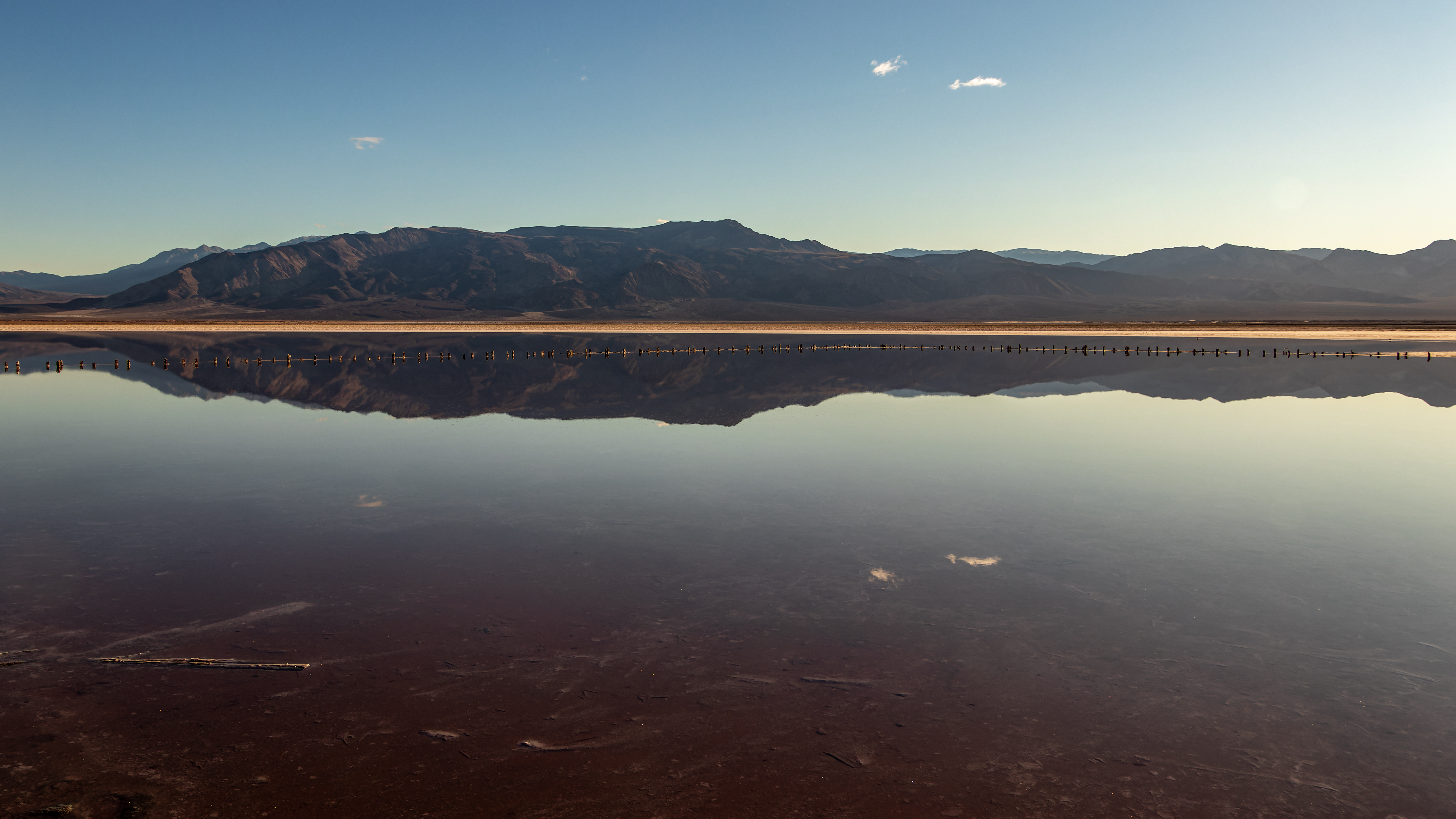
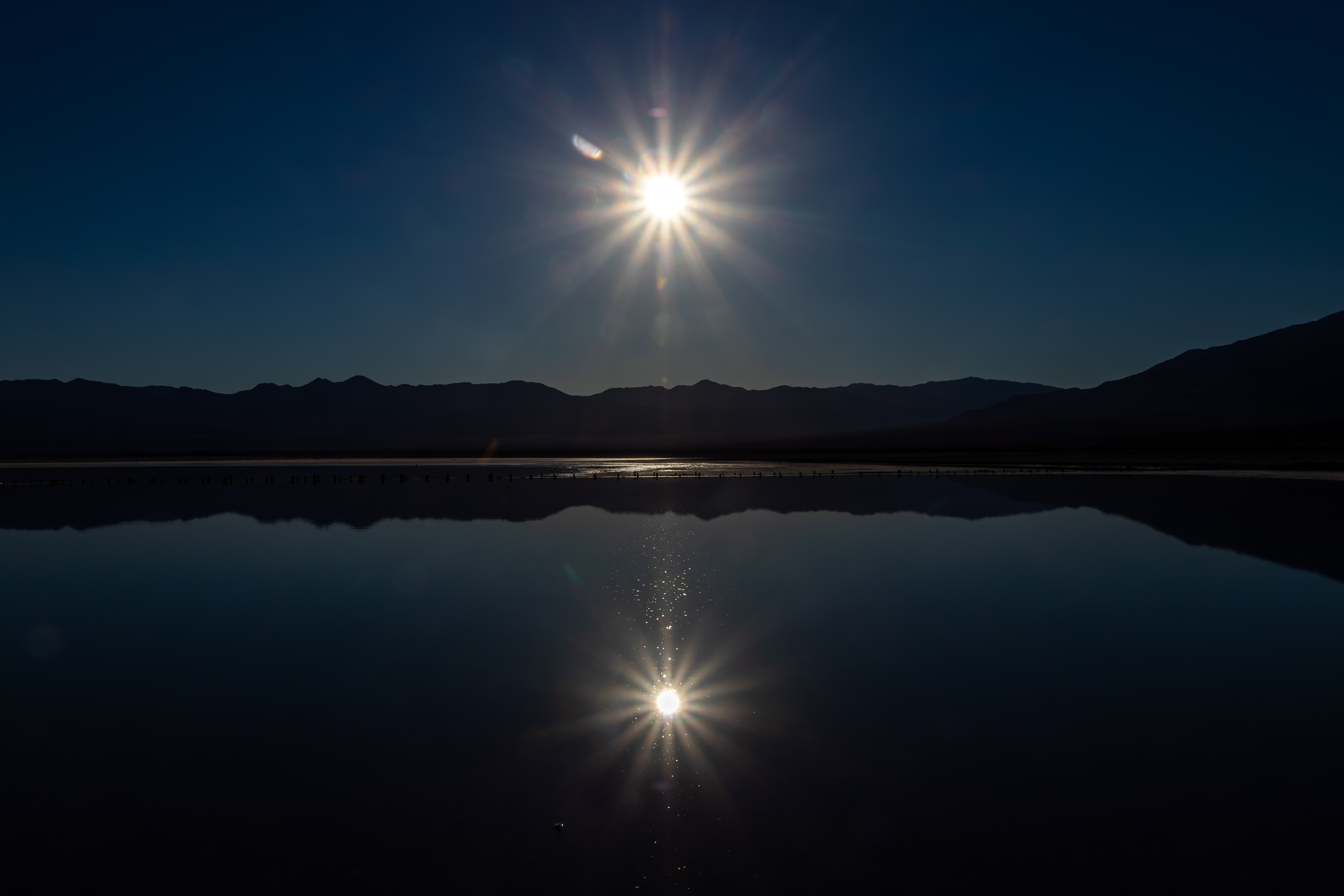
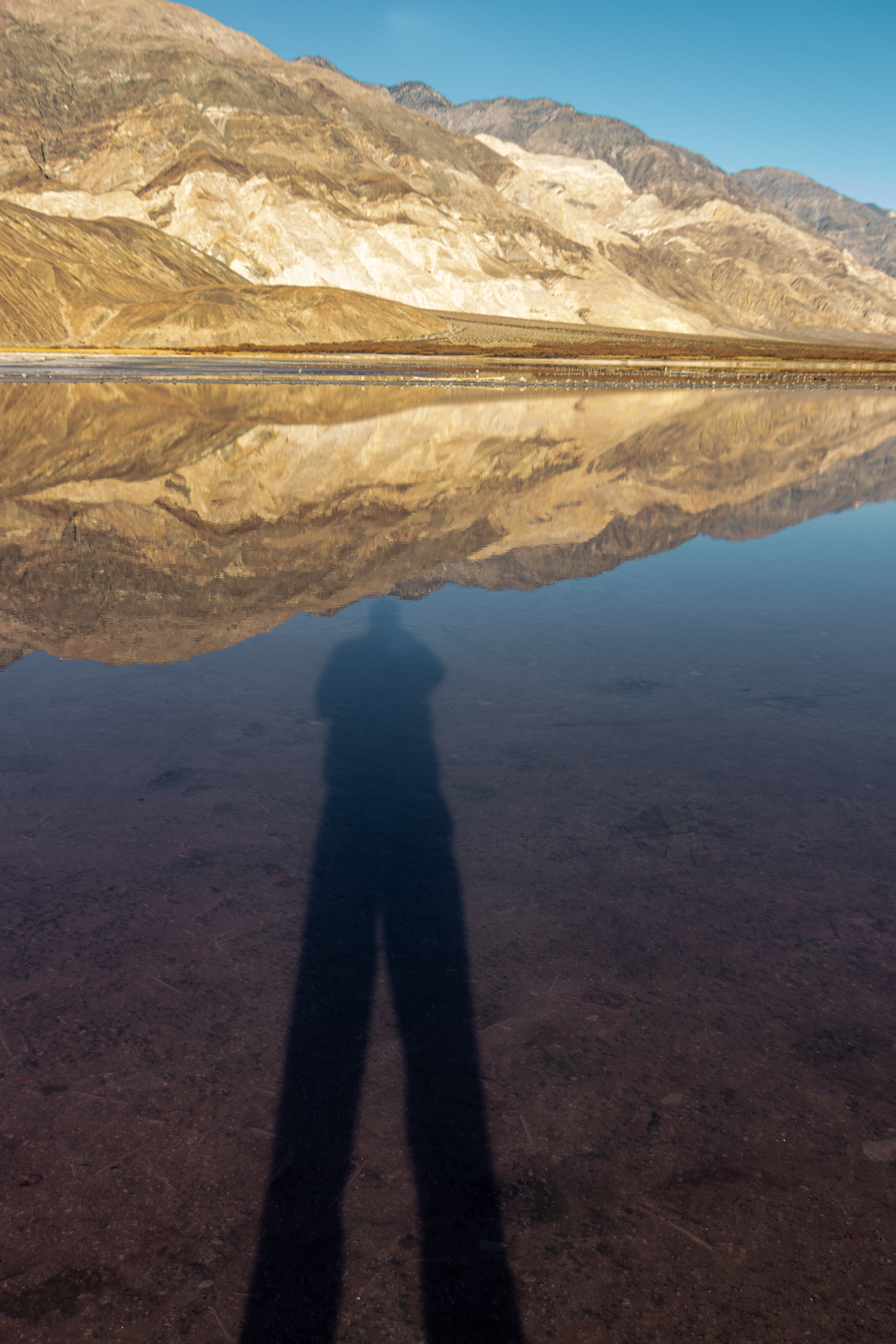
My thoughts: The visit here,
at the Salt Lake old factory, is an interesting stop on your way to / from the Saline
Warm Spring. When there is no wind, and the lake is flat you can see nice
reflection of the surrounding mountains.


The visit
Saline Valley
is a large arid valley in the northern Mojave Desert, as of 1994, declaration
and expansion of Death Valley, most of it became a part of Death Valley
National Park. The water no-outlet close valley is surrounded by mountain
ranges the most dominate is the 11,000-foot Inyo Mountains bordering the valley
on the west.
A large dry
lake occupies the center of the long valley, north of the lake area is covered
by low sand dunes. The most interesting attraction in the valley are the 3
locations of hot springs, known as Saline Valley Warm Springs.


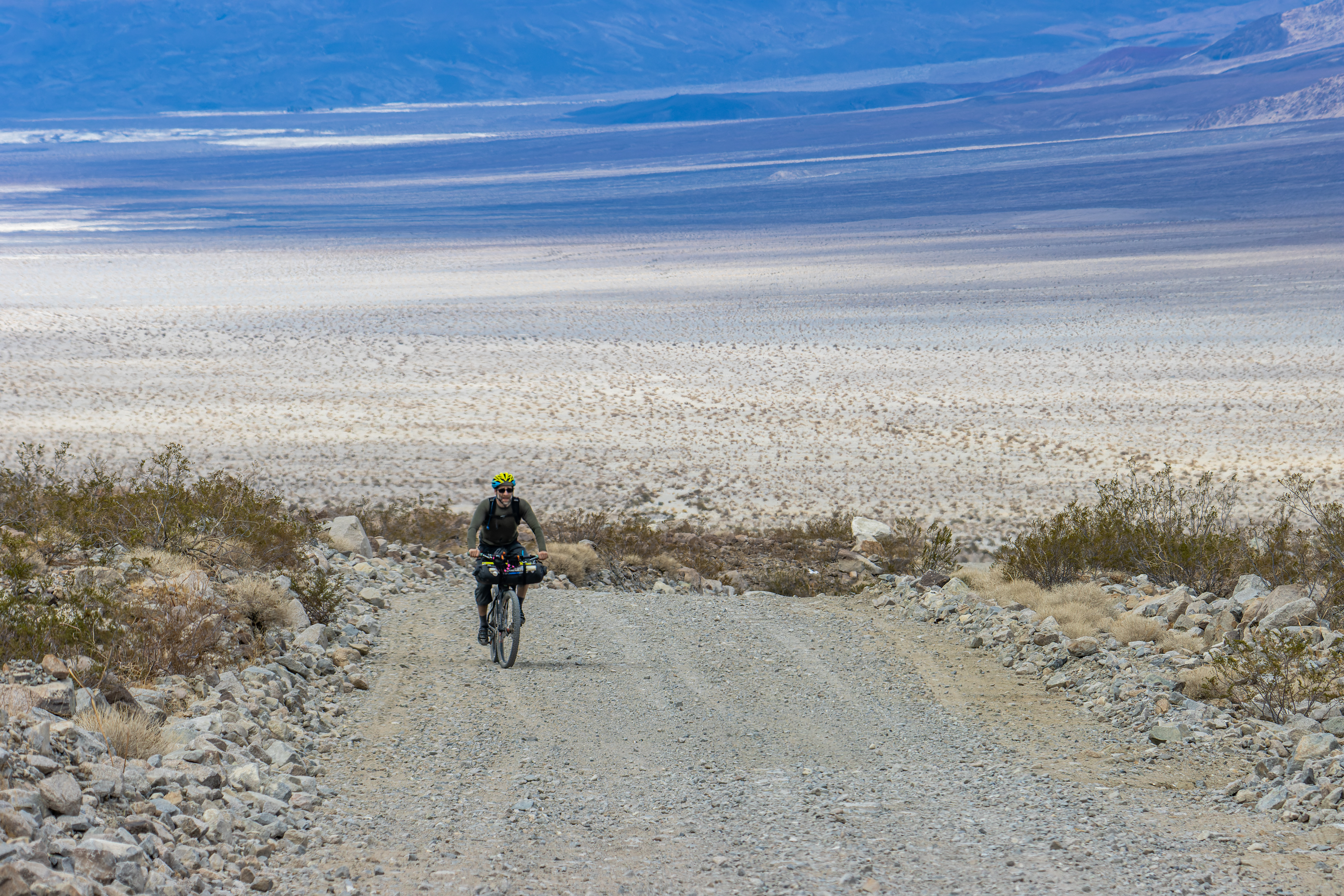
The drive:
Saline Valley
Road is a sporadically maintained dirt road running north–south through for 95
miles long. It goes through two high mountain passes: the Inyo Mountains in the
north, and the Nelson Range in the south. The northern pass is higher, but the
road is usually better and 20 mules shorter than South Pass.
Mountain passes may be closed during the winter due to snow, ice, or washouts. The "Road Closed" signs are often left in place year-round in an attempt to deter motorists who may not realize how treacherous the road is.


North Pass:
I did not drove this section so all the information here is from web searches.
From Big Pine
in the Owens Valley, take Highway 168 towards Death Valley for 3 miles. Turn
Right onto Death Valley Road. In 14 miles, you will reach Woucoba Saline Valley
Road. The road passes through Marble Canyon before entering the Saline Valley.
From here, it is downhill into Saline Valley. This road is about 60 miles, most
of it over dirt roads. 3 hours.
South Pass:


From Highway 190 junction with highway 136 drive 17 miles until you see the left turn into Saline Valley Road. The road sign may post it is closed even when it is open and safe. Saline Valley Road takes you through large Joshua Trees Forest and up to the top of South Pass (6100 feet.).

Make sure you turn left at the summit and descend into the narrow canyon that will lead you down into Saline Valley.


This
route is about 50 miles from Highway 190.
Other 4x4 options to get into Saline
valley:
There are 2 other
options to get into get into Saline valley and the hot springs.
Both roads are rugged
and unmaintained, you need to drive a real 4x4 car with high clearance, good
tires are also mandatory.
The roads:
1. From Racetrack Playa through
Lippincott Pass: This
road section is 6.7 mile long. Climbing to the pass from the high Racetrack Playa
is easy but from here there is serios mountain descend where Lippincott Road is
getting down from the high pass into the canyon. Most of the road is ok, just
need to drive slowly, but there are some sections that you need a real 4x4 car
with good tires. This is especially for the short section where there is a
large rock located in the middle of the trail. Once you pass the downhill
canyon section you are getting into Saline Valley, from here additional 2.5-mile
road will cross the valley all the way to the north-south main Saline Valley Road.


2. From Eureka Dunes: I did not visit
here so I can’t give a lot of information on this road, most of it is in good
condition but there are few rock and bouldering sections in the narrow canyon. The
Steele Pass Road from the Eureka dunes to the lower hot spring is 30 miles
long.
Salt Lake, Salt mining operation and
tram:
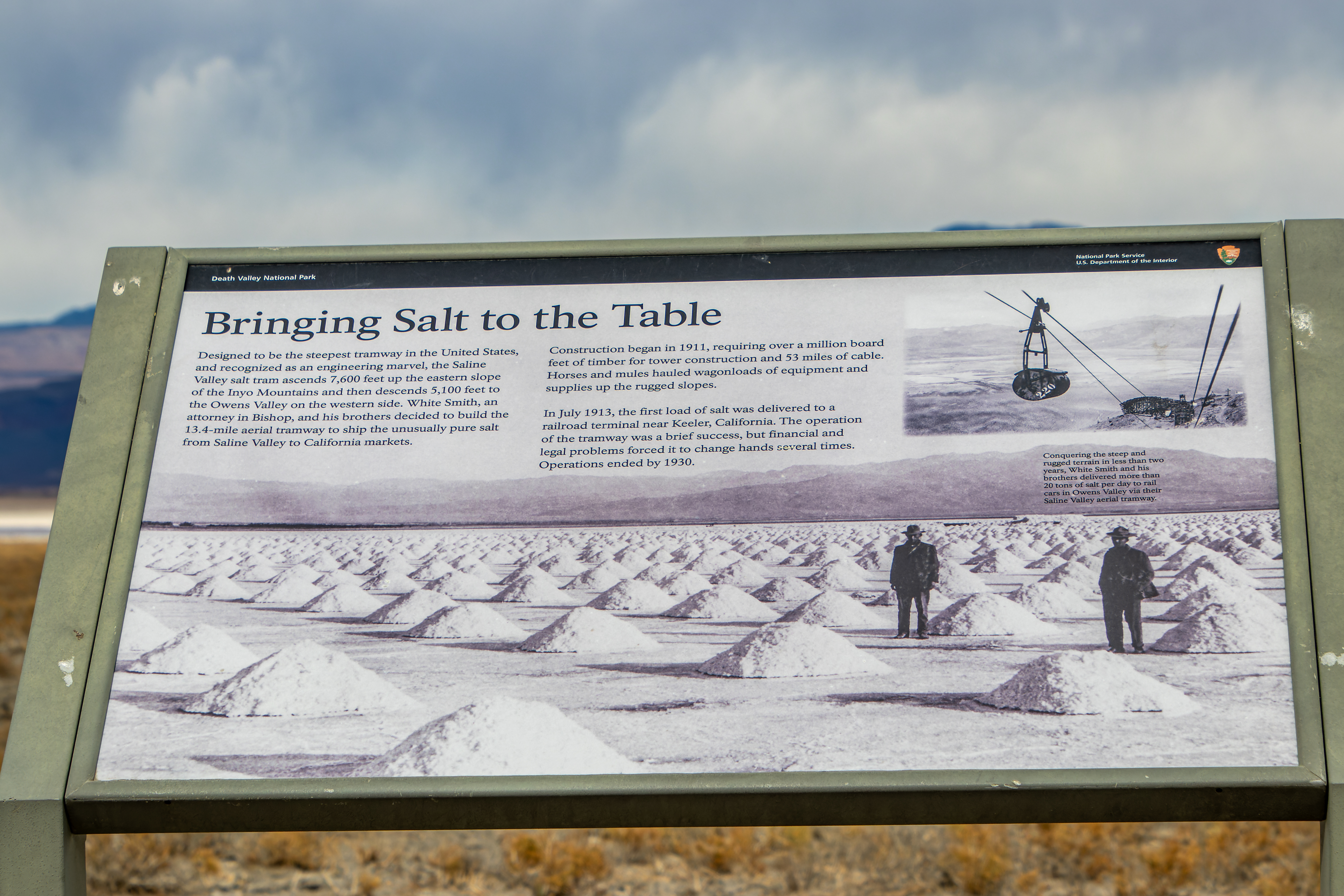

At the heart of
Saline Valley there is an old drying lake with large salt deposit. 16 square
mile deposit 30 feet thick, consisting of almost pure table salt (sodium
chloride. The main problem with using this salt deposit was the remote and
isolated location and a lack of good road to take the salt by tracks.
To overcome
this problem an electric aerial tram was constructed in 1911 to carry the salt
14 miles over the Inyo Mountains to a terminus northeast of Keeler in the Owens
Valley. The tram was the steepest ever constructed in the United States.


268 iron
buckets, each carrying 12 cubic feet of salt, would travel 7,600 feet from the
valley floor to the top of the Inyo Mountains, and then another 5,100 feet down
to Tramway on the other side of the mountains.
The mine where
operative on and off from 1915 to I930s until it ceased operations because of
the difficulties in making the complex tramway pay for itself.
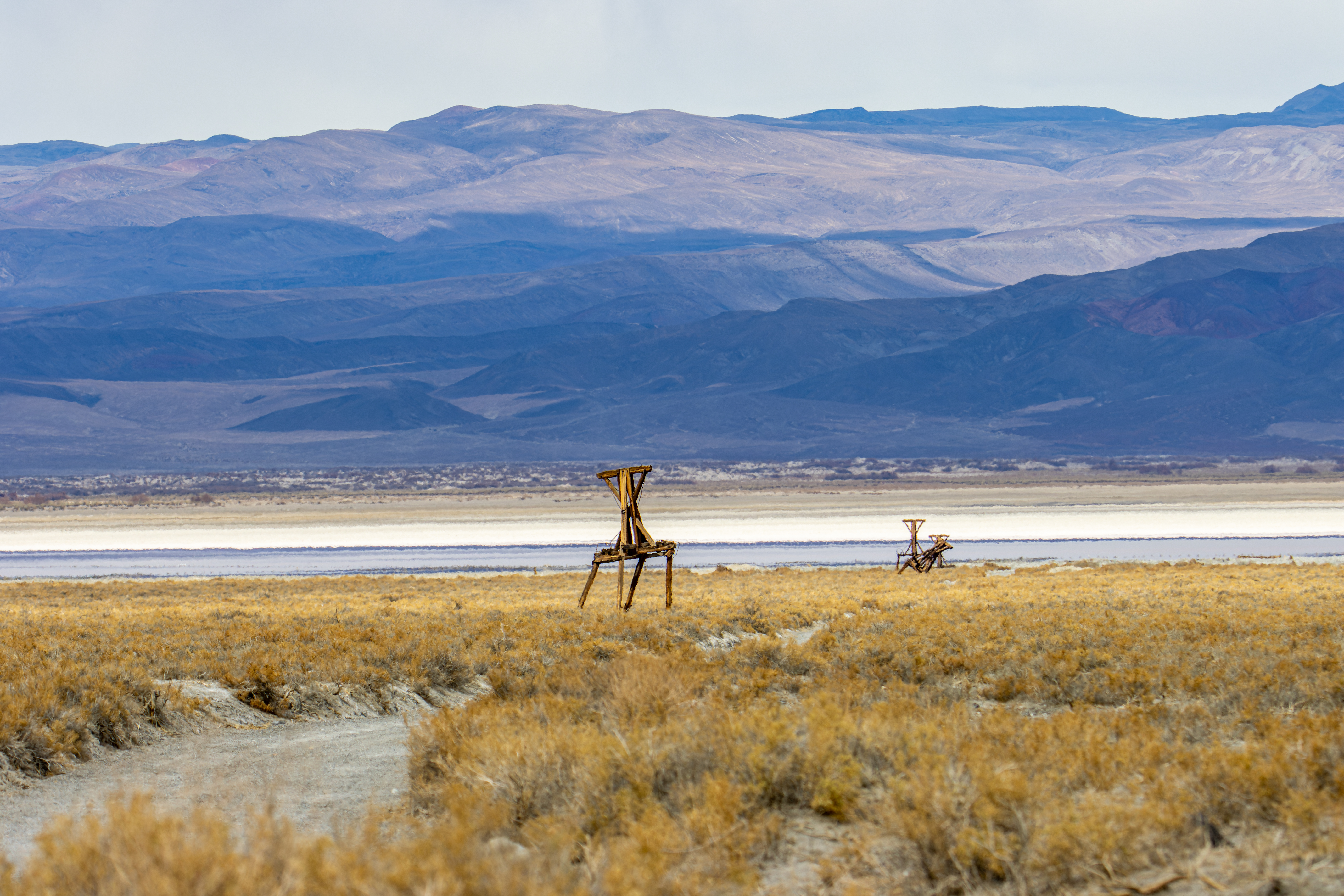
Today you can drive in the old mining site along the few last standing pools of the tram almost to the water line, please do not drive with your car all the way to the water line.
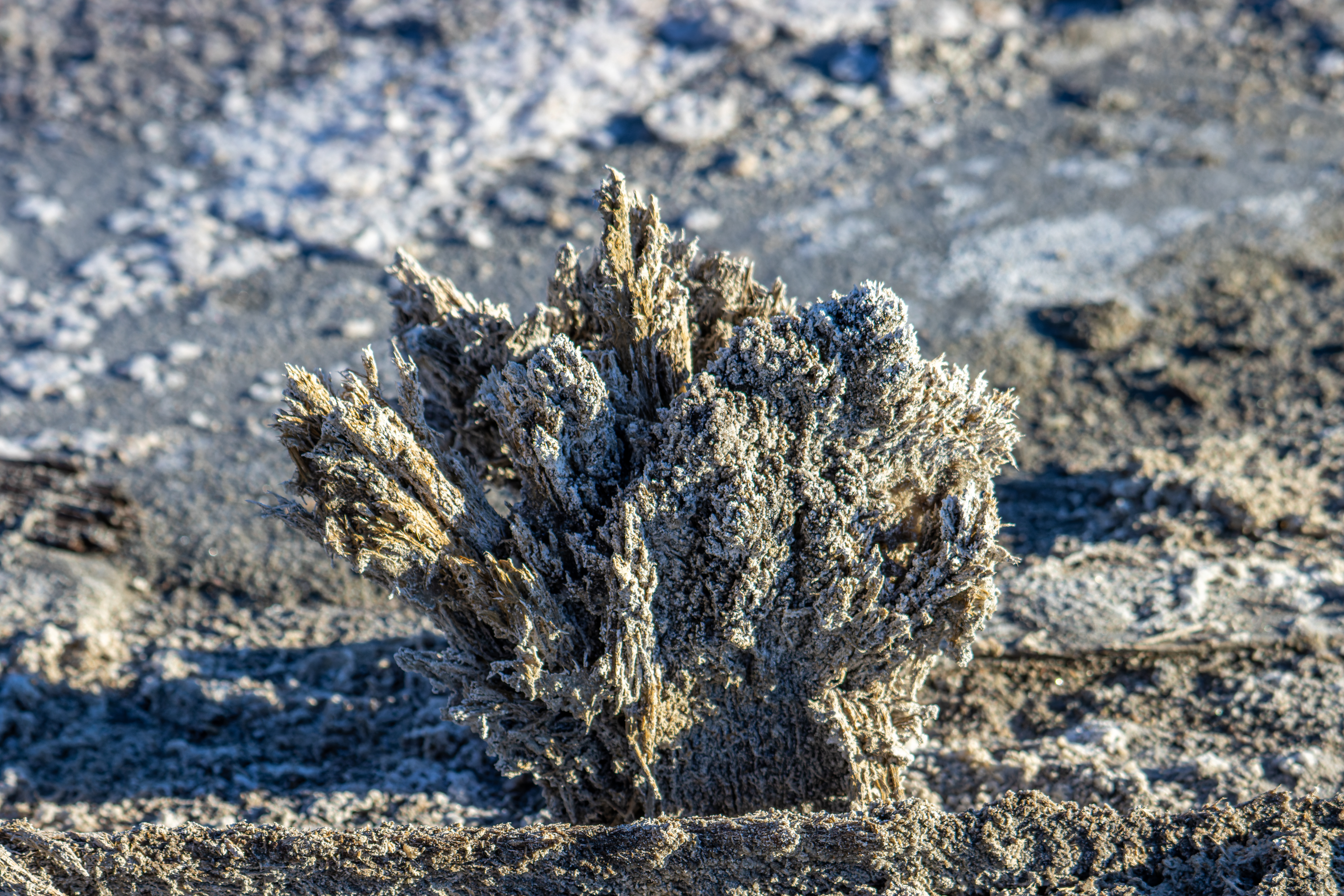
North of the salt factory site there is a large salt marsh with a lot of plant
and animal life. The marsh is fed from Hunter Canyon.


There is not
much to do here except enjoy the Salt Lake view and look back on the line of
the tram going up the steep mountains.
More Pictures:


The Road into Saline Valley from the south:


Comments
Post a Comment