
Introduction:
Update: Last time I visit the park was: Dec. 2023
Where? :
Located on the east side of Dumbarton Bridge (hwy 84) on the east bay waterfront, near the cities of Fremont and Newark.
Easy to reach and plenty of parking, can get full at weekend noon-time.
As of 2023 they are working on new entrance and parking system.
Google Map Link


What? :
A local park that has a lot to offer, marshland water ponds and grassland covered hills, probably the best bay-front view with amazing sunsets.
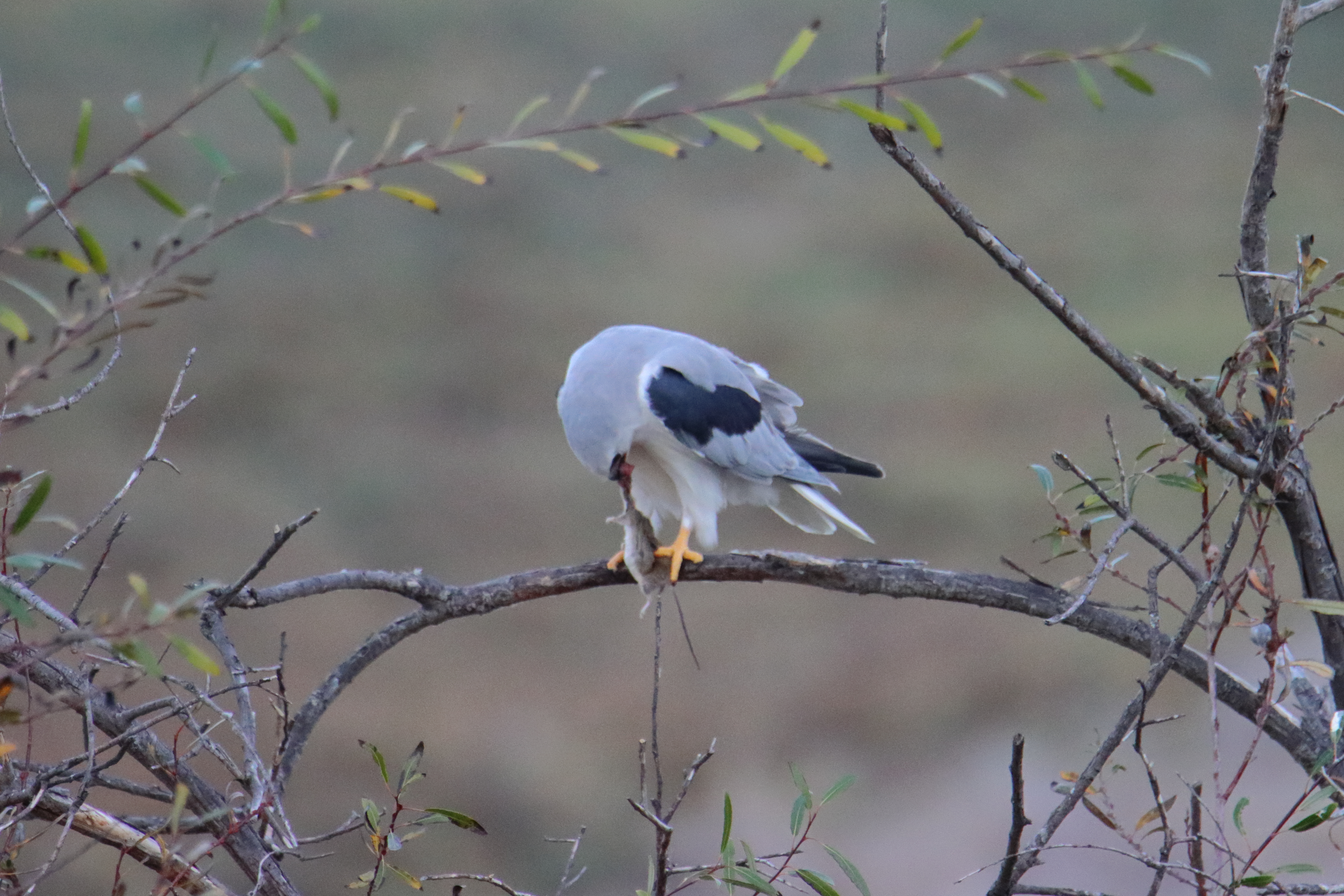
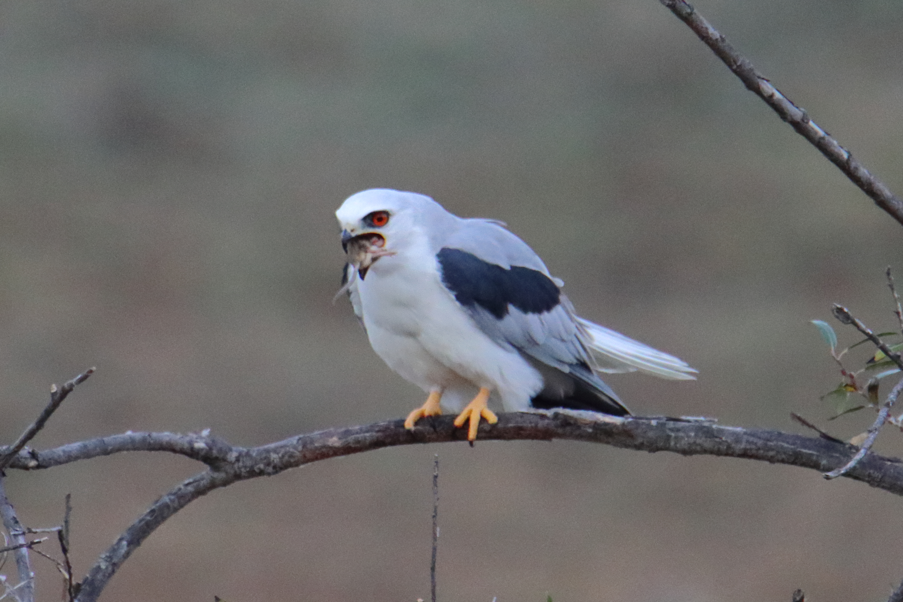
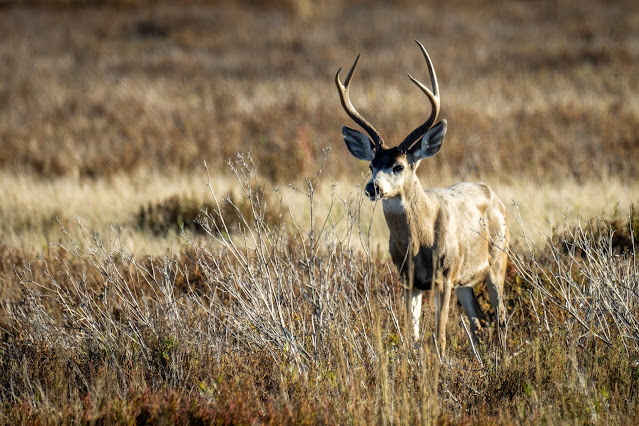
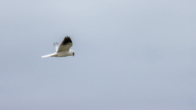
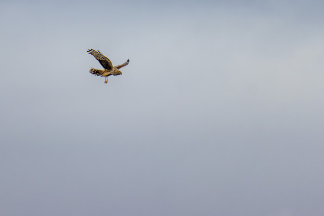
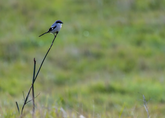
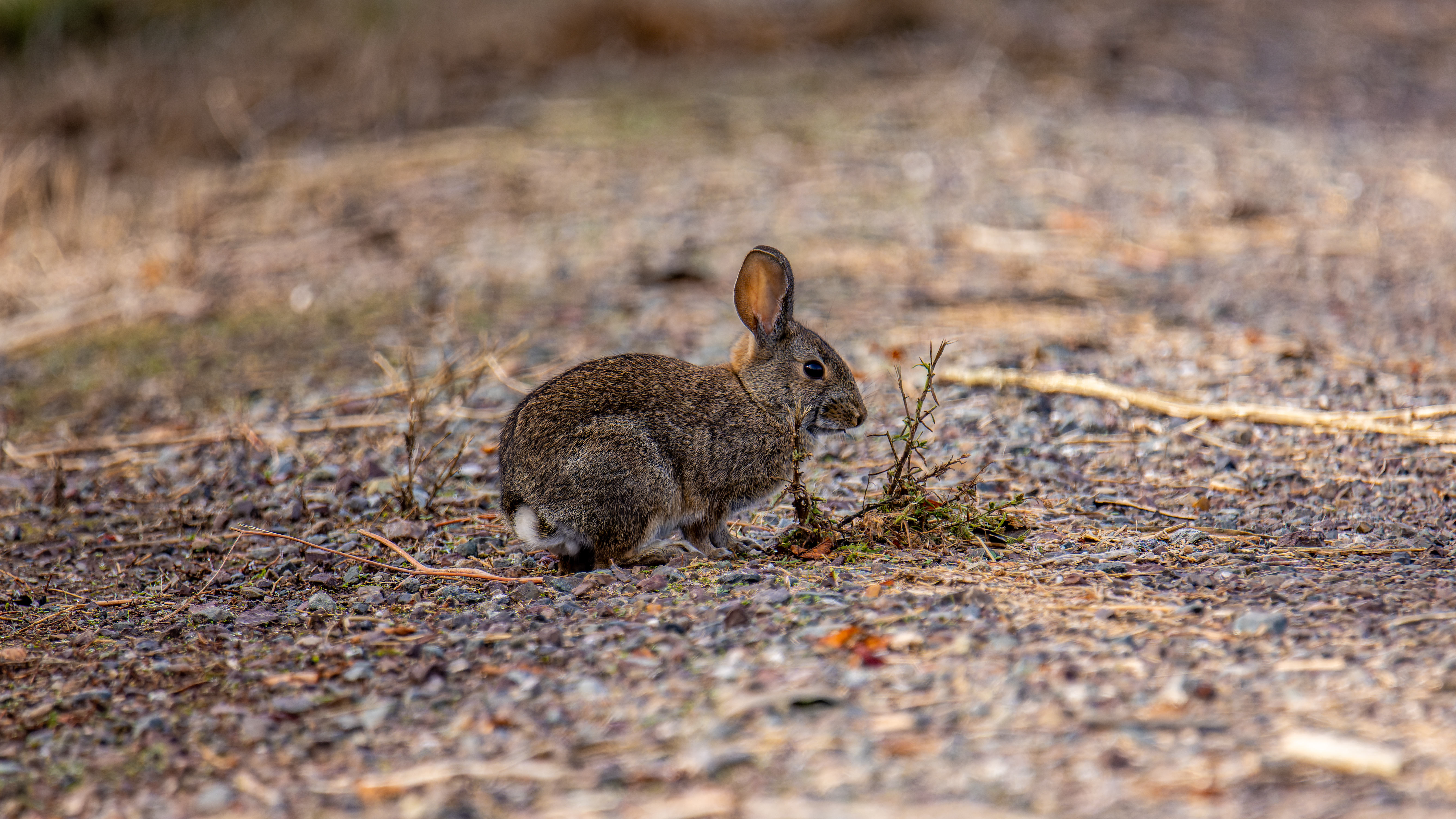
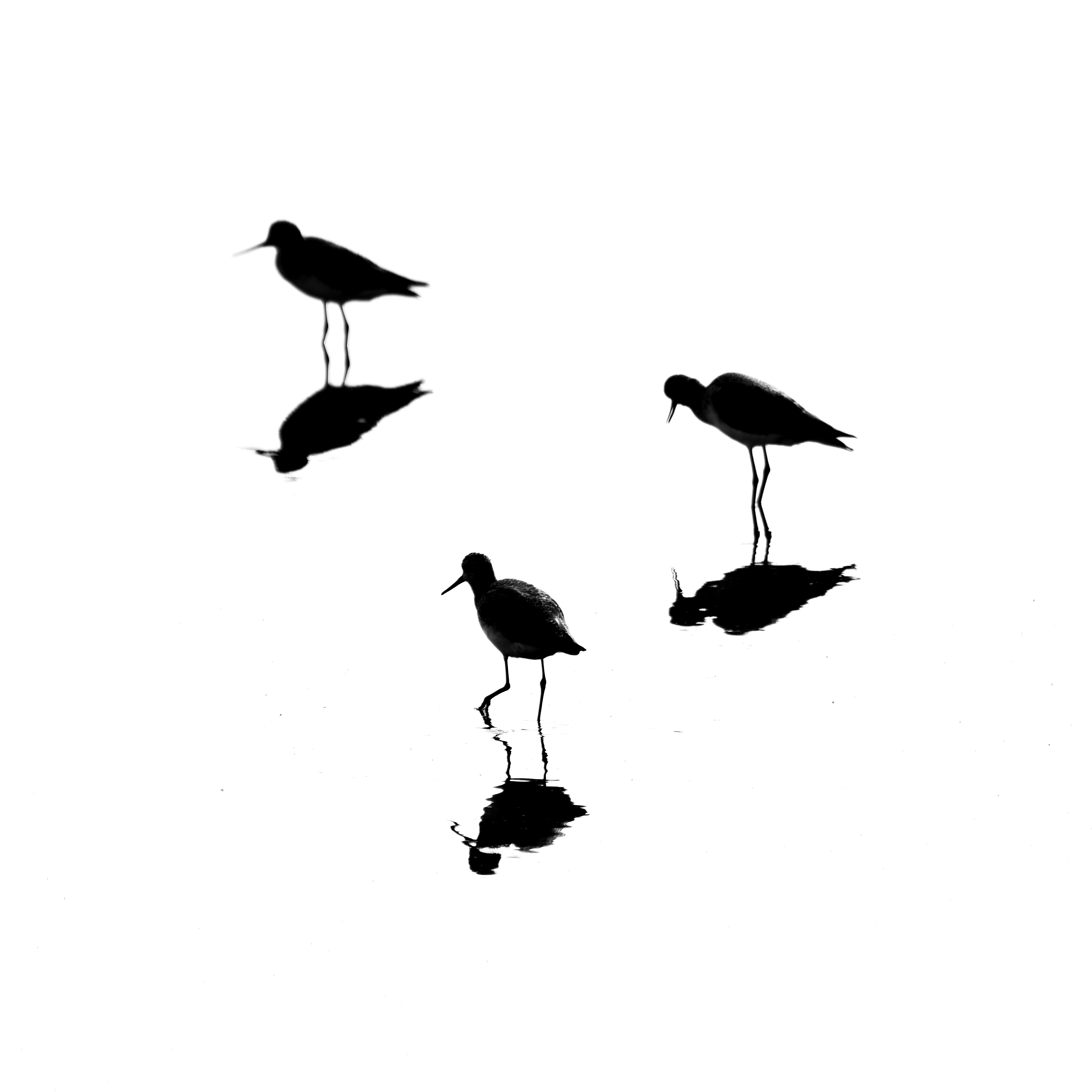
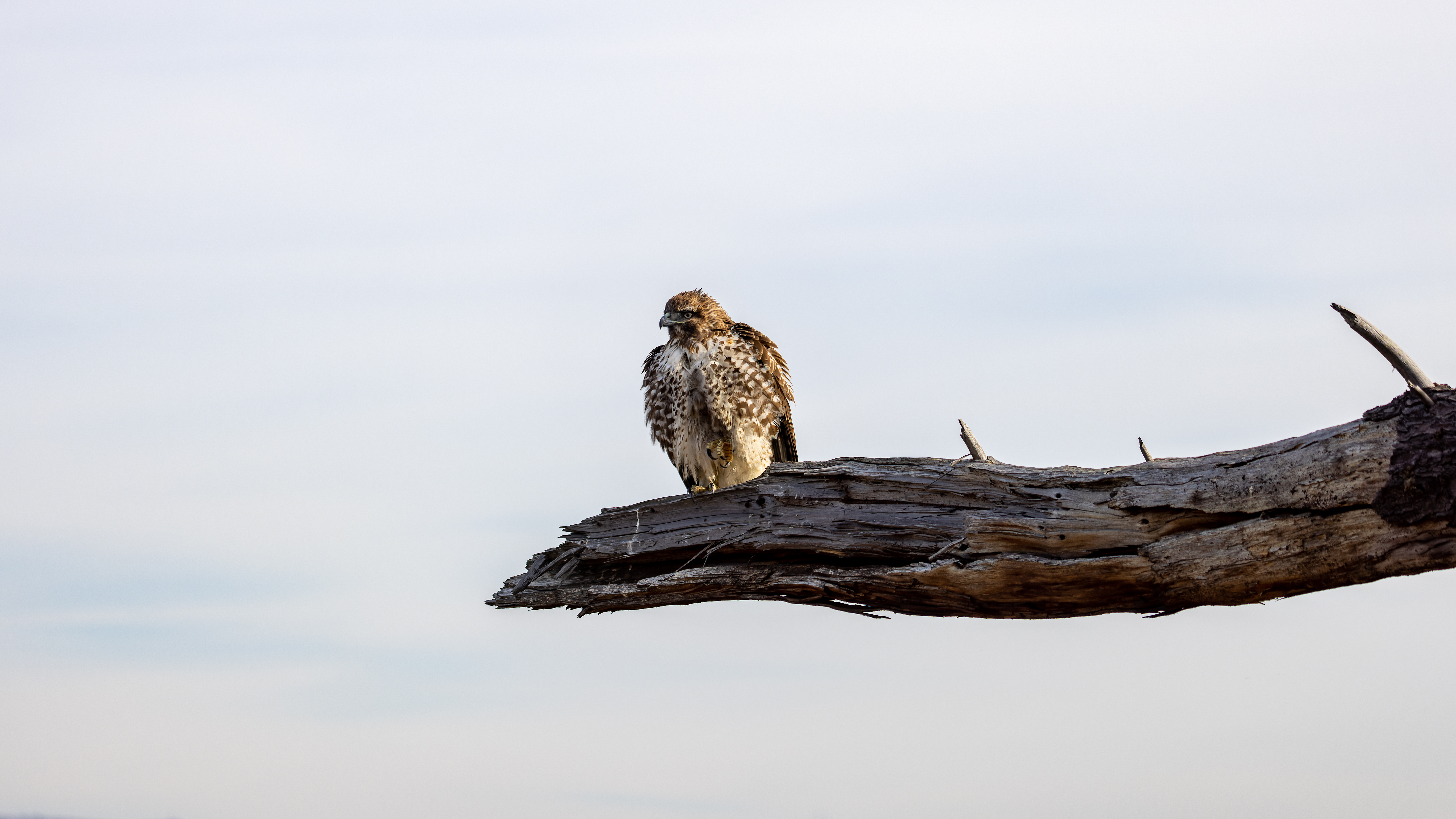
It is one of my prime locations for birds and local wildlife viewing.
The park offer trails for all levels of difficulties, it has even long paved round trail that can be done with stroller and it is dog and bike friendly.


When? :
Year Round, my preferred time is at a sunny winter day when all is green but I visit here many times in other seasons. Summer is hot and you do not have shade along the trails.


Due Note 1: This park has car entrance fee but if you are coming with bike or you do not have problem with some extra walk than you can park at
small parking lot at the entrance to the park road.
Due Note 2: The park has internal ponds and it also has a trail that flowing the bay waterfront so it attract many birds.

My thoughts:
From some reason I did not visit this place for many years, always thought
to do this “sometime”… Finally, I visit the park at early December 2020, I had such fun and synced them I'm visiting here regularly.
This is a fun local south bay park to visit with many things to see.
I really enjoy my afternoon visits here.


The
visit:
There is only one road that get into Coyote Hills Regional Park.
You pass the entrance fee satiation and soon you will see on your left the first parking lot (usually I park here), after few hundred feet there is another parking lot near the small Visitor Center.
It is not so much important where you park and there is a trail
connecting the 2 parking lots.
The park
offers many activities as hiking, bicycling, bird watching, nature
exploration, and picnicking and I saw that it even offer overnight campground.


Most of the trails are accessible to bikes and they are also good for trail strollers.
The
paved 3.5 mile is good for any stroller.
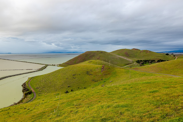
There are
2 sections of the park, the lower marshes on the east side of the park and to the
west there are few hills connected to create ridgeline and the bay waterfront.

Water
marshes:
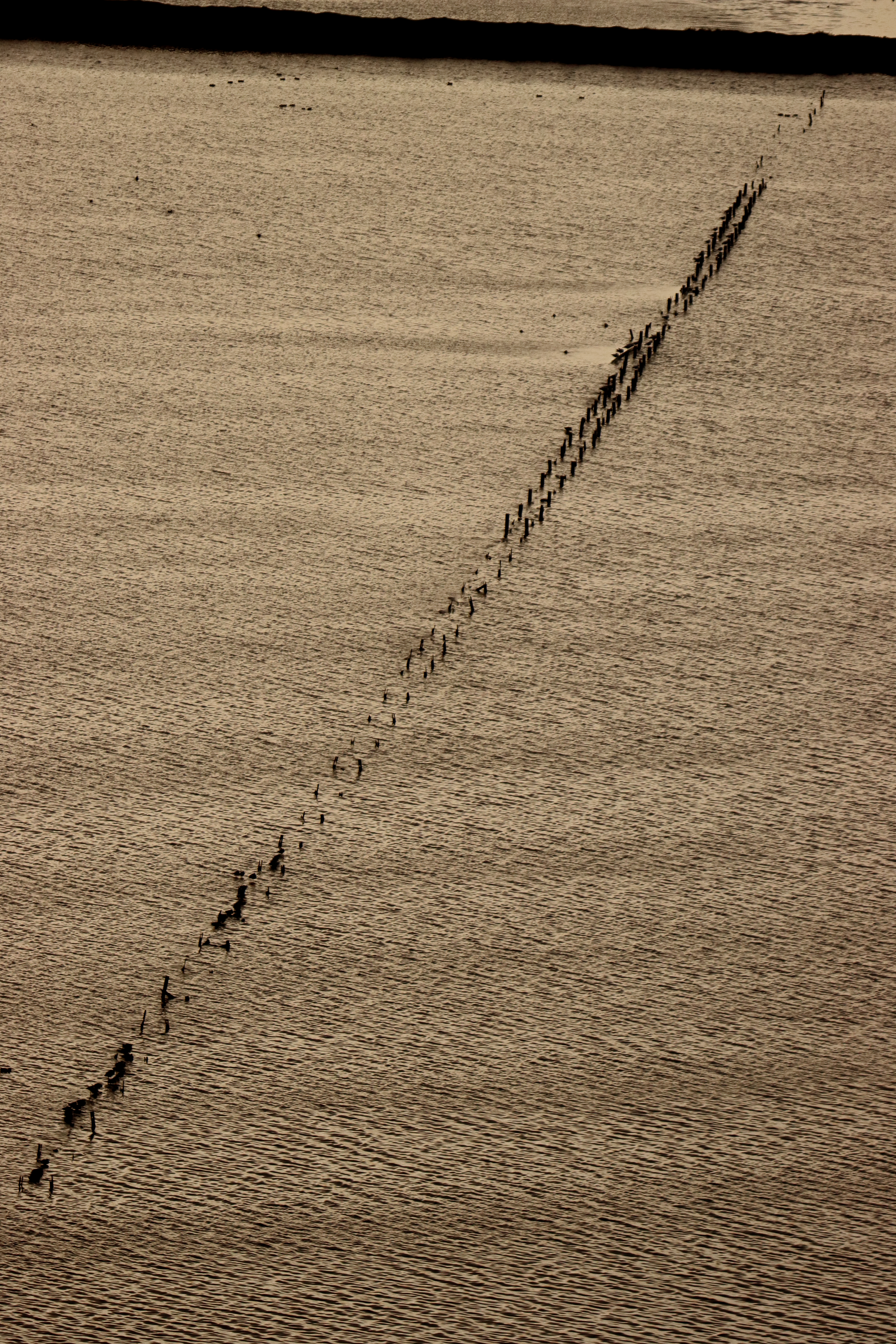
There are many large water marshes at the south and east section of the park. There are few trails that will take you near the pounds. Along the trails you can find bird watching view points with benches.
You can walk all the way to the north east park section and connect there to the Alameda Creek Trail.
At the east side of the marshes you will find the
2,000 years old native American village site, I never visit here so I can't say if it worth the hike....


Hills
and the Bay Waterfront:
Many trails are covering this section of the park.
The hills are not so high and you can hike on the trail that follow the ridgeline, follow one hill to the other. On it south side the trail follow the road leading to the hill top facility. Here the trail is blocked but you can hike down to the left.
In addition there are many connecting trails that usually do not climb
the hills top.
The Bayview
Trail is relatively easy and cover this park section.

Hiking:
There are many different hiking options and you can have chose from a short easy stroll near the north water marshes, walk and follow the 3.5 mils paved trail loop (Blue loop in my below map) or climb the hills (Yellow trails in my map below).
Once
you are done with hiking, enjoy the view, birds or sunset you can easily find the trail that will lead you to your back to your parking
lot.
you can also hike south on the waterfront trail or on the east side of the hill and reach highway 84 and cross Dumbarton Bridge Toll Plaza foot bridge that connect to Don Edwards San Francisco Bay National Wildlife Refuge.


Bike:
The Park
is bike friendly and can offer trails in all levels, including paved flat trail that can fit kids.
Most trails
including in the marshes are accessible to bike and if it is not it clearly
state in the map and with sighing indicating that this is hiking trail only.
This is
not “mountain bike park” but rather for long epic rides.


Bayview
Trail:
A 3.5 paved trail loop that is relatively easy to ride (i.e. do not climb the hills).
The trail start at the 2 parking lots (so no matter where you park you can find this trail) and keep heading north near the marshes, it keeps north and than to the west in the direction of the waterfront.
once it reach the bay waterfront the trail is heading south east following the waterfront and the foothills all the way south, the trail cross back the hills in a low section and reach the south parking lot.


Red
Hill Trail:
This is a nice trail that is following the hills top from south to north.
It involved with some short steep climbing to the hills top, but the scenic vistas of San Francisco Bay and surrounding areas of Alameda County is worth it.
Ramble around the marsh or climb
to the top of Red Hill to catch the breeze.
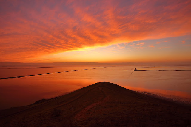
At sunset
you can be at Red Hill viewing point and see the wonderful scenic views of the
south San Francisco Bay and the peninsula mountain to the west as well as the view
to the east.

Nearby Parks:
The park is also connected by trails to a nearby parks.
On the south you can go to Don Edward San Francisco Bay preserve (follow the bridge over Highway 84) and on the north side of the park it is connected to the Alameda Creek Trail System that can take you far to the east.
Both connecting trails are allowed for hikes and bikes.


www:
https://www.ebparks.org/parks/coyote_hills/
Map:
https://www.ebparks.org/civicax/filebank/blobdload.aspx?BlobID=24173
Additional Pictures:


Picture Taken at Nov. 12, 2021


Picture Taken at Jan. 3rd, 2022


Pictures from my Nov. 2022 Visit


Comments
Post a Comment