
Introduction:
What? :
Mission Peak is
probably the most popular and crowded hike in the south bay area (maybe just
second to Rancho San Antonio County Park) but when taking the longer route from
Ed R. Levin Park you can enjoy the hike and the south bay view without the crowded.
Mission Peak rising
steeply at the southeast bay above of the city of Fremont to height of 2,517-foot
summit and from Ed R. Levine this is out and back hike of 12.5 miles and
climbing 2500 ft.


Where? : My starting
point was at Ed R. Levin County Park, located on the south east bay, located
east of Milpitas.
Google Map Link
Other nearby parks:
When? : The preferred time
to hike here is early spring nice day when all the hills are green, late spring
bring flowers but the grass start to get dry and yellow at early May.
Due note 1: Mission Peak hike
is overcrowded on weekends, with hundreds of visitors attempting the
3-plus-mile hike. Do not expect to be the only one at the peak, no matter what
the time of the day is.
Due note 2: Most hikers
are starting at Ohlone College or from Stanford Ave. Entrance (check trail and
parking opening hours). The much longer trail from Ed R. Levine has a lot less
people and you can see only few people along the hike.


Due note 3: This hike is
exposed to sun and wind, there is not shade at all so come prepared with enough
water, hat, and sunscreen. At wintertime there is no protection from the wind
or rain.
Due note 4: If you are
hiking in a low cloud day you may just end up hiking through a cloud inversion
where the blanket of the cloud will cover the bay below you.
Due note 5: This is popular
hiking spot for sunrise and sunset.
Due note 6: Large section
of this hike pass through cow grazing land. The cows are generally harmless,
but do not get too close or between a mama cow and her calf.


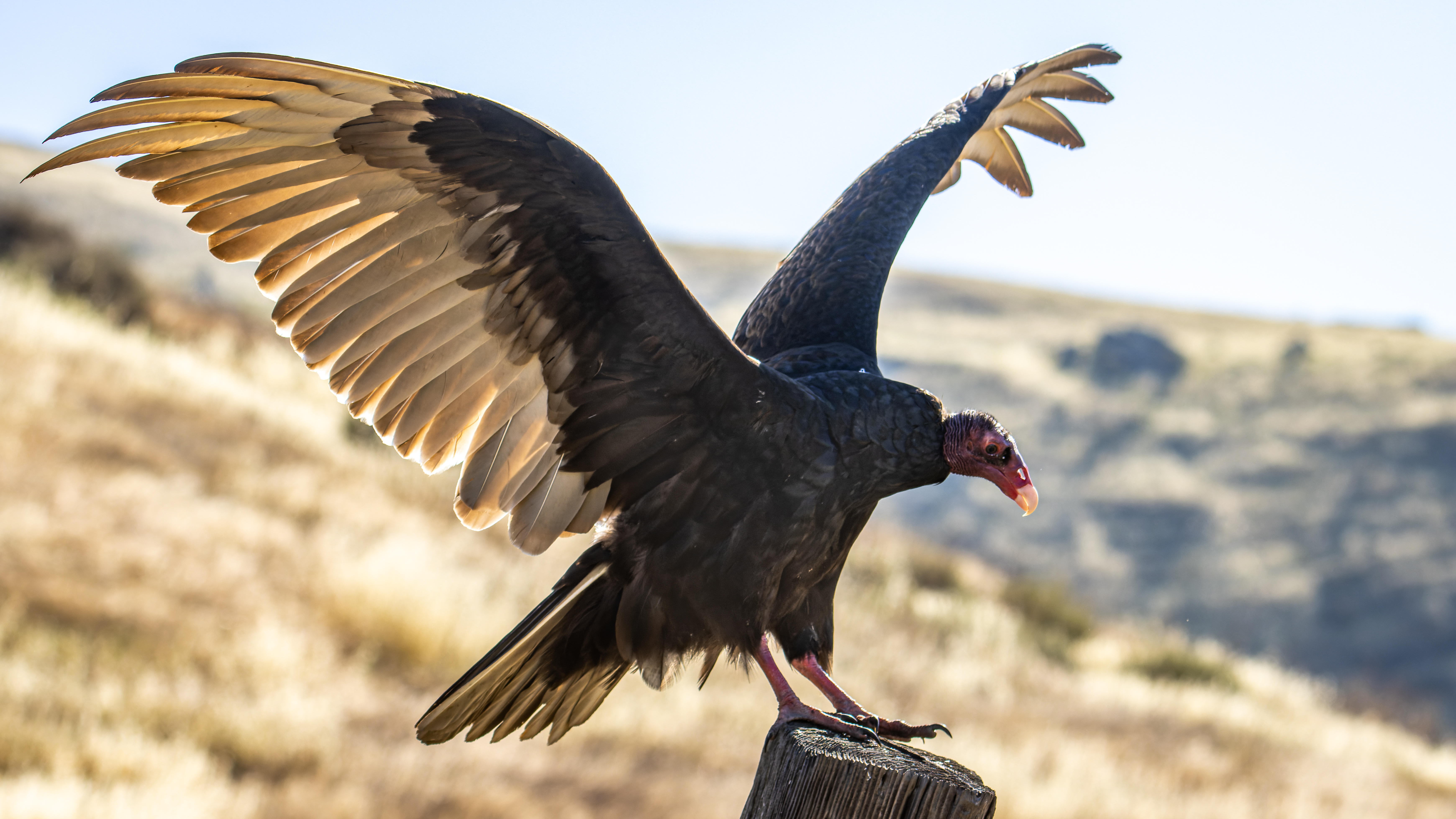
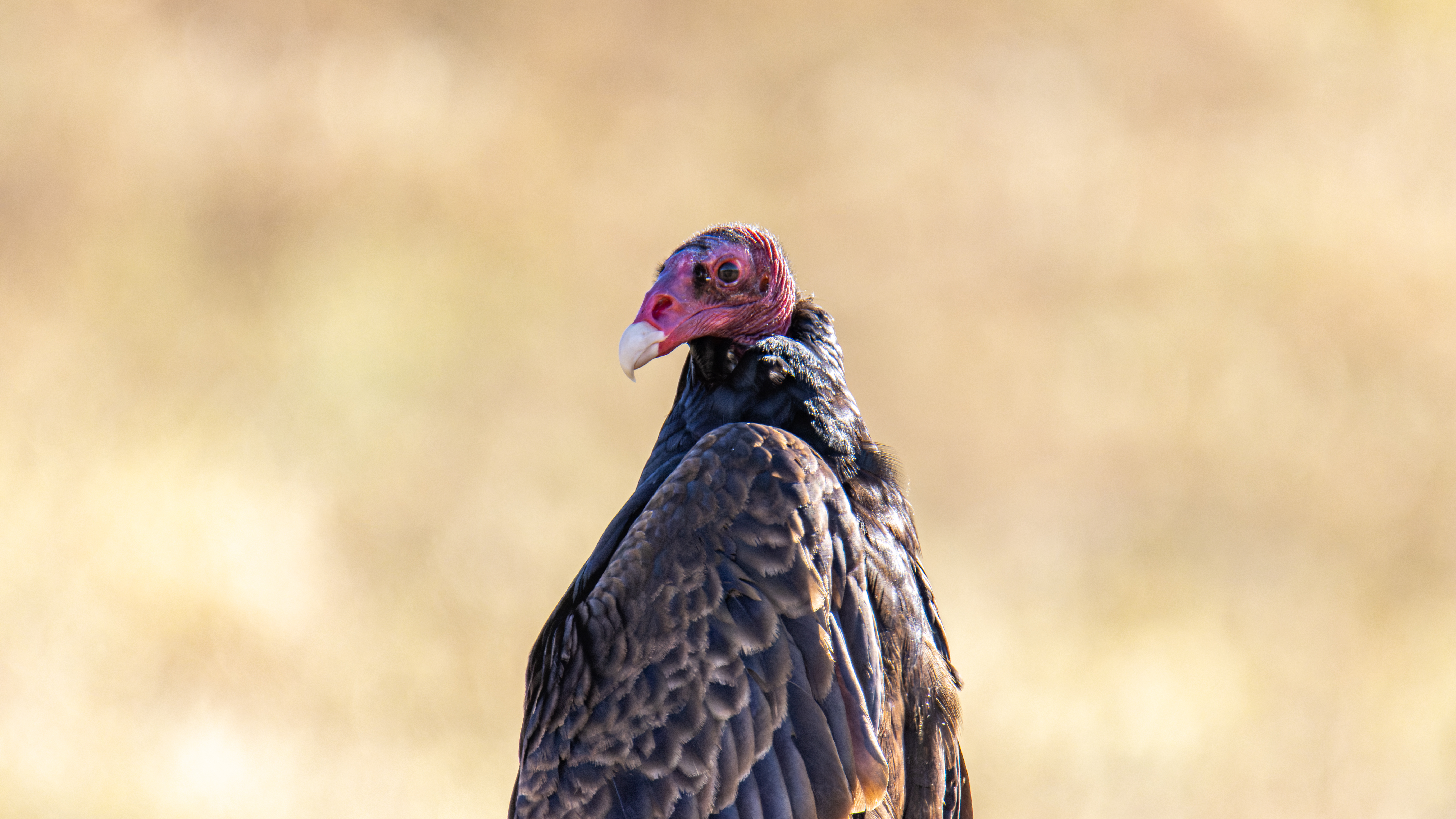
My thoughts: I hiked to Mission Peak only once, the crowded trails and the peak is not exactly my favorite location but on the other hand hiking from Ed R. Levin Park where there are only few other hikes was fun to do. I visit here mid-May, but I think this is already too late and I need to come again more at winter or early spring when all is green. Along the hike I saw many birds and to my surprise they were not so much afraid from my presence, so I manage to get some good close up pictures.


The Hike:
I will describe
in this blog my hike and I will not cover the more popular north facing hikes, There
are two main trailheads for Mission Peak: Stanford Avenue and Ohlone College.

I started my
hike at Ed R. Levin County Park (see my blog on this park visit) just near the
lake parking lots (6$ entrance fee). When I hiked here, May 2022, the lake was
half dry, 2 years back it was full.
I start my hike
near the lake going east to the lake dam and from there I climbed up, passing a
big Eucalyptus tree, and joined Tularcitos Trail.


From here I walk
into Agua Callente Trail that is leading northwest up the hill slope.
After 0.5 mile
you will cross the road and see on your left the water tank, keep hiking straight.
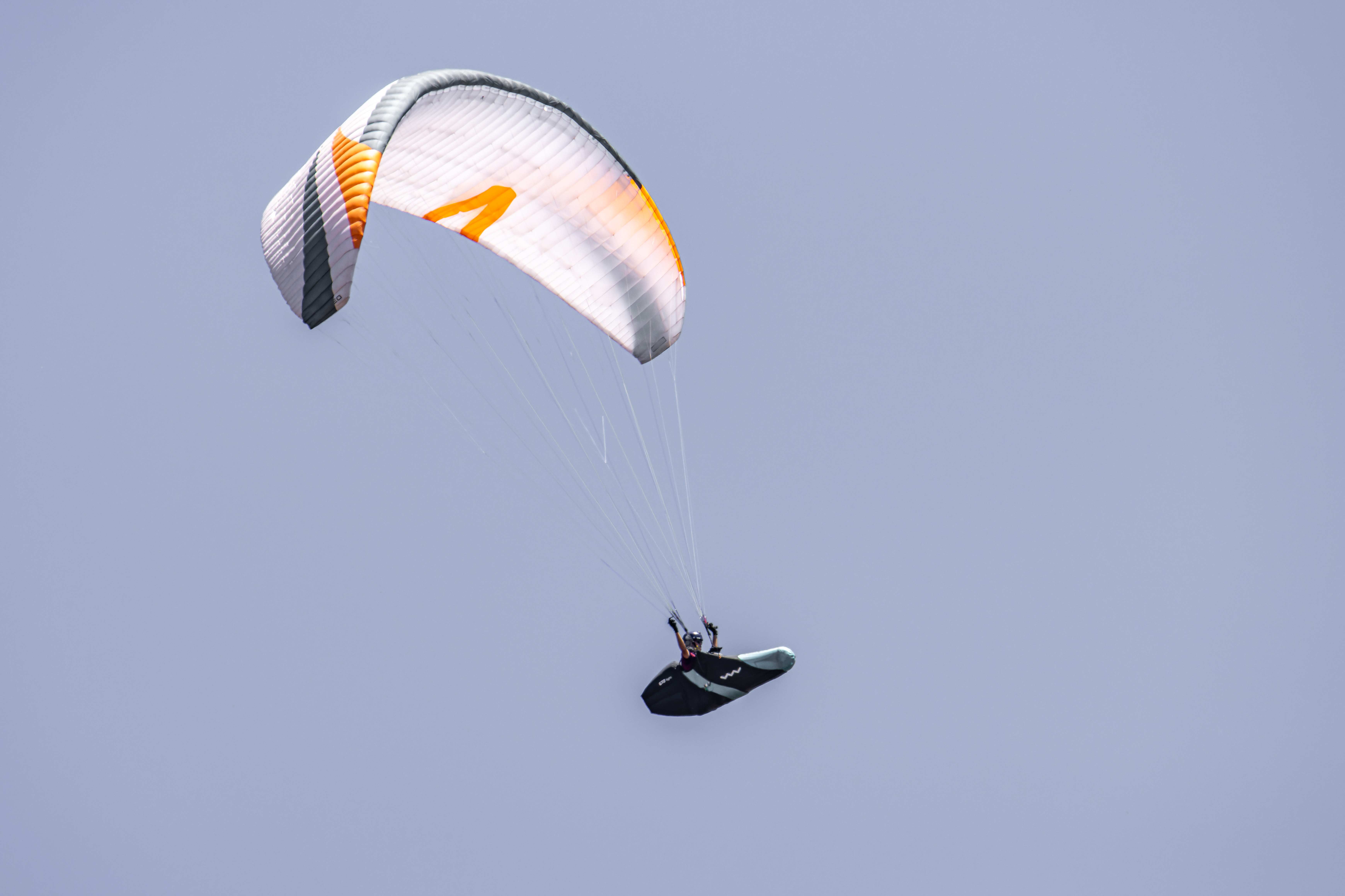
At this point you
may see hang gliders walking to the launch site on the high point on your right.


After 1.7 miles
from the hike starting point you will reach a trail junction. Keep heading up
on a single-track walking trail with the name of Monument Peak Trail, you can
also walk up the dirt road, but it is more expose to sun and less fun.


The trail is
progressing up the mountains parallel to the dirt road and after walking 0.7
miles from the junction the road turn to the right and the hiking trail turn to
the left, take the hiking trail. This 1.6-mile trail section climbs sharply on
the mountains, you will cross a gate that indicate the end of Ed R. Levin Park
area. At the end of this trail stretch you will reach the base of the tall
single antenna structure the ridge trail junction is just after it.
This large
trail junction is the highest point in this hike section and is exactly 4 miles
from the starting point at near the lake.
Infront, you see
the Monument Peak North and from here turning right on the good dirt road will
lead you to the top of Monument Peak South. If you will decide hiking to Monument
Peak South, you can find few trails that can lead you down back to Ed R. Levin
Park area.


Once you reach
the top of this section of the climb (first large single antenna, KTVU-TV
transmitter), with a slight right and taking the Bay Area Ridge Trail you will
hike in rolling pastures hills landscape, this is part of Mission Peak Regional
Preserve.
There are many grazing
cows in this area. I found it that this area is the most beautiful part of the
hike, it is not as hard as it was climbing up the mountain and the hills and rounded
mountain top are covered with grass.


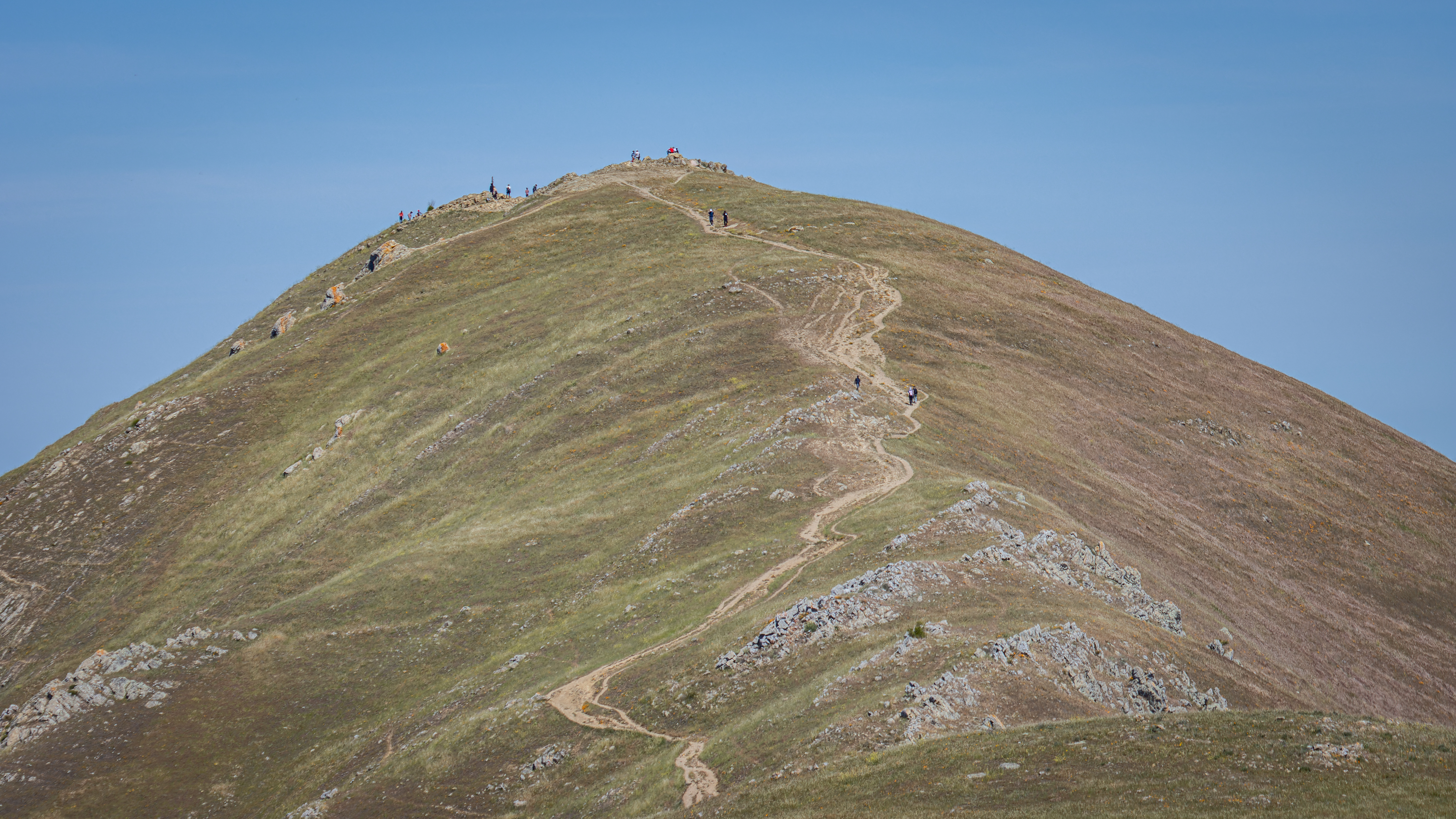
You will pass Mountain Allison on your left (many antennas) and after crossing the dirt road keep hiking northwest and you will start to see Mission Peak summit, 0.8 miles away. Cross the lower section and hike the final climb up the trail leading to Mission Peak.

All the way up
to this point you will see few hikers but at the peak there are many of them, enjoying
the view and taking their pictures on the pole.

Overall, from
the parking lot to this location it is exactly 6 miles hike with gaining of 2500
ft of elevation, and it took me 3 hours and 15 minute to reach here.
From the mountain
top you will have 360-degree views.
You can see the
south bay area below, beautiful rolling hills of Sunol Regional Wilderness to
the east and Mount Diablo far north. On the south side you can see Mount
Hamilton, and the Santa Cruz Mountains far on the other side of the bay.


The Mission Peak
pole was built on December 27, 1990, created by sculptor and park ranger
Leonard Page. Many people climbing on top of the pole and take their picture.
Mission Peak pole isn’t the true summit of Mission Peak, the highest point is the rock pile just to the south of the pole.


I hiked here
during weekend and mid-day, so the peak was full of people, not exactly the
solitude atmosphere… after short recovery and taking few pictures I started my
hike back down using the same trail I went up.
At the large trail
junction of Agua Callente Trail and Monument Peak Road, I went on the main road
heading straight down to Minnis Ranch. At the ranch gate I turn right and went around
the close area. Turn right and at the end of this short section turn left
heading to the main park section.

www:
https://www.ebparks.org/parks/mission-peak
Map:
https://parks.sccgov.org/sites/g/files/exjcpb961/files/Ed%20R%20Levin%20Guide%20Map.pdf
https://www.ebparks.org/sites/default/files/mission_peak_map.pdf
Pictures:


Comments
Post a Comment