
Introduction:
What? : Tioga Road is
the most beautiful high Sierra Road and enable the drive from east to west across
this high Sierra mountain range. This road is close during winter month, starting
at the first major snow storm and up to mid-May.
This is state highway
120 and the name Tioga Pass apply to it section in Yosemite National Park.
Plan for a full
day trip to this road (59 miles long), there are many places to visit along the
road, amazing viewpoints, short and long hikes, and enjoying Tenaya Lake and
Tuolumne Meadows.


Where? : Start at Lee
Vining in the east at highway 395 highway 120 cross the Sierra all the way to
the other side of the mountains.
Google Map Link

Additional Yosemite and nearby locations blogs:
Yosemite National Park – How to plan your One-Day visit
Yosemite NP – Tioga Pass May Lake Hike
Yosemite NP – Tioga Pass North Dome Hike
Yosemite NP – Tioga Pass Lembert Dome Hike
Yosemite NP – Tioga Pass Tuolumne Meadows
Yosemite NP – Tioga Pass Tenaya Lake
Yosemite NP – Hetch Hetchy Visit Planning
Yosemite NP – Hetch Hetchy, Wapama Falls Day Hike
Yosemite NP – Hetch Hetchy, Laurel Lake Day Hike

When? : If you are
planning to drive Tioga pass road (highway 120), enter or exit the park east
entrance or visit Tuolumne Meadows make sure to visit the park main page to
understand if this road is open or close. The road is usually open from mid-May
to end of October.
Follow the link
below for history records of road opening and closing dates:
https://www.nps.gov/yose/planyourvisit/seasonal.htm

The recommended
time is at spring when the road is open, all is green and the mountains top
covered with snow.
Summer and fall
are also good time to be here because it is not hot at the higher elevation. At
fall the river is running low and the grassland is yellow.
Due note 1: Interesting to
know that Tioga Pass (highway 120) that cross the Sierra east-west mark the
north section of the largest contiguous roadless wilderness in the continental
United States. From this road all the way 150 miles to the south of Mt. Whitney
(highway 178), no other roads cross the High Sierra.
Due note 2: Tuolumne
Meadows is the largest high-elevation meadows in the Sierra Nevada and probably
also the most accessible one, Tioga pass road (highway 120) cross it east to
west and there are many parking spots along the road.
Due note 3: Tenaya Lake is
the largest lake in Yosemite Park and one of the most beautiful lakes in the
Sierra.
Due note 4: Tioga Pass
Road went under renovation so driving conditions are good.
Parking: The main problem is that during crowded weekends
and holidays it will be challenging to find parking spots at specific popular location
along the road, plan to be flexible.

Due note 5: The nearest
Gas stations locations:
West: 38 miles
at the junction with Big Oak Flat Rd.
East: 21 miles at
highway 395 and the town of Lee Vining
Due note 6: Restrooms can
be found at the visitor information center and near many of the large parking
lots along the way.
Due note 7: when I visit
here, Oct. 2022, the grill & convenience store near the east end of the
meadow was close and under major renovation. Not clear when this will be open.
Due note 8: There is a
large campground in Tuolumne Meadows but from my experience it is fully booked
early in the year. If you are planning to stay here, book your campground in
advance. There are few other campgrounds along the road that may be less crowded.

Few general hiking guidelines:
Stay on
established trails, pack out what you pack in, Overnight backpackers need a
wilderness permit, carry (and drink) plenty of water. Be sure to treat river,
stream, lake, or spring water.
My thoughts:
One of the most
amazing roads I ever drove.
Along the years and my so many Yosemite visits I drove here many times and
always amazed by the beauty of this area.

The Road Trip:
Most visitors
to Yosemite spend their time in the valley but I highly recommend making this
winding drive up the mountains and see this amazing region.
The landscape
views, the attractions, and hikes worth your trip, even if at the end of the
day you need to drive back down to the Valley for your night stay.
I will describe
the attractions along the road from East to West, I will cover the full length
of this road also outside the east park boundaries all the way to highway 395,
this is 59 miles long road.
If you are only
driving and maybe doing few stops along the road in viewpoints plan for 2 hours’
drive.
When driving
here you do not need to do all the attractions, hikes, and viewpoint along this
long road, even if you want you can’t do it all in one day.
If you want to really
explore this wonderland you can camp in one of the campgrounds along the road
and do long hikes.

Assume you are only driving here in one day;
I will list below my “must do” stops along the
road:
1. Tuolumne Grove – If you did
not visit any other large Giant Sequoias, if you already did or plan to you can
skip this stop
2.
Olmstead Point – This is best viewing point along the road
3.
Tenaya Lake – The largest and most beautiful lake in Yosemite Park
4. Tuolumne Meadows – Large Alpine
meadows and excellent location for easy hikes


The road attractions (ordered west
to east):
Tioga Pass Road, Gas station:
This is the “official”
start of Tioga Pass Road (highway 120). From here the road climb the mountains and
cross them over to the other side of the Sierra.
If you are
coming from the east (driving west on Tioga Pass) than turning left here will
take you to Yosemite Valley and if you turn right, you will drive to the north
exit of the park.

Tuolumne Sequoia Grove Hike:
The Tuolumne
Grove, though not as large as the more famous Mariposa Grove, still contains
dozens of thousand-odd-year-old Giant Sequoias.
The trailhead
is located a 0.6 mile from the gas station on Tioga Road, turn left into the
parking lot.
From the large parking
lot (+ restroom) the trail drops 500 feet in one mile (the Old Big Oak Flat
Road). This is moderately challenging route on the way back up. Once you reach
the Tuolumne Grove there is an easy, half-mile, self-guiding nature trail.
Overall, this
is 2.5 miles out and back hike.
The grove
itself contains a couple dozen mature Giant Sequoias, including dead one you
can walk through.
This trail is
open year-round including when it fully covered with snow.
https://www.nps.gov/places/000/tuolumne-grove.htm

White Wolf Campground:
White Wolf
Campground is located about a mile off the Tioga Road between Tuolumne Meadows
and Crane Flat, approximately an hour from Yosemite Valley at 8,000 feet.
Even if the
road gate is close at Tioga Road, you can park your car there and walk and
explore this area. I hiked through this campground few years back and it was
nice place place with meadows and forest, in 2021 there was fire in this area,
so I do not current conditions.
Yosemite Creek Campground:
Yosemite Creek
Campground is 4.7 miles off Tioga Road (Highway 120), about 26 miles west of
Tuolumne Meadows and at 7,700 feet elevation. The road to get to the campground
is narrow, winding, and rough so RVs and trailers are not recommended. No tap
water is available at Yosemite Creek Campground.
North Dome Hike:
The view from
North Dome across Yosemite Valley straight to the cliff-face of Half Dome is unique
and impressive. From this location you also have a good view of Diving Board location
on the lower right side of Half Dome and Clouds Rest ridge line higher to the
left side. This is 10.5-mile out-and-back trail (includes the Indian Rock detour)
with 2400 ft of overall climbing, plan for 6-8 hours hike.
This is easy hike but not super hard hike.


You start descending in the direction of North
Dome, the way back is mainly ascending so take this into consideration.
A short side-trip
will take you to Yosemite’s only natural arch, Indian Rock.
Link to my Blog
about this hike

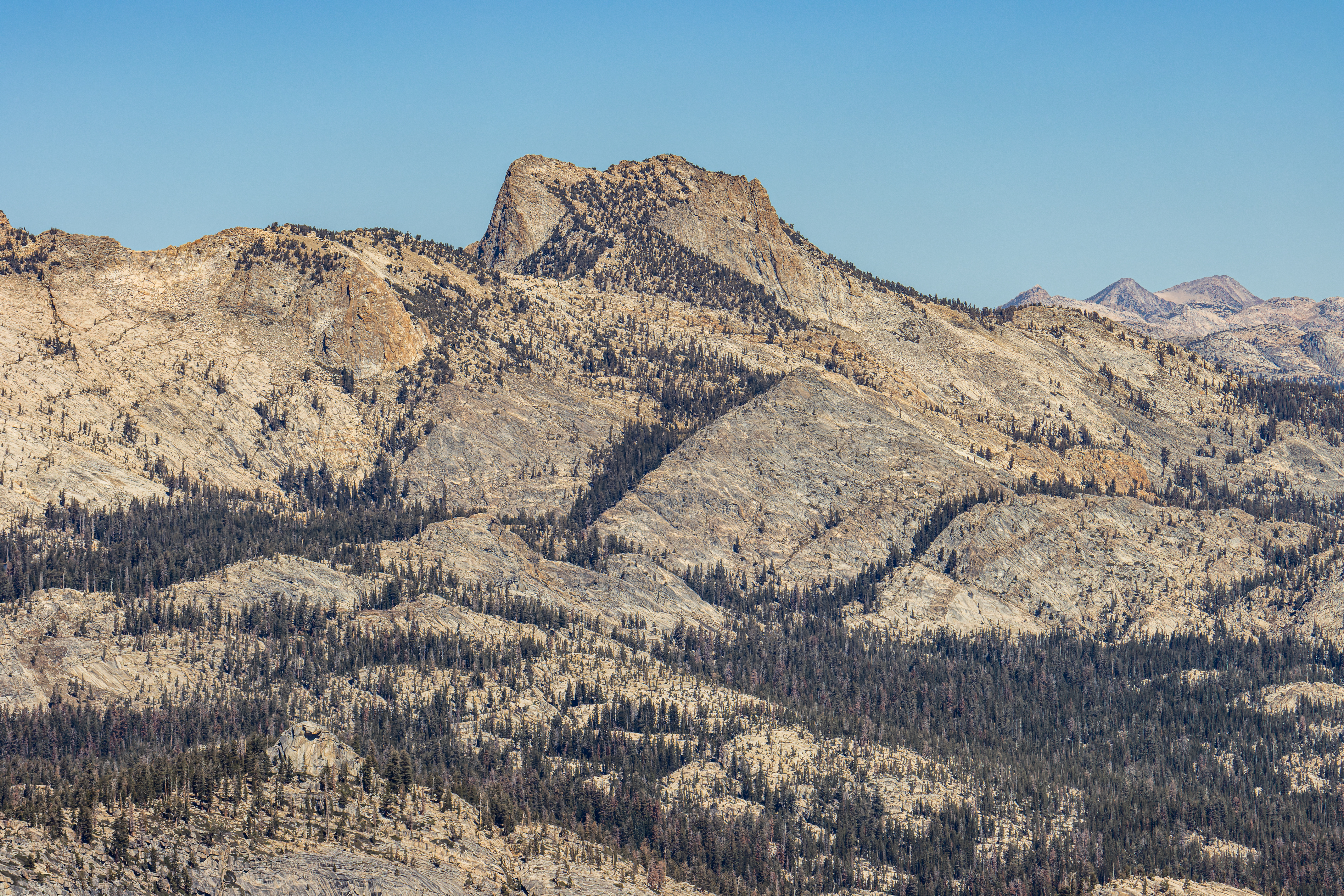
Ten Lakes Trailhead:
I did not hike
yet this trail so I can’t provide a lot more information on top of what you can
look online. This is 13 miles out and back hike to the Ten Lakes area. From here
you can also see the impressive views to the peaks across the Grand Canyon of
the Tuolumne.
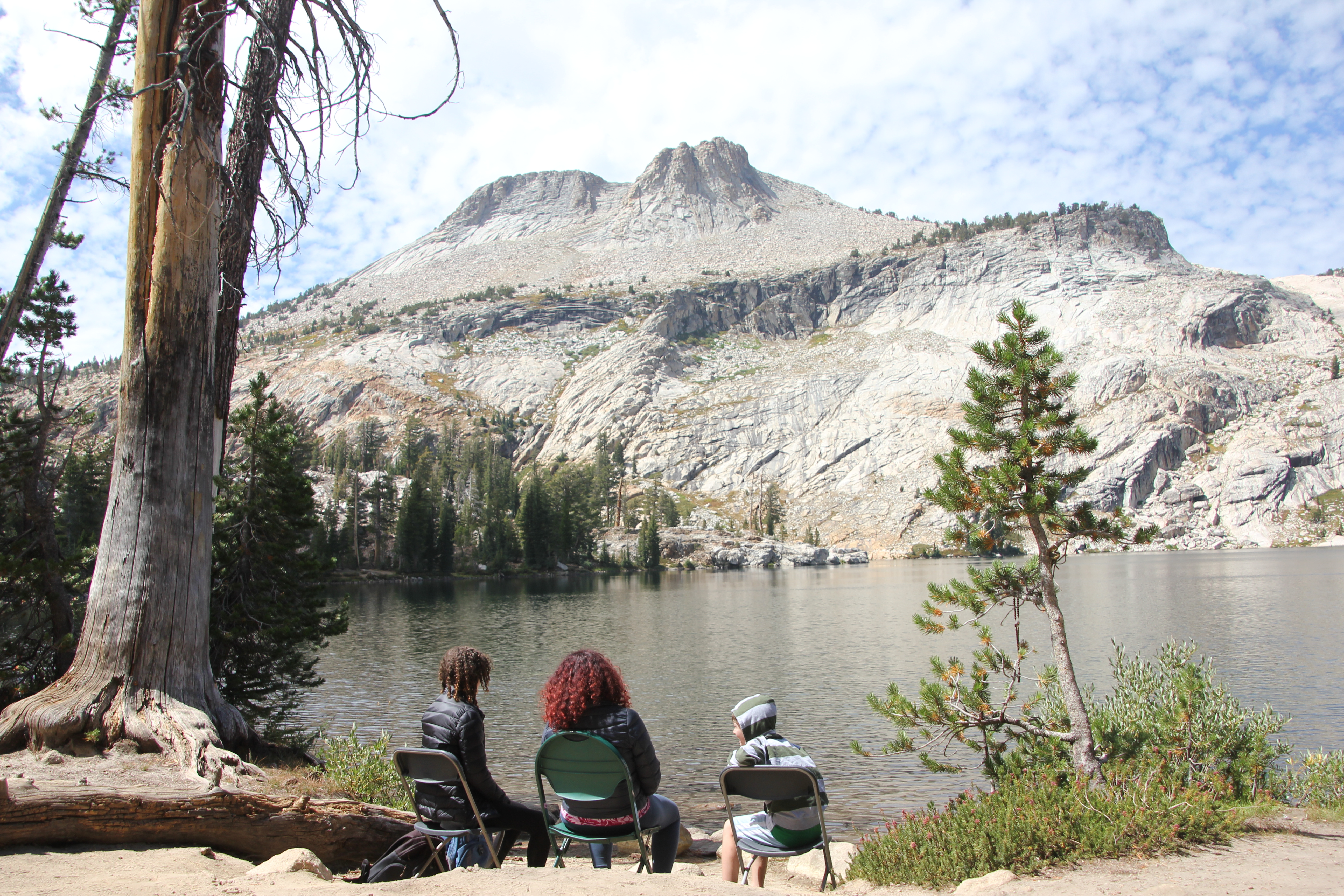
May Lake Hike:
This is
relatively short 2.5 miles out and back hike to May Lake from the end of the
road trail head, here you will climb 470 ft to the beautiful May Lake nesting
on the foots of the impressive Mount Hoffmann (10,845 feet).
Link to my Blog
about this hike


Olmstead Point:
This point can be easily accessed by car as it right on Tioga Pass Road and offers unforgettable views of Clouds Rest, Half Dome and the Tenaya Canyon.

I consider
this as a “must stop” location on your Tioga Pass drive, no matter how many
times I was here I always stop to see this amazing view.
If you look
east from this location, you can also see the granite domes above Tenaya Lake,
once you drive east there are pull-out roadside spots to better see the large lake
below.

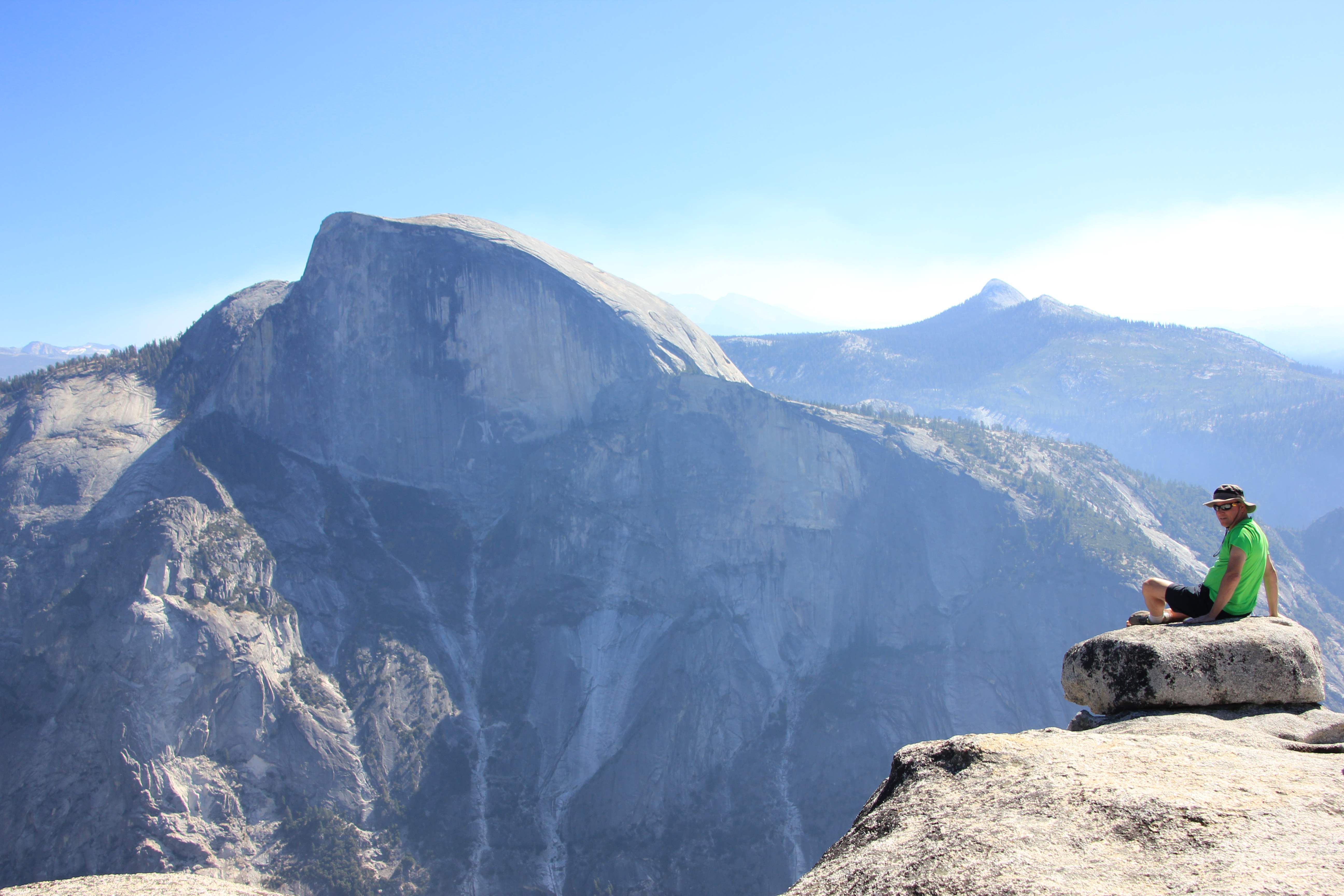
Cloud Rest Hike:
Cloud Rest is
probably one of Yosemite's best 360-degree panoramic views in the park and as a
bonus, a unique, from above, view of Half Dome.

There are few
trails that reach this mountain top location, and, in this blog, I will
describe the “easiest” and shortest popular option, Starting from Tenaya Lake
in Tioga Pass. This is 13 miles out and back with 3,100 ft elevation gain where
the mountain top is at elevation of 9,926 feet (3025m).

I consider this trial to be a challenging hike; Including 30 minutes rest at the top it took me
total of 5:45 hours. I’m relatively fast hiker (av 3 miles/hr) please plan at
list 7-8 hours for more relax hiking.
Link to my Blog about this hike
Tenaya Lake:
One of the
standout attractions along the road is Tenaya Lake.


Tenaya Lake is the
largest and probably the most spectacular lake in Yosemite located just along
Tioga Pass Road. It is the perfect location for a break in your day trip, enjoy
the view and you may even go for a swim in the lake cold water.
Link to my Blog
about this lake


Tuolumne Meadows:
At elevation of 8,600 feet above sea level, nearly two miles long, with the Tuolumne River winding gently through it and a variety of picturesque granite peaks and domes surrounding it.


The Tuolumne Meadows is one of Yosemite gems and most visited
destination. You will drive here through Tioga pass that is a destination by itself
and provides many viewing spots, hiking trailheads as well as providing access
to Yosemite Park from the east.
Link to my Blog
about this hike
Cathedral Lakes Hike:
I did not hike
yet this trail so I can’t provide a lot more information on top of what you can
look online.
This is one of
the popular hikes in this area, climbing from the Tuolumne Meadows to Upper and
lower Cathedral Lakes. You can do this hike as out and back or a more longer
loop option.


Lembert Dome Hike:
Lembert Dome is
one of the most impressive large granite mountains that is located at the east
side of the Tuolumne Meadows, just above the Tioga Road. This 3.7-mile loop
trail features stunning panoramic views looking west across Tuolumne Meadows. Plan
for 3 hours to enjoy this hike.

Although the trail
involves some climbing and exposed rock section the Lembert Dome Trail is one
of the least strenuous ways to enjoy the panoramic view of this area of the
park.
Link to my Blog
about this hike

Yosemite Entrance Gate (East) -
Tioga Pass:
This is where
highway 120 enter Yosemite National Park.
Nothing specifically
interesting here except maybe to take a picture of the park entrance. This is the
highest point on this road, almost at 10,000 feet.
Keep with your drive
in/out the park and enjoy the view from the road.


Tioga Lake & Ellery Lake
Campgrounds
Located just off
Highway 120 (Tioga Road) and only 1 mile east of Yosemite National Park east entrance.
This can be an excellent option for camping if you can’t find campground in Tuolumne
Meadows All campsites
at Tioga Lake Campground are first-come, first-served.
Check for more
information:
https://www.fs.usda.gov/recarea/inyo/recarea/?recid=20606
https://www.fs.usda.gov/recarea/inyo/recarea/?recid=20614

Saddlebag Lake:
Located at the
end of 2.5-mile sideroad turning from Tioga pass will take you to this lake (10,000
feet elevation), you can find here few campsites and from here you can hike
into the Hoover Wilderness.
https://www.fs.usda.gov/recarea/inyo/recarea/?recid=20612
Tioga Pass Road Valley View
The best views
are from the south side of Tioga Pass Road, this will be on your right when you
are driving east to west.

There are few
wide road pullouts just after you are passing Ellery Lake dam, here the road
bend sharply to the left and start to descend, there you can find safe offload parking. The views down the steep creek below and the high mountain slopes on
the other side are impressing.
It looks like
real engineering marvel to build and maintain this road section.
This section of
road was first built in 1899-1905 and it is long steep drive all the way down
to highway 395. Drive slowly and with a low gear.

Lee Vining:
Located at the
start/end of highway 120 and Tioga Road is the small town of Lee Vining, Mono
County. It is located on highway 395, 21 miles south of Bridgeport and 30 miles
north of Mammoth Lakes, at an elevation of 6781 feet. Lee Vining is located on
the southwest shore of Mono Lake.
It a perfect
place for your road trip refreshing stop, fill up gas, eat, or even stay for
the night.
On top of the
many restaurants available here there is also several Gas stations and large groceries
tor.
This is not
only the eastern gateway to Yosemite National Park (12 miles to east of
Yosemite entrance; 69 miles from Yosemite Valley) but also there are many
things to do nearby.
I wrote many
blogs about this section of the eastern Sierra and highway 395, few links are:
Mono lake - South Tufa Area
Mono lake - Rattlesnake Gulch
Bodie State Historic Park
June Lake Loop
Mammoth Lakes

Mono Lake:
Mono Lake is a
saline soda lake covering about 65 square miles in Mono County, California,
formed at least 1 million years ago, the lack of an outlet causes high levels
of salts to accumulate in the lake which make its water alkaline.
The lake is famous
for its unique tufa towers, calcium-carbonate spires and knobs formed by
interaction of freshwater springs and alkaline lake water.
When the city
of Los Angeles diverted water from the surrounding freshwater streams, it dramatically
lowered the lake level. The Mono Lake Committee formed in response and won a
legal battle that keeps lake level.

Summery:
I hope that the
information in this blog will help you to plan your Tioga Pass drive and enjoy
the stay in this amazing part of California and Yosemite National Park.
Additional Pictures:


Comments
Post a Comment