
Introduction:
What? : The view from Glacier
Point is one of the most rewording view you will see in Yosemite NP, this trail
will lead you from the valley floor to the Glacier Point located at the top of
the cliffs above.
The beauty of
this trail is not only because of the rewording view from the top of the
mountain but in addition, once you climb above the valley floor tree level you
get to see amazing view of Yosemite Falls on the other side of the valley. If
that is not enough, the view from this trail to the west is breathtaking, the
Yosemite Valley opening with El Capitan on one side and Cathedral Rocks on the
other.
This is stenose
hike, out and back (assume you are not using shuttle), and unlike it name it is
almost 5 miles long one way with 3,700 ft elevation gain.


Important note: Glacier Point
Road is close to any traffic during 2022, will be open at late spring of 2023.


Where? : The Four Mile
Trailhead is located on the right side of main valley road, after Sentinel
Beach and before Swinging Bridge Picnic Area.
If the roadside
parking is full (in the locations, you can park the car) you can park near Swinging
Bridge and hike back to the trailhead.
Google Map Link


When? : Spring, Summer
up to late Fall.
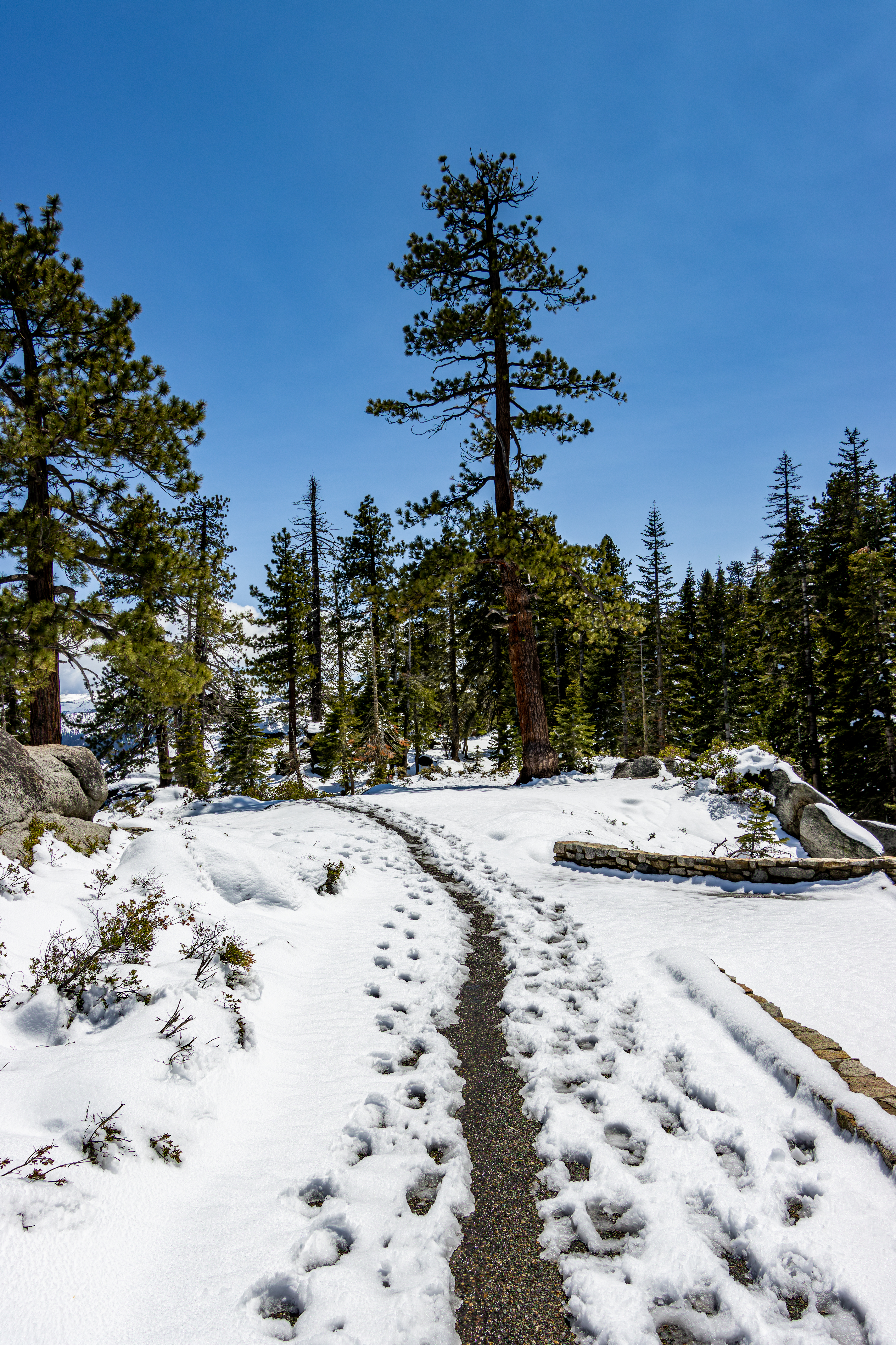
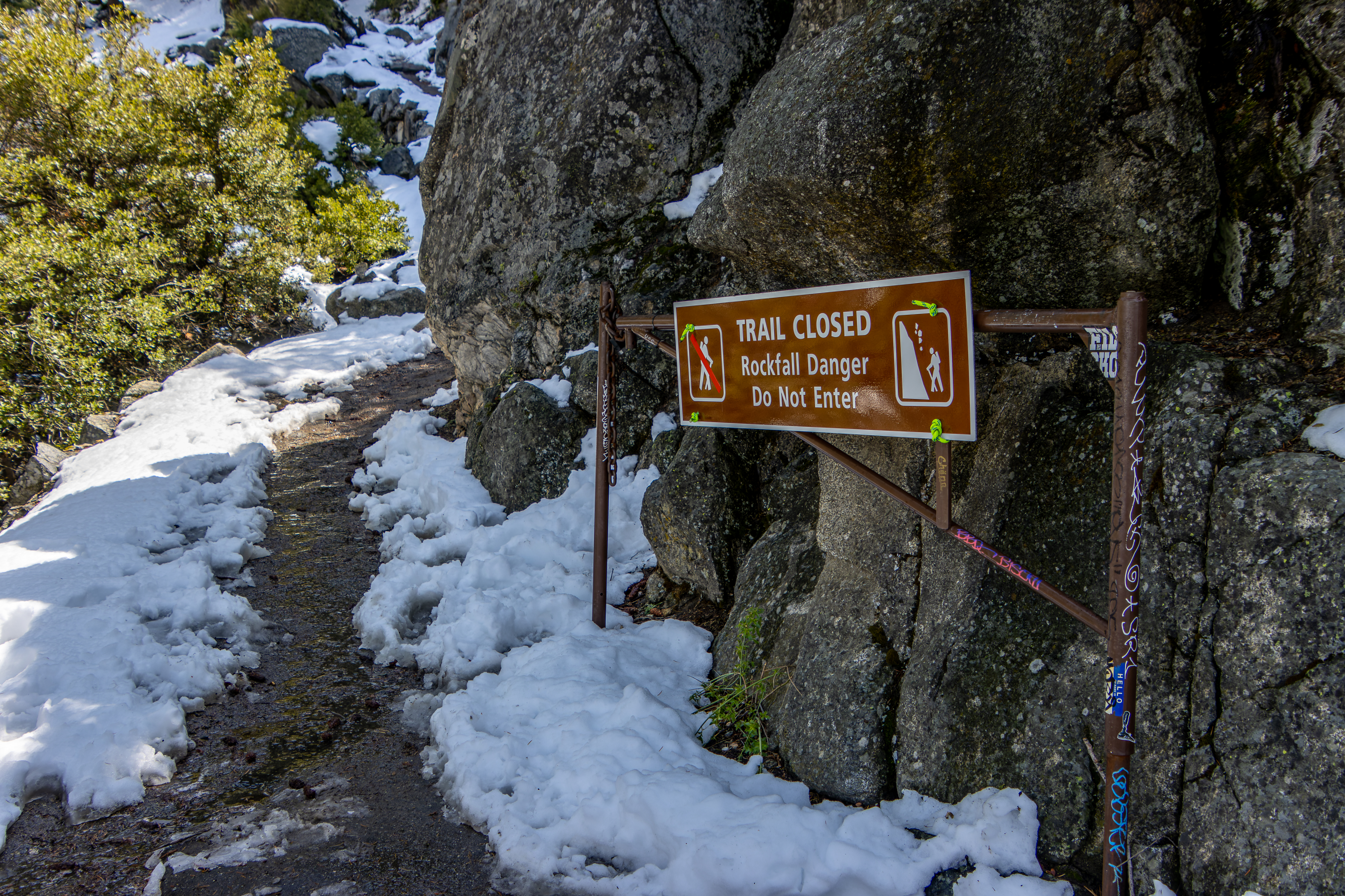
In the winter
the Four Mile Trail is closed.
You can have snowstorm
late spring when the trail is open, at that trail condition it is highly recommended
to have snow/ice grips to your shoes. You may encounter challenging deep snow cliff-hanging
sections in the upper trail, hopefully someone open the trail for you. You can
find a close gate, check at the visitor center for trail conditions.

The best timing
to view Yosemite Falls from this trail is during spring month when the snow is melting.
Late summer month
the Yosemite Falls is almost dry and may have smoke from wildfires in the Sierra
and the park, the smoke tends to accumulate in the valleys.
Late fall this
trail provide the nice fall colors view in the valley below.


Due note 1: For 2022 summer Glacier Point Road is close to car aces but there is no limitation for hiking to this location.
Due note 2: Glacier Point
Road is close to car aces during winter months, check at the below web site for
road conditions.
Link to parkroad information
Due note 3: Plan your
hiking time that may vary according to your fitness level. It will take you
3-5 hours to hike up to Glacier Point and 2-3 hours to walk down.
Due note 4: This trail is very
popular and usually crowded, you will see indication of the load according to
the number of parked cars at the trailhead.

Due note 5: One way
option: in years when the shuttle bus is in service you can take the early morning
shuttle to Glacier Point, enjoy Half Dome view, and then hike the 5-mile-long trail
down to the valley floor.
Due note 6: Restrooms: You
have restrooms at the Swinging Bridge parking lot and when Glacier point is
open you can find restrooms in the upper parking lot.
Due note 7: There are few drinking
water sources along the trail, but you probably want to filter them before
drinking them.
Due note 8: For most of your
hike you will be at the shadow of the mountains above you, this is excellent at
hot summer day but can be cold on chilly early spring day.

Due note 9: You need to understand
that when the road is open Glacier Point is one of the most crowded places in
Yosemite, the view is beautiful even with the crewed.
Due note 10: Near Glacier Point
parking lot there is a gift shop, you can buy here snacks, or water or use the bathrooms.
Due note 11: You may see
Black Bears in Yosemite, but they really be dangerous or aggressive, Bear Spray is illegal to carry in Yosemite (and in California).
Due note 12: Although this
is mostly shaded trail in clear sky sunny days sunscreen is highly recommended.
Due note 13: In early
summer bring mosquitoes repellent with you.
Due note 14: You may have
here a good cell phone coverage.
Due note 15: Dogs are not
allowed on most trails in Yosemite National Park.
My thoughts: I only hiked this
trail once, right after late spring snowstorm and I enjoy it very much.
This is steep hike,
but I found it to be not so difficult, constant grade and good solid trail. The
trail climbs the tall valley cliff with countless number of switchbacks. You
start your hike at the valley floor and soon you find yourself above the trees enjoying
the view of the valley west entrance and the tall Yosemite Waterfalls on the
other side of the valley.
Only once you
will reach the end of the hike, to Glacier Point, you will be able to see and
enjoy the view of Half Dome from the viewing deck.


The Hike:
The Four Mile
Trail was first built in 1872, and you had to pay for it $1. This is the reason
why it is in relatively good shaped, well-built and with relatively consistent manageable
gradient. The trail was modified in the early 1920s, extended to 4.8 miles. Once
you add to this length the short walk to Glacier Point itself and you will get to
5 miles one-way hike.
You will start
the climb almost immediately after leaving the trailhead. At the valley floor you
will pass few large boulders and the stone-made trail start to climb the cliff.


At first you
will walk in a dense forest where the trail switch back and gain more elevation,
once you climbed above the valley pine tree line you will start to get glimpse
of the valley view.


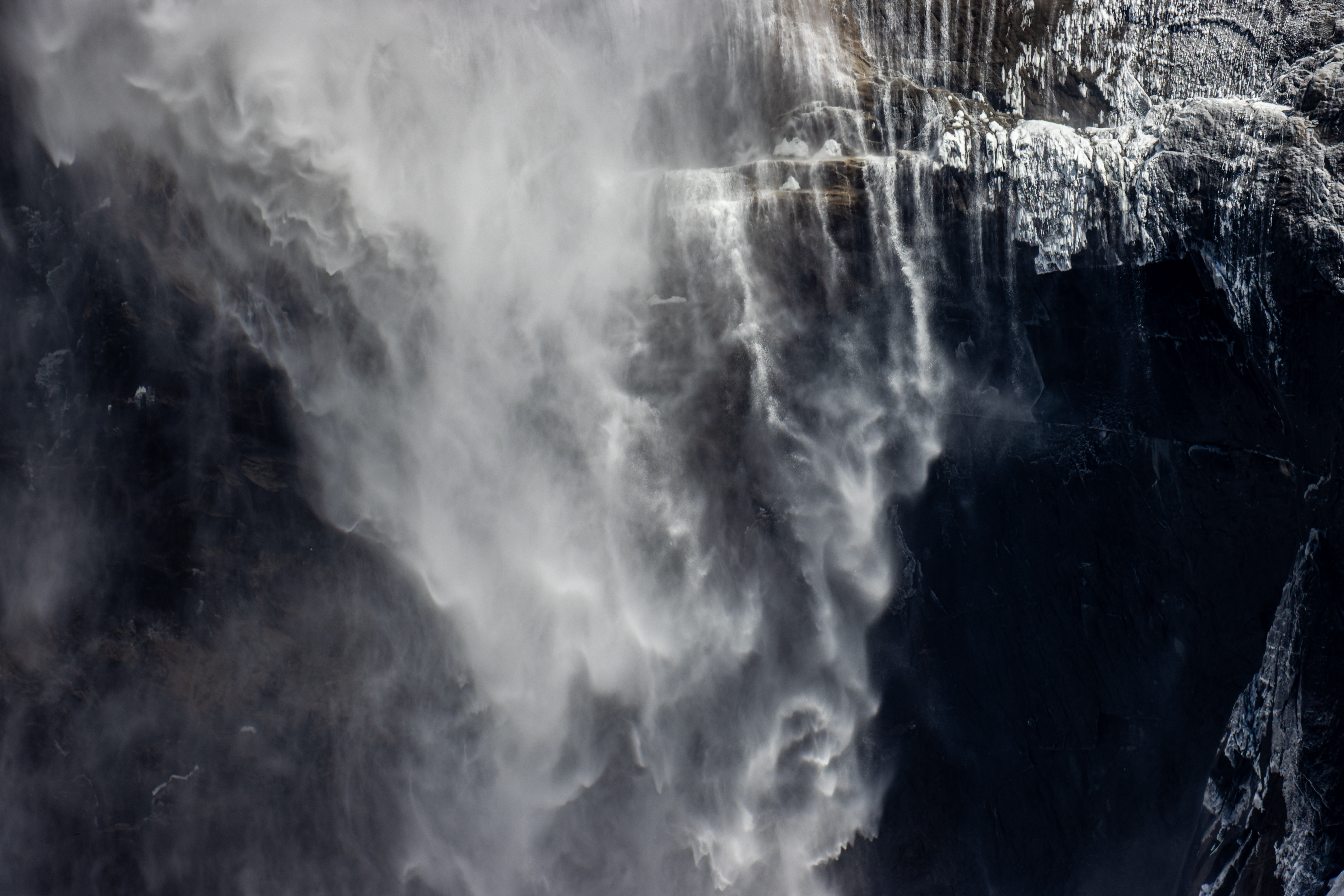
After walking
for about 0.7 miles and gaining 500 ft elevation the trail keeps climbing but moderately
and without switchbacks. In this section of the trail, especially in locations
without trees you will see the amazing Yosemite Falls. From this trail you can actually
see the 3 separate waterfall sections on the other side of the valley,


as you progress
with your hike the view change.
After 1 mile
from the starting point, when Sentinel Rock is towering above you, the trail
cross a small stream with an open section and a good view to the other side of
the valley.
After 1.3 miles
from the starting point, you will start another long series of switchbacks. When
you want/need to take a rest look back to the valley opening (“reverse tunnel
view” to the west), and you will see how the view of El Capitan and Cathedral
Rocks landscape change as you climb and gain more and more elevation.


After 2.9 miles
you will see a trail turning to the right, this side trail will lead you to Union
Point, you can walk there now or on your way down, the view here is nice but
not specially amazing.

The trail relentlessly
keeps climbing up the cliff, but this section is with long gradual switchbacks.
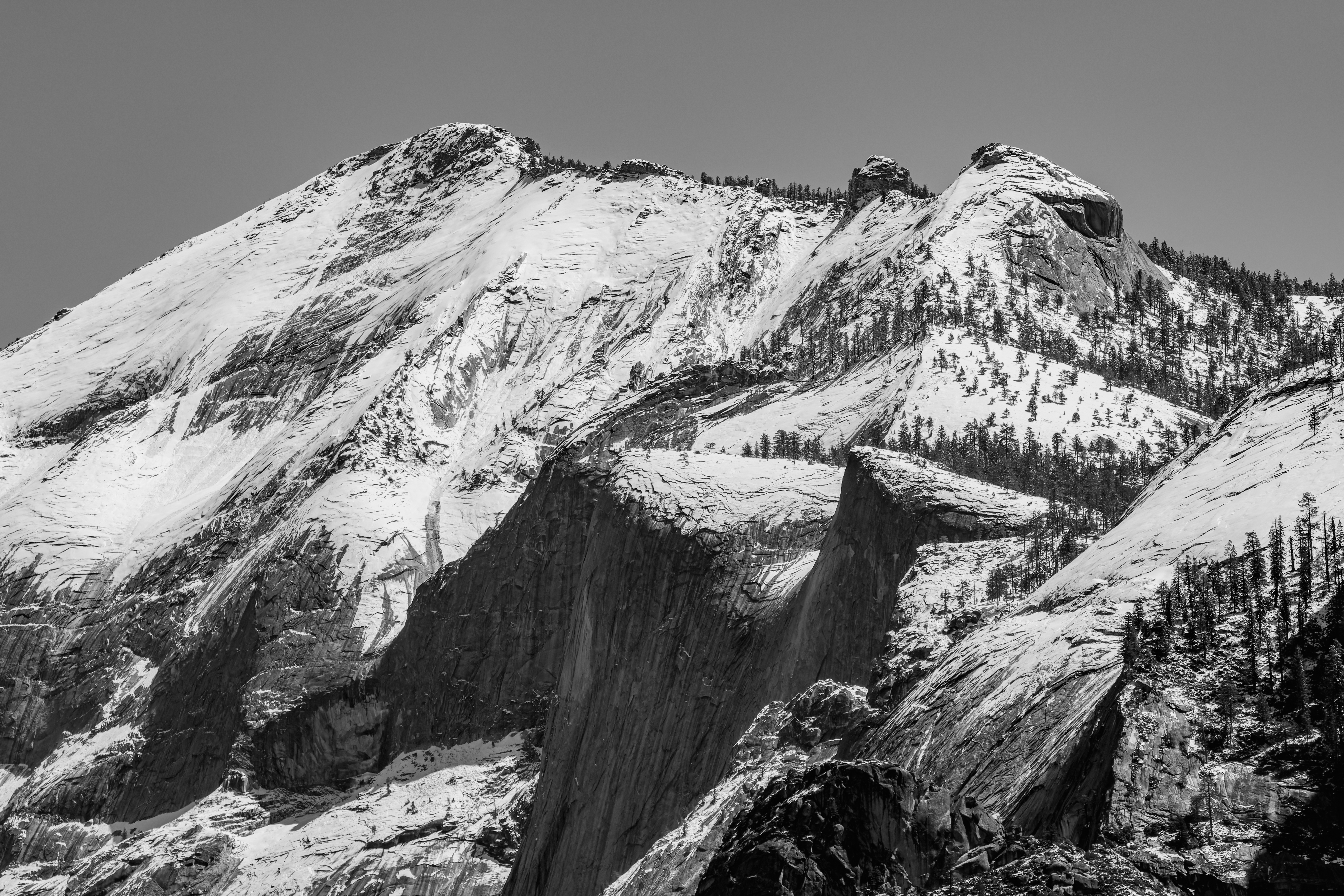
Here the trail climbs up the Sentinel Dome Mountain base, here there are
sections of switchbacks that cut into the cliff wall.
When I hiked
here after major spring storm it was a little challenging to cross this section,
deep snow piles cover the trail completely and the narrow path hanging above
the hundreds of feet cliffs.


At some point
the trail start to bend to the right and you can have the first glimpse of Half
Dome and the Tenaya Valley views.

After almost 4
miles of constant climbing the trail start to level up and get away from the
cliff into pines forest with large trees, additional 0.5 miles of walking will
bring you to Glacier Point Trail.
Turn left and
you will soon reach the Glacier Point cliff viewing platform.
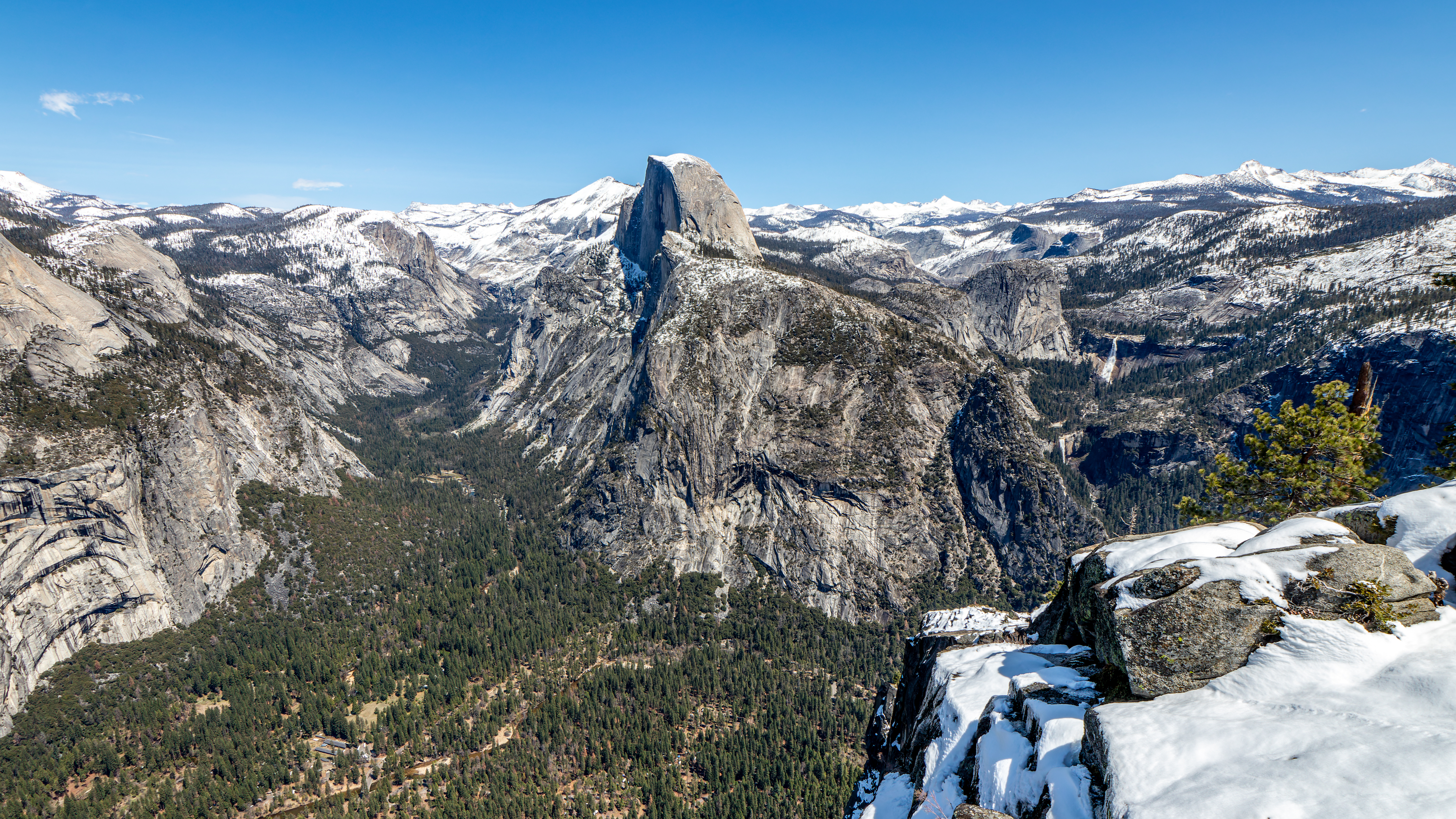
Here you will
be reworded by an amazing view of Half Dome in front of you, the Valley Floor thousands
of feet below you and Yosemite Falls on your right and Merced River canyon and Nevada
Falls down on the left side of Half dome.


If this is your
first time here, I promise you that you will be amaze by this magnificent nature
view, one of the best views in the world.
This is the place
to rest, eat and drink and just enjoy the view.
Now you need to
hike back all the way down to the valley, it will be much easier, and on your
way back you will see the view from a different perspective.
Because this
trail does not have a lot of steps it is relatively easy on your knees going
down.

After 6-9 hours
from the start of your hike, depending on your hiking abilities and how long you
rested at the top you will arrive back to the trail head. You will probably feel
your legs but I’m sure that the views you saw in this hike will stay with you forever.
If you still
want to do some more walking than the Swinging Bridge Picnic Area is not far
away and it always nice to see the Merced River and Yosemite Falls, this time
from below.
More Pictures:


Comments
Post a Comment