
Introduction:
What? :
Nevada State Park located not far from Las Vegas.
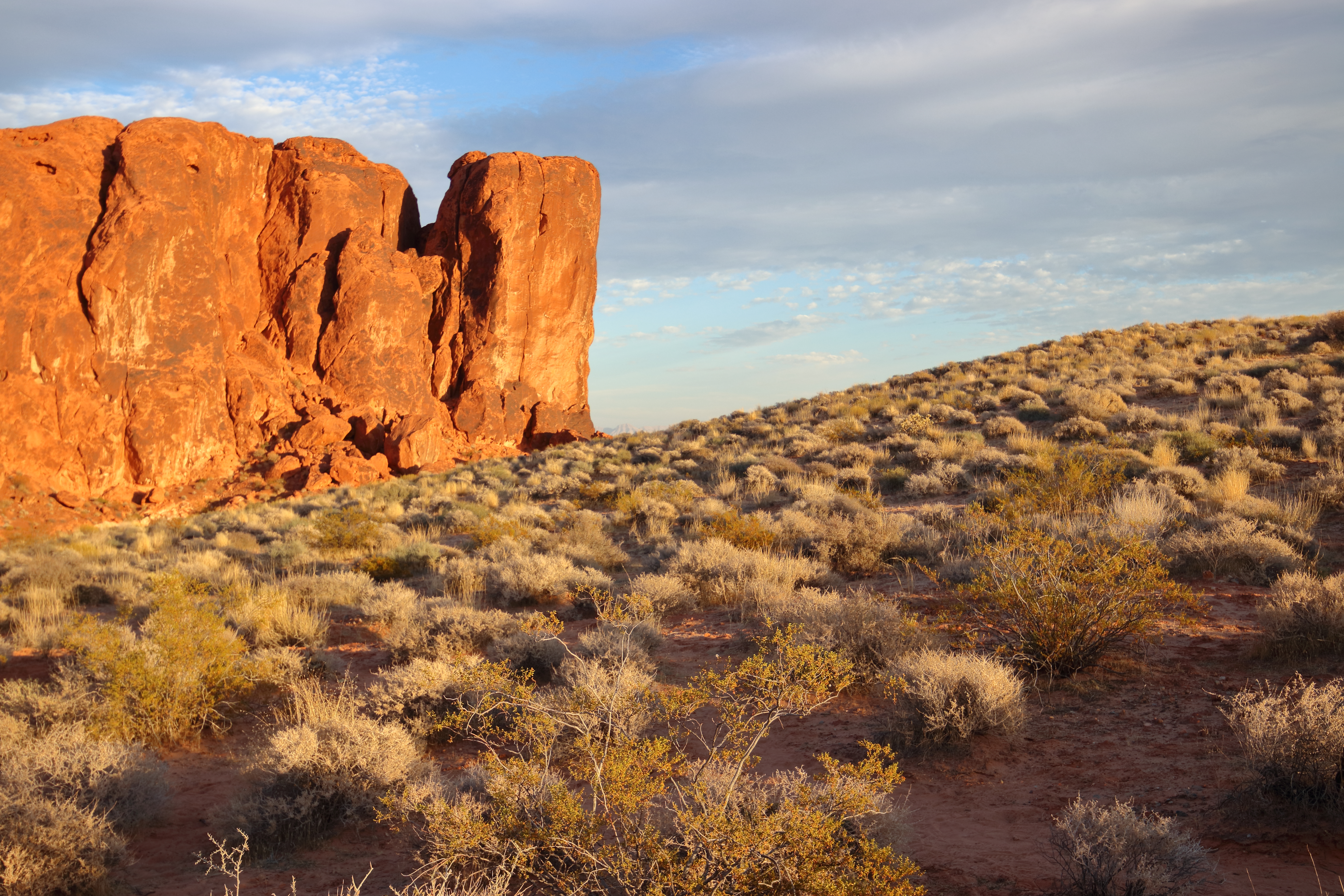
The park offer stunning formations of the Aztec Sandstone, which formed from shifting sand dunes 150 million years ago. The sandstone, with it red and pink colors, fill the landscape in this area creating several unique small hills and rock/boulder formation.You can find several hiking options, exploring the rocks, arches, boulders and unique canyons that are in the park.
You can can visit this park by driving with your car and enjoying the many viewing points along the park roads or combine it with hiking to different rock formation in the park.
It is not a large par, only 4 by 6 mi but it offer a lot to do, see and explore.


Where? :
Valley of Fire is located in the Mojave Desert 50 miles northeast of Las Vegas (about one hour drive), at an elevation between 1,320–3,009 feet. On it east side it is just at the north entrance if Lake Mead National Recreation Area.
Visit in the park can be done as side trip attraction on your way north on highway I-15 or as a day
trip from Las Vegas.
Google Map Link


Related Blogs:
- Red Rock Canyon Nevada
- Red Rock Canyon – Turtlehead Mountain Hike
- Red Rock Canyon – Calico Basin Trail
- Red Rock Canyon – Guardian Angel Gully Passage
- Red Rock Canyon – Calico Hills Loop Hike
- Lake Mead NRA – Goldstrike Hot Springs
- Lake Mead NRA – Hoover Dam South Viewpoint, Off Trail Hike
- Arizona Hot Springs Hike
- Lake Mead National Recreation Area – Visiting Hover Dam
- Lake Mead NRA – Boulder City, NV; Old Train Track Hike
- Lake Mead NRA – Sunset View Scenic Overlook
- Lake Mead NRA – Owl Canyon Hike
- Lake Mead National Recreation Area – Northshore Road
- Lake Mead NRA – Anniversary Borax Mine and Canyon Hike
- Lake Mead NRA – Redstone Area Hike
- Lake Mead NRA – Rogers Spring
Related National Park Blogs:


When? :
As everything else near Las Vegas this is not recommended outdoor destination for a hot summer day,
unless you are planning not to hike so much or to spend here the late afternoons and enjoy the sunset.
Fall, Winter and early spring month has much colder temperatures and are the most recommended season to visit the park.

Due
note 2: Summer month are not only very hot but also has blue sky without colorful sunsets. I recommend visiting this park during cooler months that bring lower temperatures.
Due note 4: This is Nevada State Park you need to pay daily use entree fee per car.
Due Note 5: There is a large population of Desert Bighorn Sheep in the park and I manage to see them during my visits.


My thoughts:
It is not clear how I did not visit this park in the past.
This is probably a must visit park for someone staying in Las Vegas or on the way north to Zion.
The main road, red-colors and rock formation provide many hikes and endless picture opportunities.
I visit this park several time and always discover something new.


The
Visit:
The
park can be very hot during summer, no shade at the hikes so bring a lot of
water to the hikes.
The park access by the main road that cross it from west to east (2 park entrances).

Near the visitor center there is another road that get into the remote section of the park.


When you are driving into the park from the west (I-15) there
is a nice rocky section to explore near Atlatl Rock Campground.
When coming from highway I-15 stop on Beehive parking lot (on your right side) and see the interesting rock formation.

After few hundred feet of driving turn left into the campground loop.
Park here and climb the stairs to the viewing deck, from there you can see the very nice Atlatl Rock, Set of stairs are going up close to the old Native American petroglyphs.

keep doing the drive loop and stop at several interesting point along the short loop.
Look for the following rock formation:
- The small Arch Rock
- Piano Rock
- Lizard Rock Cave
- King Kong Rock
- Fire Cave/Windstone Arch


From here you will drive to the visitor center, this is also where the park main in and out road start.
at the visitor center you can find information about the park and ask for visit/hike recommendation. You can also find here a store with food, drinks and souvenirs.


Trails
and view spots on the main park road:
Petroglyph
Canyon Trail:
A nice 1.5 mile hike into a canyon that has few places of

Fire Canyon / Silica Dome:
This is a short turn right into the road will take you to high vista point.


Fire Wave:
This is probably a must see location at the park.
One mile hike will take you down from the roadside parking to see a nice red and white layered rock formation.

This is probably one of the nicest place in the park, you need to hike back the same way to the parking lot or you can create a loop hike that cross the road and connect to The White Domes Trail.


The White Domes Trail:
At the end of the road parking lot start the loop trail that will take you among large white domes.
The sandy trail will go down into the canyon and from there you can do a loop or go back exploring the high rocks and enjoy the view.


Elephant Rock:
Located at the east side of the park just before the road is exiting the park you can find the Elephant Rock Arch formation just near the road.
A very short hike from the parking lot will take you to the arch.


Valley
of Fire Visitor Center:
http://parks.nv.gov/parks/valley-of-fire
Map:
https://www.hikespeak.com/pdf/VOF-Brochure-09-2014.pdf
Additional Pictures:


Comments
Post a Comment