
Introduction:
What? : Hope Valley is
a mountain valley in Alpine County, California, located on the eastern slope of
the Sierra Nevada east of Carson Pass. This is one of California favorite and
most beautiful fall color destination, at that time, when all the aspen trees that
grow in the valley change their color from green to bright yellow and red.


For a Beautiful Nature Prints - Visit my Etsy Store
Where? : Highway 88 pass through the valley from west
to east and you can drive north to lake Tahoe using highway 89.
Google Map Link

Fall Colors in California - Trip to Eastern Sierra
Susie Lake Hike – Lake Tahoe
Eagle Lake Hike – Lake Tahoe
Emerald Bay State Park – Lake Tahoe
Bear at South Lake Tahoe

When? : Highway 88
road is open year round including winter. The valley is always nice but the best
time to visit here is during the few weeks at fall when the many aspen trees that
grow in the valley change their color from green to bright yellow and red.
Usually, the best
timing for fall color is around mid-October.

Due note 1: Check online
and in social media groups the color conditions to time to peek colors.
Due note 2: there is no
service in the valley, you can dine and sleep in Wylder Hotel Hope Valley at
the east. You can find more places to eat at Alpine Village or at South Lake
Tahoe.
Due note 3: Drive slow and
enjoy the view, because its popularity during fall colors many people drive slowly
and stop on the roadside for taking pictures.
Due note 4: There are many
places you can park/stop off highway 88. Whenever stopping make sure your car
is off the road and you are safe to walk.
Due note 5: In winter its Snowpark
attract cross country skiers, snowshoers, and many snowmobilers (organized from
nearby South Lake Tahoe).


Due note 6: Where to eat: Wylder
Hope Valley is a unique resort located in the east side exit of the valley. The
resort features the only nearby restaurant, when we visit here at fall time it
was too long line for us to get dining table, so we kept driving east to Markleeville
(highway 89) and eat good lunch at Cutthroat Brewing Company.
Due note 7: There are many
available Campground in Hope Valley and the surrounding lakes.
My thoughts: I try to visit
here when I can at fall time, at that time you can see here one of the most
rewording fall color demonstrations.


The visit:
Sitting at an
elevation of just above 7,000 feet and framed by peaks reaching over 10,000
feet high, Hope Valley is known for its wide vistas, fly fishing, fall colors,
and winter activities.
Hope Valley is probably
one of the best fall color road trip destinations in California, but you can
visit here any time of the year (including winter when all is covered with
snow) and you can find many different outdoor activities things to do here.
You will
probably come to this valley from the west on highway 88 or from South Lake
Tahoe (Highway 89).
Driving from the west on highway
88:
Highway 88
winds its way from Jackson west into the Sierra Nevada. As you drive up the
mountains you will pass Kirkwood Mountain Ski Resort on your right and soon
after you will reach to Caples Lake, from here you will be able to see late fall
the aspen trees yellow color. On the far side of the lake you can see the high Melissa
Coray Peak.


Just past
Caples Lake, you will arrive to Carson Pass at 8,652 feet.
Here you have a
car parking for day hiking to the nearby lakes and a wilderness backpacking
entry point.
Immediately after
the pas there are 2 gravel off-road parking with the first view of Hope Valley. From
here you can enjoy the vast view across the valley and see Red Lake just below
you.


Keep driving
and the road gently wind into the valley below.
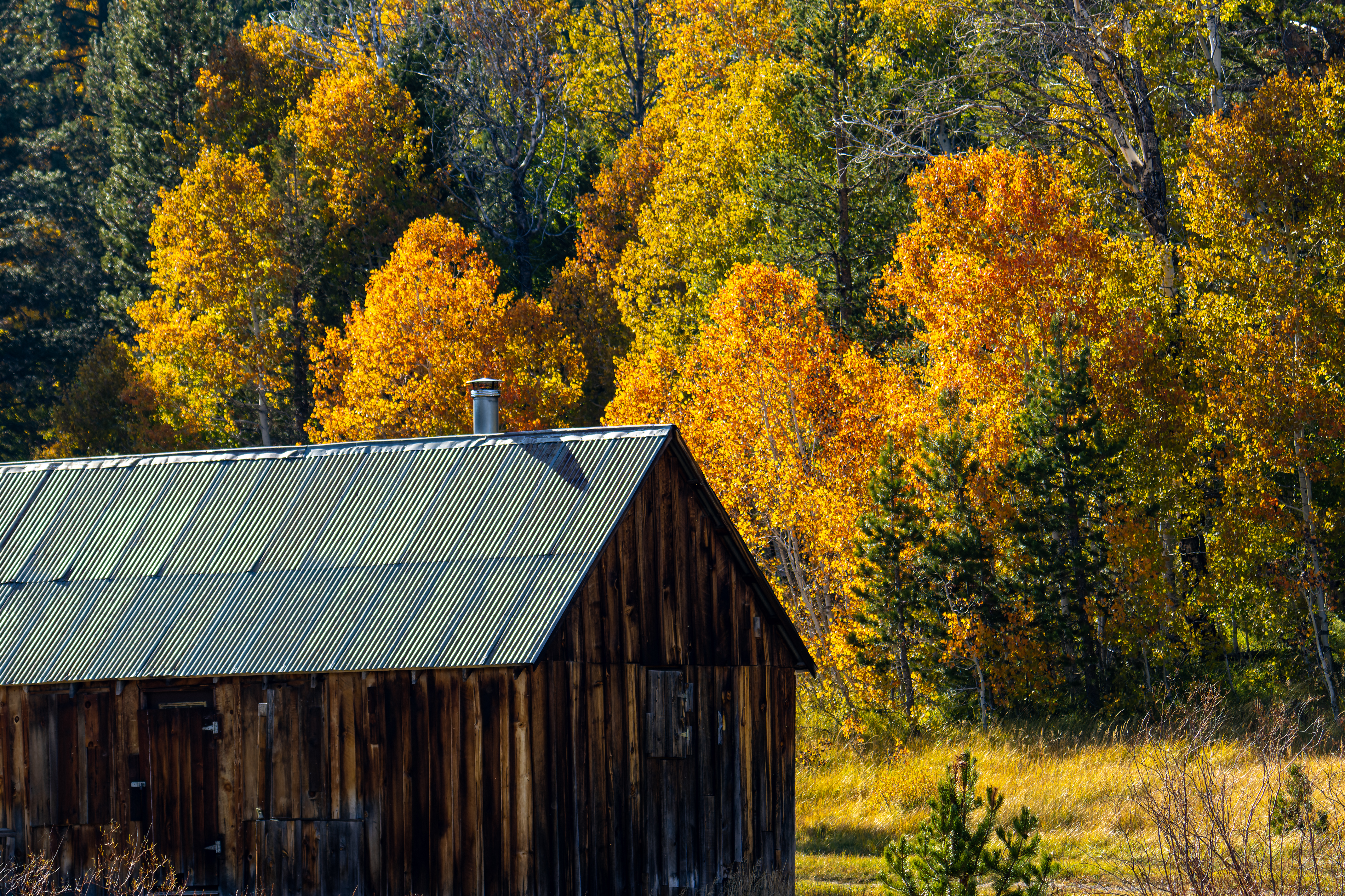
“Famous” wooden cabin:
Exactly 3.5
miles from Carson Pass Information Station parking you will reach to the most
recognize photo location from the valley, old wooden cabin nested between colorful
trees.
You have safe
parking spots on both sides of the highway, drive here slowly and park safely.
This is a
private property so respect it and do not enter, you can see the cabin from the
road, but you need to find the right place to get good picture.
If you are
coming from the east and driving west this location is exactly 5.3 miles from Picketts
Junction (highway 88 and 89).


Driving to the valley from Lake
Tahoe:
In this drive section
you can have a lot of colorful yellow aspen trees on both sides of the road.
soon the road will start to level, and you will reach the valley floor and you
will head to Picketts Junction.

From here I recommend
turning right and explore the valley or you can drive left to nearby Wylder
Hotel Hope Valley.


Road Trip Options:
Hope Valley can
be reach as a day drive from the bay area (~4 hours’ drive) or by a short drive
from South Lake Tahoe.
You can combine
your visit here with a drive to the small Markleeville town. This is a small
place with coffee shop, pub, and restaurants, excellent lunch & rest stop
location. From here you can drive over the high Monitor Pass south to east
Sierra and highway 395 or cross over the Sierra to the west on the narrow
highway 4.
If you are
doing this loop (bay area à highway
88 and Hope Valley à Markleeville à Highway 4 back home) This is a
long day drive but the landscape and the views along the drive worth it.

Most of the
people that visit here stay on the main highway and enjoy the view, but you can
have many outdoor activities here and in the nearby mountains.
The West Carson
River gently crosses the valley grassy plains and is a good destination for fly-fishing.
Crater Lake:
Find the
trailhead 2.2 miles east of Red Lake exit or if you are coming from the east
this is 1.9 miles west of the Blue Lakes Road turnoff.

The trail is
actually a 4x4 road that leads up to the slopes of Stevens Peak. The 2.5-mile challenging
drive/hike climbs from 7,400 feet to 8,650 feet as it winds back and forth up
the mountain side.
Crater Lake is
nestled in a pocket part way up the slope between Red Lake Peak and Stevens
Peak.
It was a fun
drive and the view of the small lake, and the valley below is rewording.


Do not tempt
driving here with AWD car, you need a “real” 4x4 to drive over the few rocky
steep sections.

Scotts Lake:
I did not visit
this location, but it looks like a fun place to drive to.
Driving the Blue Lake Road:
The drive starts
where the Hope Valley Sno-Park is located.
A good road
will lead you into the mountains following the West Fork Carson River. After 11.5
miles of fun driving, you will reach Lower Blue Lake dam.


You can enjoy Lower
and Upper Blue Lakes and also visit the side unpaved road (no need for 4x4 when
it is dry conditions) that lead to the not so far Tamarack Lake. After this
lake You can keep driving to the direction of Wet Meadows Reservoir Trailhead
and explore this vast outdoor national forest and wilderness area.


During my visit
I did not have the time to explore all off-road driving options in this area, but
it looks like that from Lower Blue Lake you can pass Twin Lake and drive all
the way to Meadow Lake, Markleeville.
Emerald Bay State Park – Lake Tahoe
Bear at South Lake Tahoe

When? : Highway 88
road is open year round including winter. The valley is always nice but the best
time to visit here is during the few weeks at fall when the many aspen trees that
grow in the valley change their color from green to bright yellow and red.
Usually, the best
timing for fall color is around mid-October.


Note: Pictures in this blog where taken during my many visits in this place.
Due note 1: Check online
and in social media groups the color conditions to time to peek colors.
Due note 2: there is no
service in the valley, you can dine and sleep in Wylder Hotel Hope Valley at
the east. You can find more places to eat at Alpine Village or at South Lake
Tahoe.
Due note 3: Drive slow and
enjoy the view, because its popularity during fall colors many people drive slowly
and stop on the roadside for taking pictures.

Due note 4: There are many
places you can park/stop off highway 88. Whenever stopping make sure your car
is off the road and you are safe to walk.
Due note 5: In winter its Snowpark
attract cross country skiers, snowshoers, and many snowmobilers (organized from
nearby South Lake Tahoe).


Due note 6: Where to eat: Wylder
Hope Valley is a unique resort located in the east side exit of the valley. The
resort features the only nearby restaurant, when we visit here at fall time it
was too long line for us to get dining table, so we kept driving east to Markleeville
(highway 89) and eat good lunch at Cutthroat Brewing Company.

Due note 7: There are many
available Campground in Hope Valley and the surrounding lakes.

My thoughts: I try to visit
here when I can at fall time, at that time you can see here one of the most
rewording fall color demonstrations.


The visit:
Sitting at an
elevation of just above 7,000 feet and framed by peaks reaching over 10,000
feet high, Hope Valley is known for its wide vistas, fly fishing, fall colors,
and winter activities.
Hope Valley is probably
one of the best fall color road trip destinations in California, but you can
visit here any time of the year (including winter when all is covered with
snow) and you can find many different outdoor activities things to do here.
You will
probably come to this valley from the west on highway 88 or from South Lake
Tahoe (Highway 89).

Driving from the west on highway
88:
Highway 88
winds its way from Jackson west into the Sierra Nevada. As you drive up the
mountains you will pass Kirkwood Mountain Ski Resort on your right and soon
after you will reach to Caples Lake, from here you will be able to see late fall
the aspen trees yellow color. On the far side of the lake you can see the high Melissa
Coray Peak.


Just past
Caples Lake, you will arrive to Carson Pass at 8,652 feet.
Here you have a
car parking for day hiking to the nearby lakes and a wilderness backpacking
entry point.
Immediately after
the pas there are 2 gravel off-road parking with the first view of Hope Valley. From
here you can enjoy the vast view across the valley and see Red Lake just below
you.


Keep driving
and the road gently wind into the valley below.

“Famous” wooden cabin:
Exactly 3.5
miles from Carson Pass Information Station parking you will reach to the most
recognize photo location from the valley, old wooden cabin nested between colorful
trees.
You have safe
parking spots on both sides of the highway, drive here slowly and park safely.
This is a
private property so respect it and do not enter, you can see the cabin from the
road, but you need to find the right place to get good picture.
If you are
coming from the east and driving west this location is exactly 5.3 miles from Picketts
Junction (highway 88 and 89).
For google map location of this cabine follow this link: location


Driving to the valley from Lake
Tahoe:
If you are coming from South Lake Tahoe, you will pass Grass Lake meadows and after Luther Pass you will gradually start to descend into Hope Valley.

In this drive section
you can have a lot of colorful yellow aspen trees on both sides of the road.
soon the road will start to level, and you will reach the valley floor and you
will head to Picketts Junction.

From here I recommend
turning right and explore the valley or you can drive left to nearby Wylder
Hotel Hope Valley.


Road Trip Options:
Hope Valley can
be reach as a day drive from the bay area (~4 hours’ drive) or by a short drive
from South Lake Tahoe.
You can combine
your visit here with a drive to the small Markleeville town. This is a small
place with coffee shop, pub, and restaurants, excellent lunch & rest stop
location. From here you can drive over the high Monitor Pass south to east
Sierra and highway 395 or cross over the Sierra to the west on the narrow
highway 4.
If you are
doing this loop (bay area à highway
88 and Hope Valley à Markleeville à Highway 4 back home) This is a
long day drive but the landscape and the views along the drive worth it.


Most of the
people that visit here stay on the main highway and enjoy the view, but you can
have many outdoor activities here and in the nearby mountains.
The West Carson
River gently crosses the valley grassy plains and is a good destination for fly-fishing.
Crater Lake:
Find the
trailhead 2.2 miles east of Red Lake exit or if you are coming from the east
this is 1.9 miles west of the Blue Lakes Road turnoff.

The trail is
actually a 4x4 road that leads up to the slopes of Stevens Peak. The 2.5-mile challenging
drive/hike climbs from 7,400 feet to 8,650 feet as it winds back and forth up
the mountain side.
Crater Lake is
nestled in a pocket part way up the slope between Red Lake Peak and Stevens
Peak.
It was a fun
drive and the view of the small lake, and the valley below is rewording.


Do not tempt
driving here with AWD car, you need a “real” 4x4 to drive over the few rocky
steep sections.

Scotts Lake:
I did not visit
this location, but it looks like a fun place to drive to.
Driving the Blue Lake Road:
The drive starts
where the Hope Valley Sno-Park is located.
A good road
will lead you into the mountains following the West Fork Carson River. After 11.5
miles of fun driving, you will reach Lower Blue Lake dam.


You can enjoy Lower
and Upper Blue Lakes and also visit the side unpaved road (no need for 4x4 when
it is dry conditions) that lead to the not so far Tamarack Lake. After this
lake You can keep driving to the direction of Wet Meadows Reservoir Trailhead
and explore this vast outdoor national forest and wilderness area.


During my visit
I did not have the time to explore all off-road driving options in this area, but
it looks like that from Lower Blue Lake you can pass Twin Lake and drive all
the way to Meadow Lake, Markleeville.
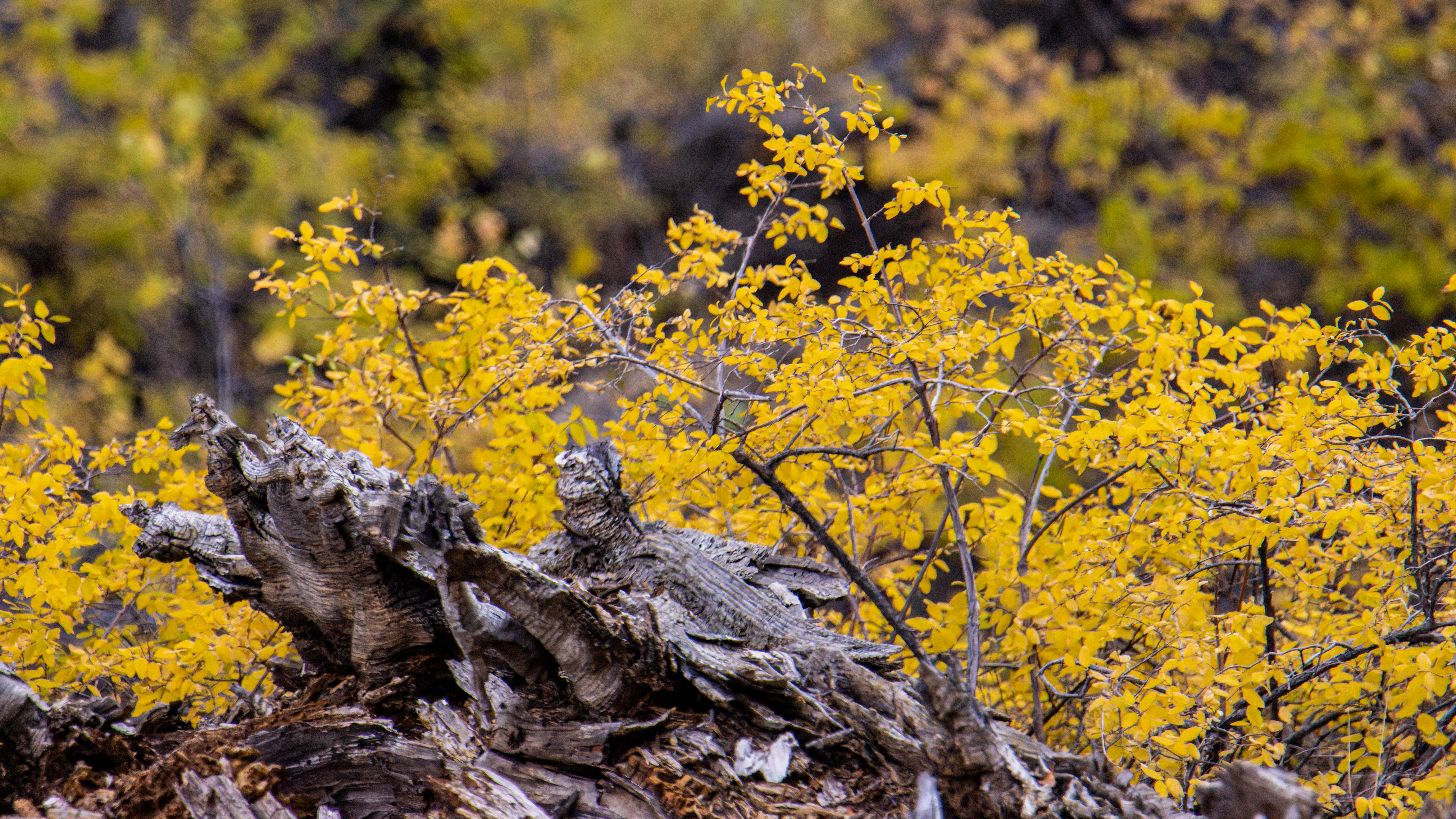
Additional Pictures:


Comments
Post a Comment