
Introduction: Day 1
What? : This Blog part of a 4 days, 60 miles, backpacking hike in the Hoover and Yosemite
Wilderness, 2022.
My friend and I start our eastern Sierra loop hike from Twin Lake near Bridgeport (highway 395), from there we went up the mountains into Hoover Wilderness in the direction of Yosemite National Park. We hiked on some sections of the PCT and after 3 days we finished our loop hiking back down to our starting point.


For a Beautiful Nature Prints - Visit my Etsy Store
Where? : The Robinson
Creek / Barney Lake Trailhead is located at Twin Lake near Bridgeport
California (east Sierra highway 395).
Trailhead - Google Map Link

When? : Late Spring,
Summer, and early fall.
Early spring
can be challenging with snow covered trails.
Late summer, as
anywhere in the Sierra, you can have smoke or even closures from fires. There
is no problem of water availability along this hike. We hiked here late dray year
(2022) and we can find water in many places along the hike.

Due note 1:
You need Hoover
wilderness permit for this hike; the permit is also good for the Yosemite NP
sections.
https://www.fs.usda.gov/recarea/inyo/recarea/?recid=21879
https://www.fs.usda.gov/Internet/FSE_DOCUMENTS/fseprd904026.pdf
Due note 2:
This is a bear
country, so food need to be carried in bear-resistant container.
Due note 3:
Follow wilderness regulations and do not leave trace. Do not camp within 100 feet of any lake shore, stream, or trail. Do not leave toilet papers please pack them out with you (Ziplock plastic bag).


Day 1
8.3 miles, Total Ascent 277 ft
climbing, 6hr
Robinson Creek / Barney Lake Trailhead
to Peeler Lake


We started the
day early in the morning, driving from San Francisco Bay area east, taking the
108 road and crossing the Sierra in Sonora pass (10,000 ft high).
I like driving
highway 108, winding up the Sierra trough a deep river gorge and alpine valleys,
it is also good place to enjoy fall colors, many Aspen groves along the road
and in the fall they all turned yellow (early Sep. it is too early for fall
colors).
When climbing
the Sierra, the heavy smoke covers the mountains and limit the visibility, this
was not promising for our hike.
After crossing
Sonora pass the road wind sharply down to the east side of the Sierra and soon
after you reach highway 395, turn right and after additional 20 minutes’ drive
you reach the small town of Bridgeport.
As you get into
town, right after the first gas station there is a small road turning right.
Take the Twin Lakes Road, after 15 minutes’ drive you will pass the 2 large lakes
on your left and at the end of the road you will get into Annett's Mono Village.
Pay 15$ at the
entrance so you can park your car at the lake parking lot, you can also park on
the road before the Village gate for free…
We parked our
car, took our backpack, and started our hike, we start to walk to Robinson
Creek / Barney Lake Trailhead.
Keep walking through
the RV park, head right, pass the large meadow and find the main trail. Soon
you will see the end of the private property sign and you will walk into the
Hoover wilderness.


At its first
short section the trail is passing through a large pine trees forest and after short
hike you will walk into open landscape, cover with low bushes section. Here you
can see the ragged mountain peaks towering above on both sides of the large valley.


When we started
to walk around 11am the smoke still covers the high elevation mountains,
limiting visibility, but as time pass the wind start to peek up and clouds start
to move in.
After the trail
open section, the trail turns right (3 miles from starting point) and start to
climb through a large Aspen grove.
I do not know
why but many people do not respect nature and carve their names on the tree
trunks ☹
It is probably
beautiful to visit here later the year during fall color season where all the
aspens are changing color to yellow and orange.

The long
switchback climbs the right side of the valley, after 1 mile you are done with
the steep section and after additional 0.3 mile, we reached the first lake on
our trip, Barney Lake.
This is 4.25
miles from the starting point and 1,100 ft of climbing.
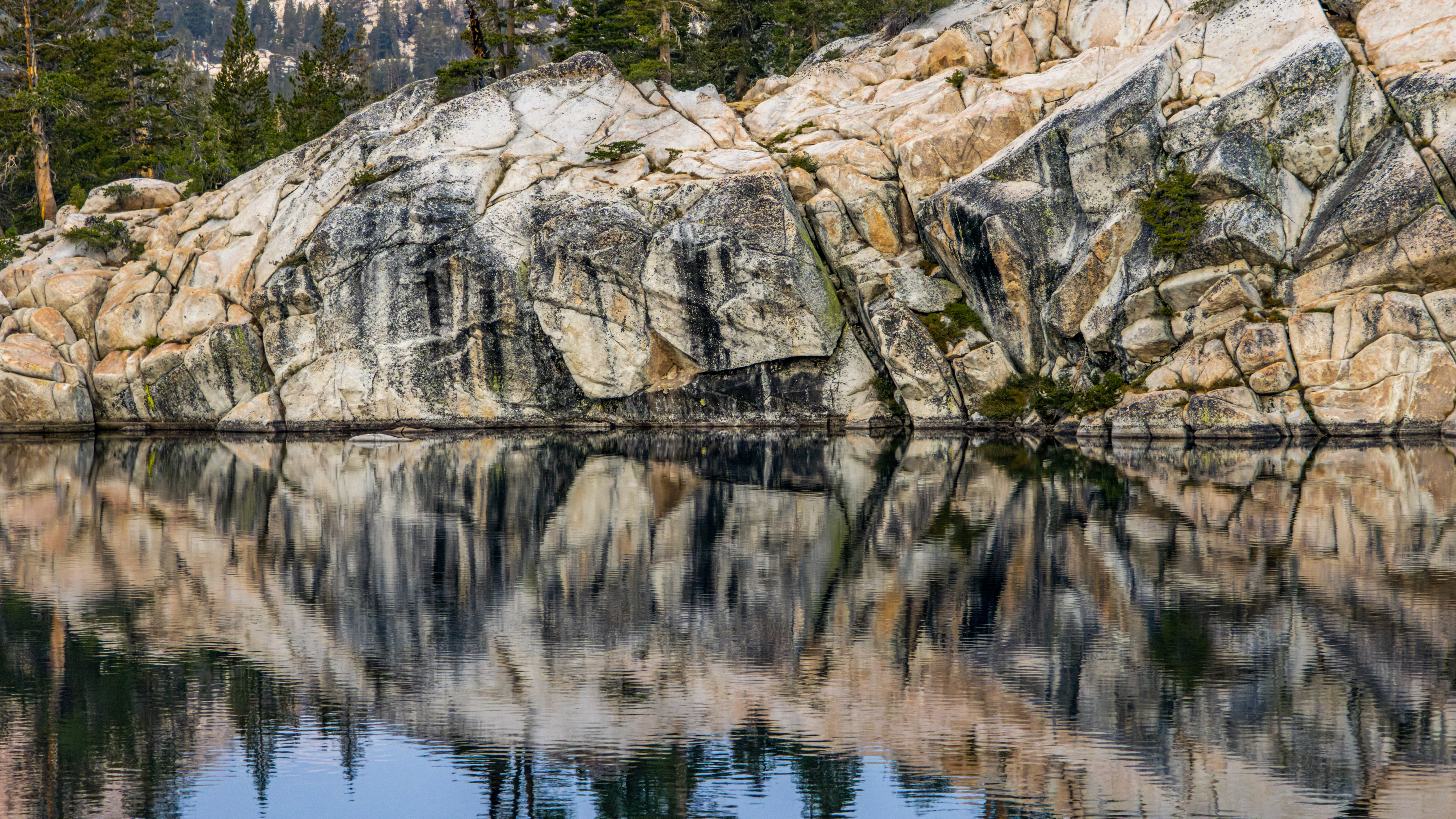
We took a short
break here; the lake view is very nice. It is nested inside a canyon between two
mountains where in the other side of the lake, up in the creek, you can see Crown
Point Mountain towering above.


For short time
the wind stopped, and I manage to get few nice reflection pictures. While we
were resting the wind start to blow and after no more than 10 minutes it
started to rain. We decided to wait and see how this will evolve, the mini
storm move quickly, and the rain almost stopped completely.
The smell of
the fresh soil, pine trees and clear air fill us with good vibes, we continue
to walk again.

The trail continues over the right (west) side of the lake and above the small green valley that is located just after the lake.


Soon the trail starts to climb steeply up the
mountains, in the next 2.3 miles we climb additional 1,200 ft.
After 2.7 miles from Barney Lake we reached a trail junction (with a falling apart junction sign), here you need to turn right to the direction of Peeler Lake.

The trail
keeps climbing and after 0.7 mile you will reach Peeler Lake. Short walk on the
right rocky bank of the lake will bring you to the “official” lake camping
site.
It took us,
including all the stops, almost 6 hours to hike from the parking lot to our
first night campsite (total of 8.3 miles).

Near the lake, in the first flat forest section, you can find several good flat clean spots to set your tent for the night.

When we arrived
here, late in the afternoon we saw 6 other tents, we find a level place for the
tent and start night camping arrangements.
On the other
(east) side of the lake you can see Crown Point Mountain towering above.
The wind and
the rain clear the air from all the heavy morning smoke, and we had time to relax,
enjoy the view and the sunset.
We eat our
dinner and went to sleep early around 8:30 pm.


Additional Pictures from Day 1:


Comments
Post a Comment