
Introduction: Day 2
What? : This Blog part of a 4 days, 60 miles, backpacking hike in the Hoover and Yosemite Wilderness, 2022.
My friend and I start our eastern Sierra loop hike from Twin Lake near Bridgeport (highway 395), from there we went up the mountains into Hoover Wilderness in the direction of Yosemite National Park. We hiked on some sections of the PCT and after 3 days we finished our loop hiking back down to our starting point.


Where? : The Robinson Creek / Barney Lake Trailhead is located at Twin Lake near Bridgeport California (east Sierra highway 395).
Trailhead - Google Map Link

When? : Late Spring, Summer, and early fall.
Early spring can be challenging with snow covered trails.
Late summer, as anywhere in the Sierra, you can have smoke or even closures from fires. There is no problem of water availability along this hike. We hiked here late dray year (2022) and we can find water in many places along the hike.

Due note 1:
You need Hoover wilderness permit for this hike; the permit is also good for the Yosemite NP sections.
https://www.fs.usda.gov/recarea/inyo/recarea/?recid=21879
https://www.fs.usda.gov/Internet/FSE_DOCUMENTS/fseprd904026.pdf
Due note 2:
This is a bear country, so food need to be carried in bear-resistant container.
Due note 3:
Follow wilderness regulations and do not leave trace. Do not camp within 100 feet of any lake shore, stream, or trail. Do not leave toilet papers please pack them out with you (Ziplock plastic bag).


Day 2
18.5 miles, Total Ascent 3,560 ft climbing, 9-10 hr
Peleer Lake to Dorothy Lake (Yosemite NP)


We were both tired from the previous day early wake up, the drive and the hike and we slept for almost 10 hours straight, we wake up started our day just before sunrise (7am).

After packing up the camp we started to hike west on Peeler Lake Trail, passing the lake and head down the slope until we reached a large green meadow.
After 0.9 mile we reach a trail junction with Buckeye Pass Trail here, we turn right (we will arrive from the left at the last day of our hike). The trail slowly, almost level, lead to the mountain pass.

After 0.7 mile from the trail junction, you will almost not notice it but you will cross over the highest point and start to head down on the other side of the pass. From here you will start to go down the South Fork Buckeye Creek.

The Buckeye Canyon Trail start descending gradually but steadily and after 3.8 miles you will loss 1,150ft of elevation. At this point you will reach a trail junction, Buckeye Canyon Trail turn to right down the main river valley and West Walker River Trail turn to the left and climb North Fork Buckeye Creek.
At this flat area you will see a small old log hut, probably used by hunters.

The trail starts to climb up the north fork, in 2.5 miles you will climb 1,500ft, the last section was challenging. As you climb up the pass, take rests and look back to the canyon below and enjoy the view.
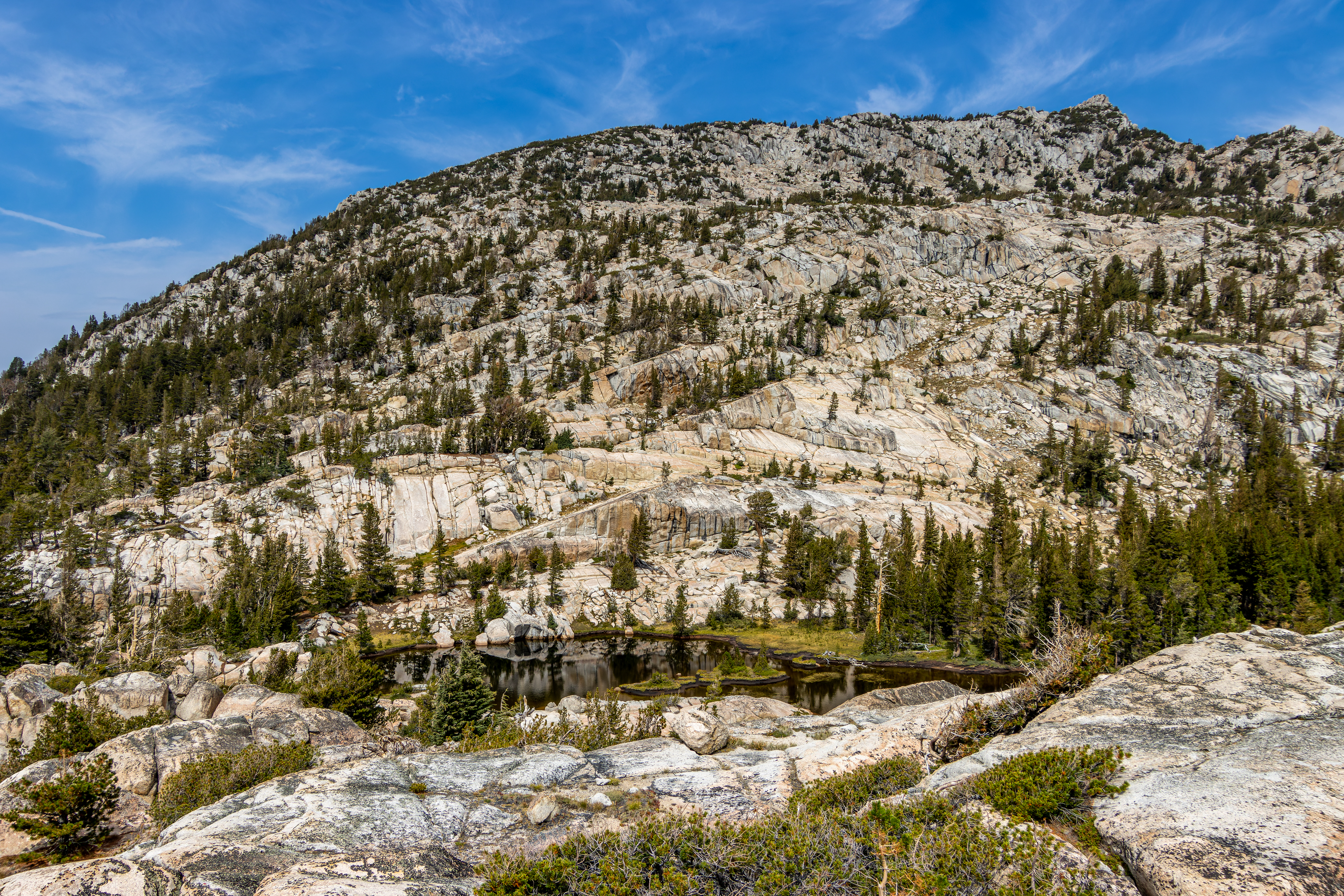
The last section of the climb is exposed and steep and suddenly you will find yourself looking on the other side of the high mountain pass.


At this point we stop for a short break, I went to see the small lake that is located at the pass, few hundred feet north of the trail.


In the next 2.3 miles the trail will descend 1,600 ft into the forest follow Kirkwood Creek path.

Once we reach the lower section of the valley and for the next 2.3 miles, we hiked in one of the most beautiful meadows valleys I ever hiked in. Large open spaces grassland, dotted with pins trees and the West Walker River stream slowly flowing and twisting down the valley.

Unfortunately, we did not see any elk or deer in this section although we saw “tons” of droppings all over the meadows. Maybe the deer herds are moving to lower locations for the winter ?
We kept moving down the valley until we reached a trail junction. Overall, from the mountain pass to a trail junction it is 4.9 miles long with 1,800 ft descend.

At this trail junction we turn left into Cascade Creek Trail, soon after we turn left we reach West Walker River. The water level was low but in order not to get wet we cross to the other side on a large dead tree log.


From here the trail start to climb up the ridge, the first 1.4 miles are steep climb and after that section the trail keep climbing but in much lower grade.
Here the temperature droop down and it start to rain, we waited under a large tree and once the heavy rain stopped, we keep hiking up the trail. At this point (1.4 mile from the valley below) we reached the PCT trail.


From this junction the PCT heading southwest, soon after we pass Lake Harriet, after additional short climb we pass Stella Lake while we are slowly climbing to Dorothy Pass. We were already tired from the day hike and our hiking pace was relatively slow, with all the wind, clouds, rain, and the ragged landscape this was gloomy afternoon.
At Dorothy Pass we entered Yosemite National Park, from here you can see Dorothy Lake less than a mile ahead of us.


After 0.8 miles we reached the lake campsite that is located not so far from lake shore in a small flat section covered with pine trees.
It was stormy all this afternoon, raining from time to time. The wind pickup and we quickly set up the tent below the trees so we can stay dry inside.

This was a long day, overall, 18.5 miles walk in 10 hours.
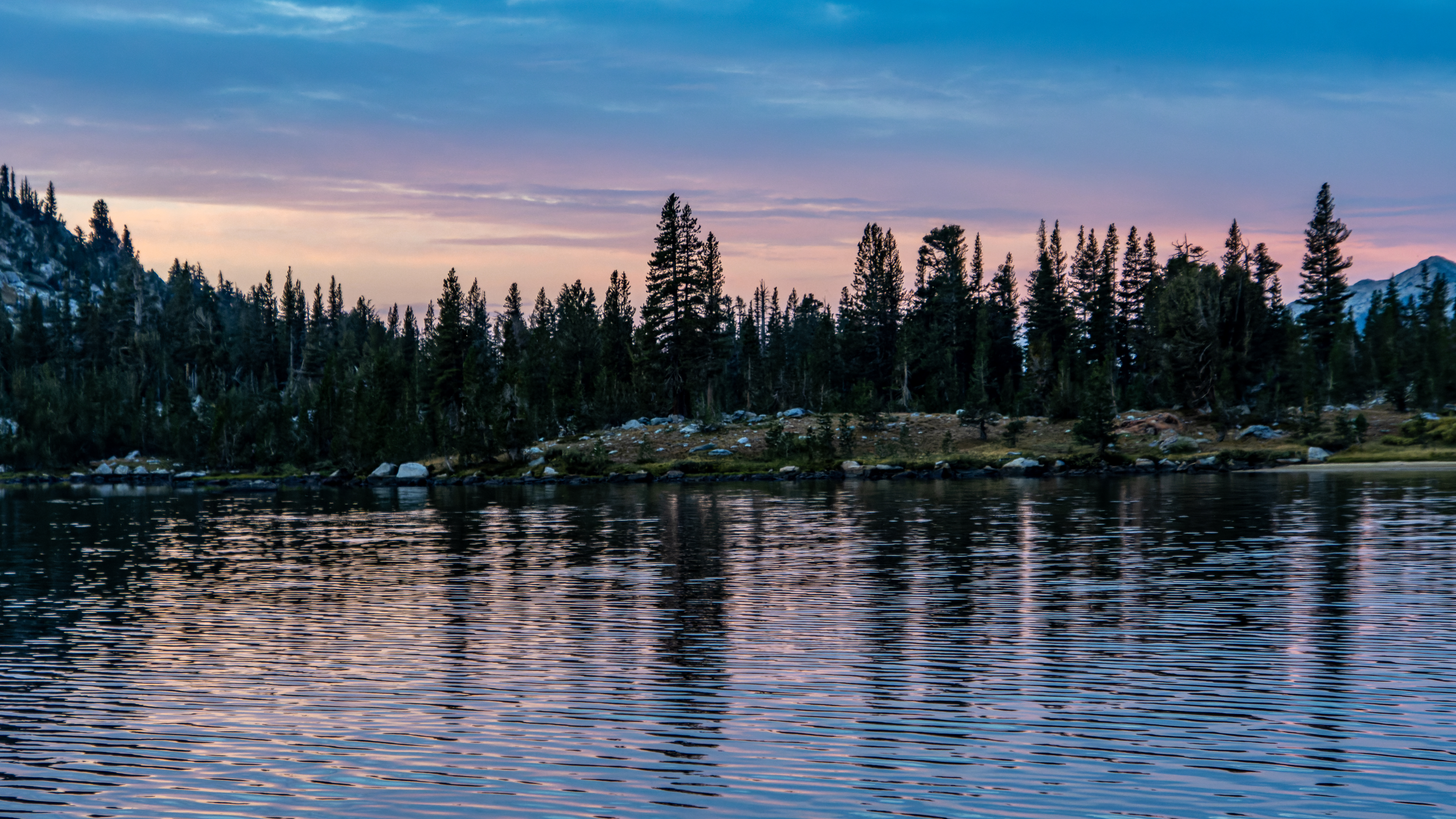
It was cold and windy all that evening and night, later that night, I woke up around 11pm, the wind stopped, and the sky got clear of clouds.

Additional Pictures Pictures from Day 2:


Comments
Post a Comment