
Introduction: Day 4
What? : This Blog part of a 4 days, 60 miles, backpacking hike in the Hoover and Yosemite Wilderness, 2022.
My friend and I start our eastern Sierra loop hike from Twin Lake near Bridgeport (highway 395), from there we went up the mountains into Hoover Wilderness in the direction of Yosemite National Park. We hiked on some sections of the PCT and after 3 days we finished our loop hiking back down to our starting point.


Where? : The Robinson Creek / Barney Lake Trailhead is located at Twin Lake near Bridgeport California (east Sierra highway 395).
Trailhead - Google Map Link

When? : Late Spring, Summer, and early fall.
Early spring can be challenging with snow covered trails.
Late summer, as anywhere in the Sierra, you can have smoke or even closures from fires. There is no problem of water availability along this hike. We hiked here late dray year (2022) and we can find water in many places along the hike.

Due note 1:
You need Hoover wilderness permit for this hike; the permit is also good for the Yosemite NP sections.
https://www.fs.usda.gov/recarea/inyo/recarea/?recid=21879
https://www.fs.usda.gov/Internet/FSE_DOCUMENTS/fseprd904026.pdf
Due note 2:
This is a bear country, so food need to be carried in bear-resistant container.
Due note 3:
Follow wilderness regulations and do not leave trace. Do not camp within 100 feet of any lake shore, stream, or trail. Do not leave toilet papers please pack them out with you (Ziplock plastic bag).


Day 4
20 miles, Total Ascent 2,200 ft climbing, 10 hr
Rancheria Creek to Robinson Creek / Barney Lake Trailhead


Unlike all other mornings this day we woke up to a smoky morning, the creek and the mountains were covered with heavy smoke and the visibility was low.
We pack our camp and start to hike east (south) up the creek on the PCT.


After 3.8 miles of constant walking, we arrived at a trail junction, here the PCT turn sharply right, continue up the ridge, and our trail keep progressing in the main canyon direction.


We hiked the Kerrick Meadows Trail that is following upstream of Rancheria Creek and after 0.7 miles (4.5 miles from our day starting point) we entered a large open meadow.

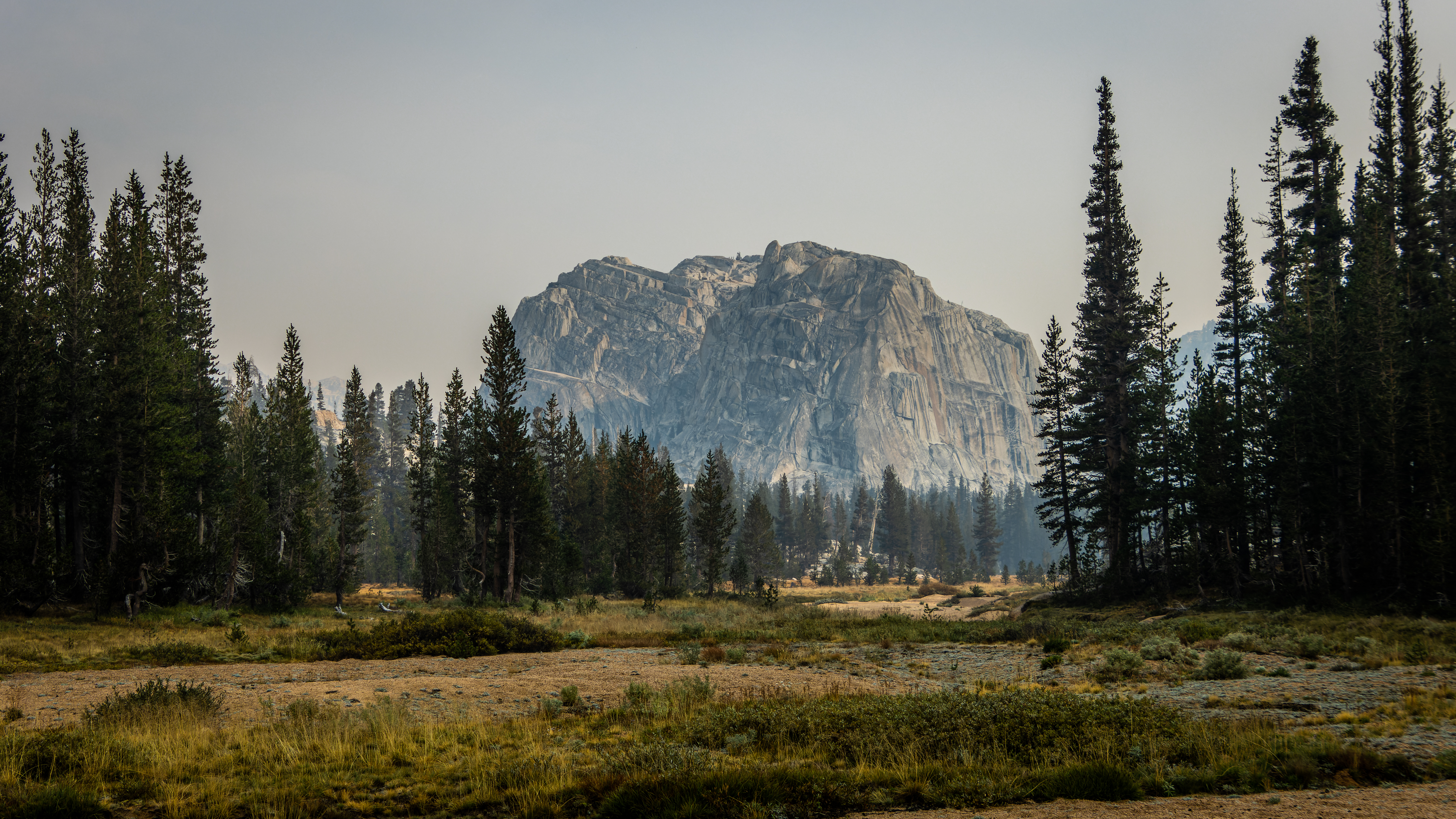
From here the trail keep climbing moderately but constantly, after 6.8 miles from our starting point the landscape has changed, and we enter a large open flat and expose valley. The grassland landscape was open without trees, and you can see the drying winding creek, the valley was covered with yellow low grassland vegetation. Unfortunately, the mountain ridges were covered with smoke.


At this trail section we saw a group of 3 National Park Rangers, as expected after small talk they check our permit and that we carry all our food in bear canisters. They also told us that a major thunderstorm is expected to get into the area later that afternoon, and that the high mountains we are planning to hike through are exposed to the wind, rain, and lightning…

The mountains on both sides of the large valley were covered with heavy smoke.
After hiking 9 miles from our day starting point, we arrived at a trail junction.
Here we had to decide what to do, our original plan was to turn right and hike up to the ridge on our right and maybe even spend the night over there. On the other hand, we can hike straight and go to the lake we spend the first night and from there hike back to the starting point and end the trip that day.
The smoke and the poor visibility push us to the decision to try and hike all the way back to our car and drive home that day.

We keep hiking up the main creek all the way to the trail junction with Peeler Lake Trail, a point that we cam from 3 days back.


We turn right and hike to the nearby Peeler Lake (our first night campsite), this was 11.4 miles from our starting point.
It was around 1pm in the afternoon, we took a short rest near the lake, fill our water, and look at the smoky mountain across the lake in front of us. This was such a different view from what we saw few days back when the air was without smoke.


After a short stop we began our 8 miles hike down to the hike end point.
This time it was a lot easier hiking downhill.


We started our way down and here we saw few other groups climbing the steep trail to the lake.
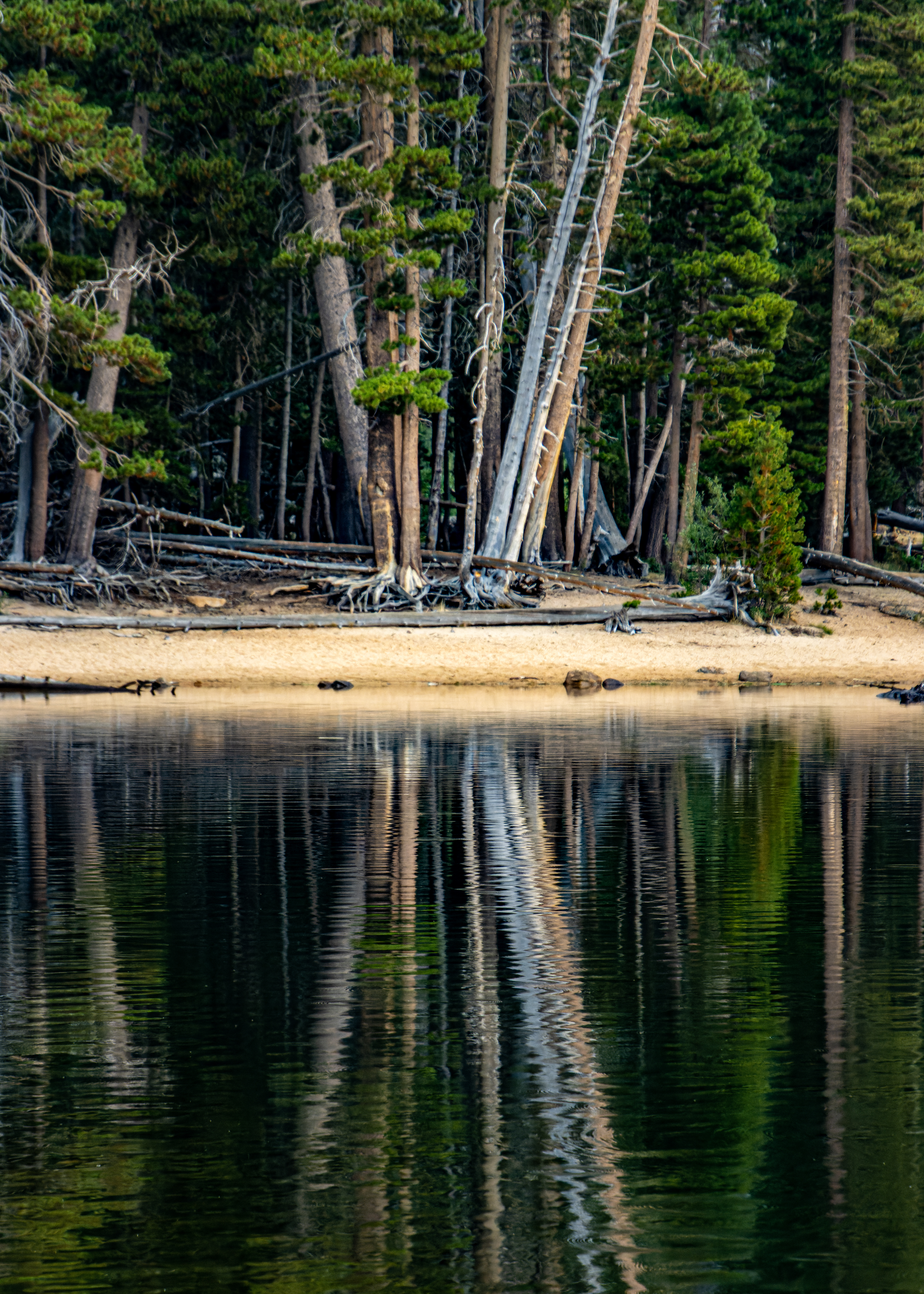
After 4 miles we arrived at Barney Lake, I took few more reflection pictures.
Again, as we were here 3 days ago also now the wind starts to blow, and soon after dark clouds cover the mountains and rain started to fall.


We keep hiking down the trail where it was raining on/off.
After additional 2 hours of hiking, we arrived the parking lot where we left our car 4 days ago, it was just before 5pm.

From here it is almost 5 hours’ drive back home…
We put our backpacks in the car, change to clean cloth, and start our long drive back home.
We stopped at Bridgeport to refuel and get hot coffee for the road and from there it was almost non-stop drive, west on the 108 back home.

Summery:
It was excellent hike, 60 miles in 4 days, not over challenging, amazing wilderness landscape and unlike many other hikes we did in the past this time we saw a black bear.
Overall, the weather was good and except afternoon thunderstorm and light rain showers it was perfect temperatures for hiking. The smoke from the fires forces us to change our plan at the last day.
As always it was fun hiking together with a good friend, sometimes we are talking passionately about random topic and in other times we are walking silently and enjoying the nature.
Additional Pictures Pictures from Day 4:


Comments
Post a Comment