
Introduction
What? :
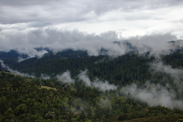
This park spread on both sides of Stevens creek (running water in the winter) canyon section. The hillsides are covered with an old forest where the Black Mountain ridge on the north side of the creek is mainly covered with open grassland.
There are several dirt roads that have dual use, hiking and mountain biking, where most trails include some downhill and steep climbs.


Where? :
Very large park located south of Page Mill Road not far from road 35 (skyline).

When? :
Recommending to hike at winter day when all is green.
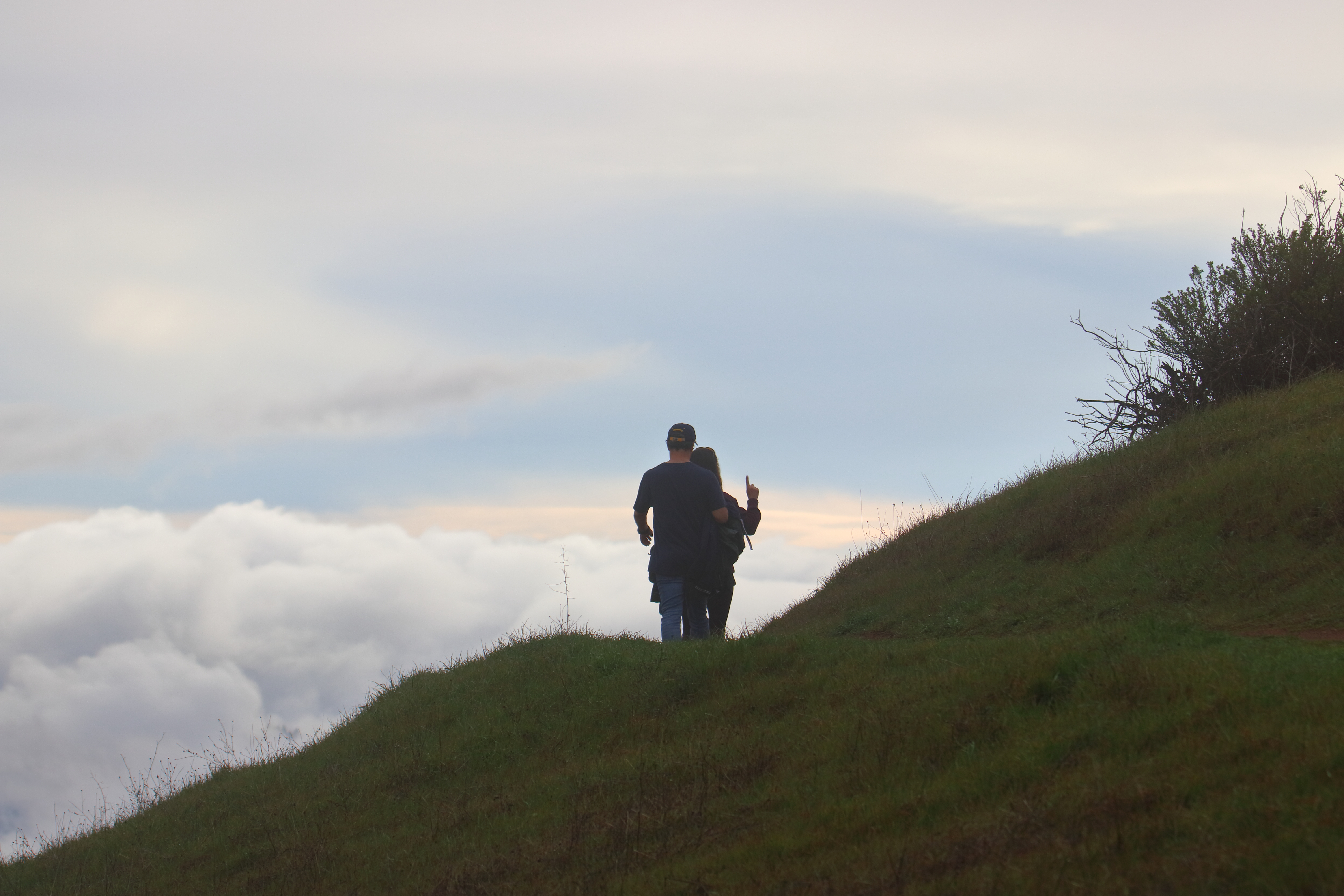
Or hike to Black Mountain at clear day so you can enjoy the view.

Nearby Parks Blogs:

My thoughts:
I really like this park, both for hiking or biking. if you are coming in the afternoon it is not so crowded as it during noon.
I always enjoy visiting at the rain or right after, all is green.
Fun visit at nice summer day, climb to black mountain and enjoying the view.

The visit:
There
are several hiking options in the park and all are starting from the parking lot.

Probably the best one is the following 3 miles trail:
From the parking lot go down on Stevens Creek
Nature Trail that flow the creek down. Hike up left and connect
to Canyon Trail.
From there you will go back to the parking lot, after passing the small Sag Pond (on you right) turn left into the connector trail that will lead you back to the parking lot.

You can extend this hike to be longer by taking from the parking lot the White Oak Trail following the ridge line at start but gradually descend down into the creek. Connect to Skid Road Trail and follow it all the way down. On your way you will pass few wooden bridges where in the last one you will cross Stevens Creek and from there you will start to climb up.


Longer hike Option:

You can combine this park hike with visiting the nearby (just across the road) Los Trancos Park.
I started by doing 2.5 miles long loop hike at Los Trancos.

After returning back to the parking lot I kept hiking and did to the longer hiking option above.
Overall, this will be 6.5 miles long hike with 1,100 ft of elevation gain.

You can
also hike to Black mountain viewpoint:
This is a steep 1.5 miles climb all the way to the mountaintop, you can climb up using Bell Vista trail and hike down using Indian Creek Trail.
On a nice way the view from the top of Black Mountain to Stevens Creek canyon below you and skyline ridgeline on the other side is very nice and will justify the long climb.


Mountain Bike:
This reserve is very popular with mountain biking.
there are several loop option, connecting trail to skyline trails and the climb to Black mountain is rewording.
Deu note: After heavy rain days make sure that the trail following down Stevens Creek is not close for bike access mid-way at the stream crossing!

Long bike ride option:
You can go down on Canyon trail all the way to the Stevens Creek Canyon road (no car parking is allowed over there), from there you will ride to the Stevens Creek Lake.
At the lake you will turn left just before the Stevens Creek Quarry entrance and climb the steep Montebello road. At the end of the road you will connect to Montebello dirt road that will take you all the way to Black Mountain viewing point. From here it is a fun ride back to your starting point.
Because this is a loop ride you can also start it at Stevens Creek lake.

www:
Map:
https://www.openspace.org/sites/default/files/map_MB.pdf


Hiking down from Black Mountain to Rancho San Antonio County Park:


Hiking to Skyline Ridge Open Space Preserve


Hiking to Skyline Ridge Open Space Preserve


Comments
Post a Comment