
Introduction:
Last time I visit Montaña de Oro State Park was at Nov. 2021
What? :
With over 8000 acres, including seven miles of shoreline,
Montaña
de Oro is one of the largest state parks in California. Spectacular views of
the open hills landscape, ocean cliffs, long shoreline with rocky coves or sand
beaches.
For more information see my blog on Morro Bay.
Where?
: The park is seven miles south of Los Osos town on Pecho Valley Road.
Google Map Link


Due note
1: The park can be crowded with tourists and locals that use it as their “local
park” for kids’ activity, bike, running.
Due note
2: we spend the night in the nice Morro Bay State Park Campground, right in
Moro Bay. We did not make any reservation but we mange to find open spot for
the night. At sunset we went to the Morro bay nearby (across the golf course. We
then went to Bayshore Bluffs Park and took some night photos.
Due note
3: There is Morro Bay State Park Boardwalk going into the marshes, I discovered
it only when I wrote this blog, looks like fun place to see.

My
thoughts: We spend here our afternoon and enjoy it very much. Exploring the
long clean secluded beach at the north section, cove and tide pools and the
south and hiking in the open landscape. For next time we will probably reserve a
longer visit for this park.
The
visit:
This
park features rugged cliffs, secluded sandy beaches, coastal plains, streams,
canyons, and hills, including 1,347-foot Valencia Peak. Naturalists and
backpackers enjoy the solitude and freedom found along the park's trails.

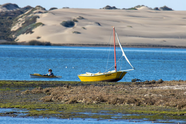
Morro Bay State Park - Sandspit
Beach:
Right after
the road enter Montaña de Oro State Park there is and exit to the right, short
drive will take you to Sandspit Beach parking lot.
From here
a short hike will take you down through the sand dunes all the way to the ocean beach.
At the
beach you can hike north as far as you want into Morro Bay State Park sand spit
dunes that are creating and protecting the Morro Bay.
Nothing
special to see except walking on the sandy beach, you will find only few people
here.


Spooner's Cove:
The
best-known beach in the park is Spooner's Cove, right across from the campground.
There are few other coves just north of this beach.
You can
park at the beach parking lot on your right or if it is full right after on the
roadside.
In this
beach can enjoy the sandy beach, explore the side rocks and the tide pools or
watch for sea birds.

It was
already late at the afternoon, so we decided to hike a short trail on the cliff
beaches.
We parked
right after the closed campground and took the Bluff Trail west. The easy well-maintained
flat trail is going on the high cliffs above the ocean coves below.
After reaching
the most west viewing point the trail turn south, after short hike you can find
narrow trail that is going down into a hidden cove, excellent place to explore
the rocks and the tide pools.
After this
cove the trail keep going south and you can find few options to turn right (east)
to the direction of the main park road. No matter with option you decided to
take you will reach back to the road, cross it and go back to the parking lot.


This trail
is excellent for kids but any other will find it very enjoyable. Overall, we
did 2.2 easy mile trail (orange color trail in the map). You can extend the
hike by keep going south and cut back to the road on the next trail (blue trail
on the map, + 0.7 mile). You can also climb the hills on the east (light-blue
trail on the map, +2 miles, total of 2.2 miles).


There are
many other longer trails options that are going east of the park main road into
the hills and you can do long loop hikes. You can also hike along the beaches,
in the eucalyptus forests, a lot to see and explore.
www:
https://www.parks.ca.gov/?page_id=592
Map:
https://www.parks.ca.gov/pages/592/files/mdo-brochure-lr.pdf
Los Osos Oaks State
Reserve:
This
small park preserves centuries-old coast live Oaks growing over ancient sand
dunes. This reserve is located just outside the town of Los Osos.
The small
85-acre park was established in 1972.
Your visit
starts at the small parking lot at Los Osos valley road, 0.7 mile east of the
junction with S. Bay Blvd.


Park
your car and hike into the small oak forest. This is small parks and the few
trails are clearly marked and easy to hike. Hike the Loop trail, Oak view trail
and Los Osos Creek trail that cover this tree grove.
It is
interesting to see all the old oak trees. This visit is probably less than an
hour long, can be covered in 30 min, and good also for kids.

We visit
here at a sunny mid-day where the sunlight was harsh, I think that the best
time to visit here is with darker atmosphere and fog, this will give the old
trees a misery feeing of enchantment forest from Hobbit movie.
https://www.parks.ca.gov/?page_id=597
https://www.parks.ca.gov/pages/597/files/LosOsosOaksBrochr2011.pdf
Pictures:


Pictures from Nov. 2021


Comments
Post a Comment